Back Lagoon

Our water quality monitoring program has shown Back Lagoon to have excellent water quality. Find out more about the estuary and its unique features.

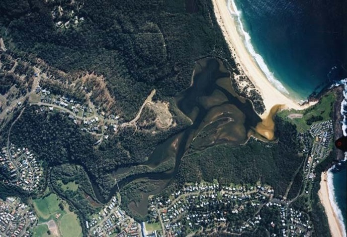
Back Lagoon is located on the south coast of New South Wales on the outskirts of Merimbula. It is classed as a lagoon with an intermittently closed entrance. The entrance is managed by Bega Valley Shire Council to reduce impacts of foreshore inundation.

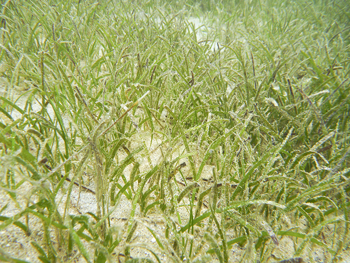
This estuary is particularly dynamic due to the relatively large size of the catchment compared to the lake. The estuary supports extensive seagrass beds.

Estuary health and features

Water quality

As part of our water quality monitoring program we assess the water quality and ecosystem health of an estuary using a range of relevant indicators. We sample a subset of the estuaries between Wollongong and the Victorian border every 3 years. The most recent sampling in Back Lagoon was completed over the 2017–18 summer when 2 sites were sampled on a monthly basis.

Back Lagoon water quality report card for algae and water clarity showing colour-coded ratings (red, orange, yellow, light green and dark green, which represent very poor, poor, fair, good and excellent, respectively). Algae is rated 'excellent' and water clarity is rated 'excellent' giving an overall rating of 'excellent' or 'A'.

This report card represents 2 water quality indicators that we routinely measure: the amount of algae present and water clarity. Low levels of these 2 indicators equate with good water quality.

The report card shows the condition of the estuary was excellent with:

  • algae abundance graded excellent (A)
  • water clarity graded excellent (A)
  • overall estuary health graded excellent (A).

Find out more about our estuary report cards and what each grade means. Read our sampling, data analysis and reporting protocols and find out how we calculate these grades.

Physical characteristics

Estuary type: Lagoon

Entrance
location
Latitude (ºS) –36.88
Longitude (ºE) 149.93
Catchment area (km2) 31.4
Estuary area (km2) 0.4
Estuary volume (ML) 215.9
Average depth (m) 0.6
Notes: km2 = square kilometres; m = metres; ML = megalitres.  

Water depth and survey data

Bathymetric and coastal topography data for this estuary are available in our data portal.

Land use

The catchment of Back Lagoon has low disturbance with over 80% remaining forested. Urban and grazing areas each occupy about 5% of the catchment.

National and marine parks

  • No conservation areas are located within this catchment.
  • This estuary does not flow into a marine park.

Community involvement

Back Lagoon

Local government management

Local councils manage estuaries within their area unless the estuary is attached to a marine park. Bega Valley Shire Council manage this estuary.