Khappinghat Creek

We collaborate with local government to monitor the condition of Khappinghat Creek. Find out more about the Khappinghat Creek estuary and its unique features.

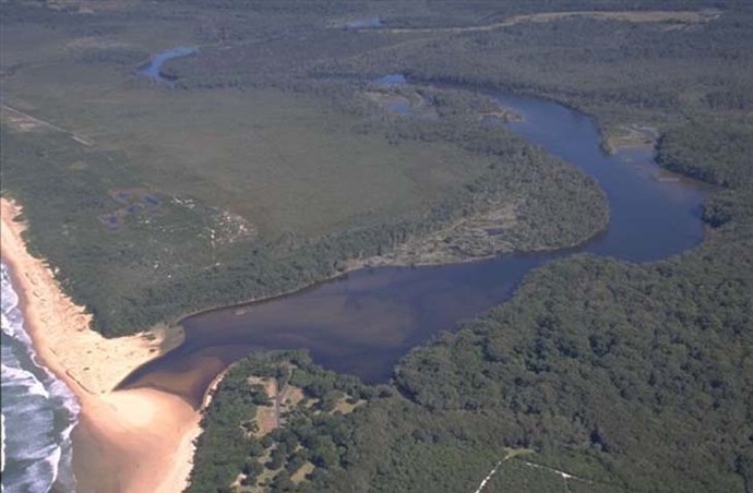
Khappinghat Creek is situated on the mid-north coast of New south Wales near the township of Wallabi Point. It is classed as a lagoon, with an entrance intermittently open to the sea.

Khappinghat Creek and its entrance at Saltwater Beach support a rich fabric of undisturbed habitats and hold spiritual significance to local First Nations people, with several sites related to the Dreamtime located here.

Estuary health and features

Water quality

As part of our water quality monitoring program we assess the water quality and ecosystem health of an estuary using a range of relevant indicators. We sample 2 sites on a monthly basis over summer in Khappinghat Creek as part of a collaborative program with MidCoast Council.

The most recent sampling was completed over the 2021–22 summer. The results of the monitoring program, including a detailed water quality report card for Khappinghat Creek, are available on the Mid Coast Council website.

Find out more about our estuary report cards and what each grade means. Read our sampling, data analysis and reporting protocols and find out how we calculate these grades.

Physical characteristics

Estuary type: Lagoon

Entrance
location
Latitude (ºS) –32.01
Longitude (ºE) 152.57
Catchment area (km2) 90.7
Estuary area (km2) 1.2
Estuary volume (ML) 885.1
Average depth (m) 0.9
 Notes: km2 = square kilometres; m = metres; ML = megalitres.

Water depth and survey data

Bathymetric and coastal topography data for this estuary are available in our data portal.

Land use

Khappinghat Creek drains a moderately disturbed catchment. Around 70% of the land remains forested and a lot of this land is managed in conservation areas or by Forestry Corporation. Urban areas and rural residential–grazing areas each make up about 14% of land use.

National and marine parks

Community involvement

  • Manning Coastcare Group is the umbrella organisation for a set of local volunteer groups that do environmental work, one of which one is based near Khappinghat Creek at Wallabi Point.
Khappinghat Creek

Local government management

Local councils manage estuaries within their area unless the estuary is attached to a marine park. MidCoast Council manage this estuary.