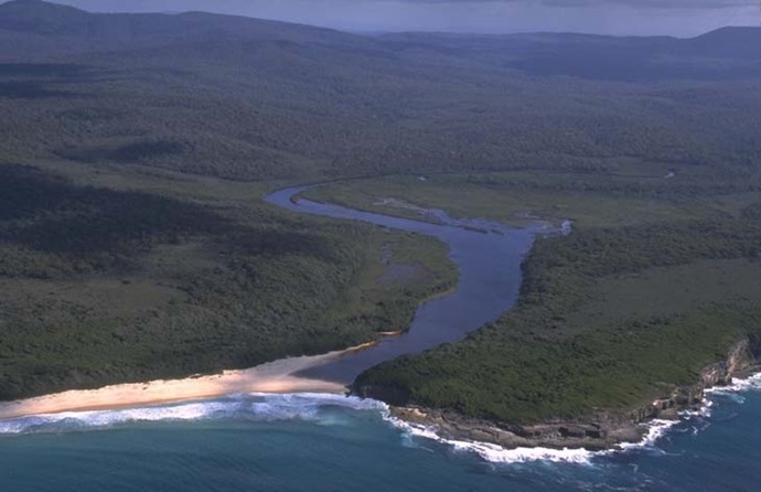
Nadgee River is located on the south coast of New South Wales. It is classed as a creek with an intermittently closed entrance.
This estuary is recognised as near-pristine because of its protection status and isolation within Nadgee Nature Reserve.

Our water quality monitoring program has shown the Nadgee River estuary to have good water quality. Find out more about the estuary and its unique features.
Nadgee River is located on the south coast of New South Wales. It is classed as a creek with an intermittently closed entrance.
This estuary is recognised as near-pristine because of its protection status and isolation within Nadgee Nature Reserve.
As part of our water quality monitoring program we assess the water quality and ecosystem health of an estuary using a range of relevant indicators. We sample a subset of the estuaries between Wollongong and the Victorian border every 3 years. The most recent sampling in Nadgee River was completed over the 2020–21 summer when 2 sites were sampled on a monthly basis.
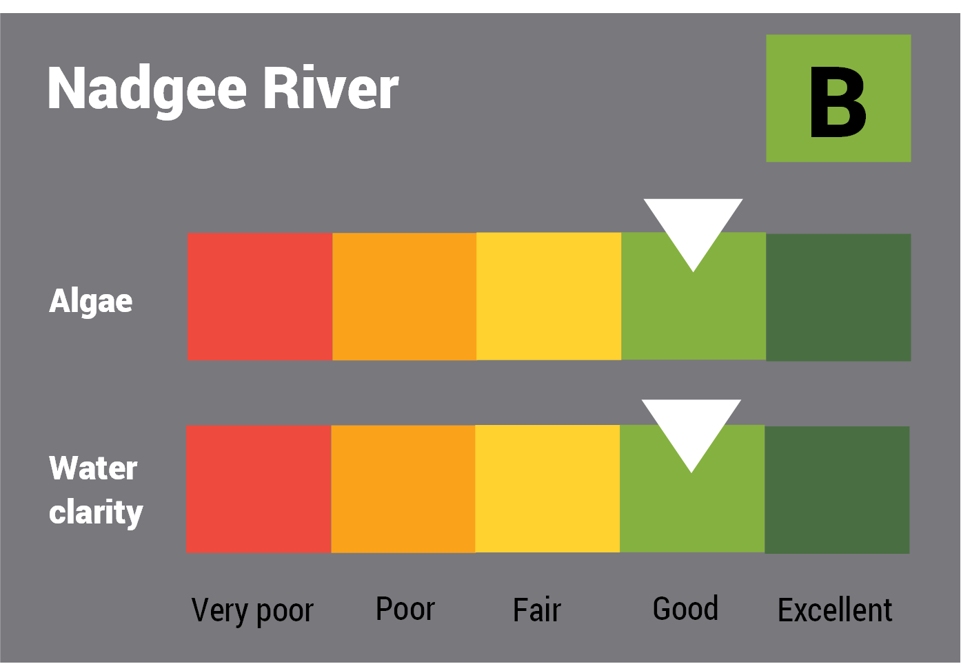
This report card represents 2 water quality indicators that we routinely measure: the amount of algae present and water clarity. Low levels of these 2 indicators equate with good water quality.
The report card shows the condition of the estuary was good with:
Find out more about our estuary report cards and what each grade means. Read our sampling, data analysis and reporting protocols and find out how we calculate these grades.
We have monitored water quality in the Nadgee River since 2008. This table shows the water quality grades for this estuary over that time.
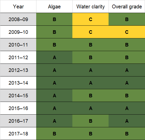
Grades for algae, water clarity and overall are represented as:
Estuary type: Creek
| Entrance location |
Latitude (ºS) | –37.44 |
|---|---|---|
| Longitude (ºE) | 149.97 | |
| Catchment area (km2) | 58.8 | |
| Estuary area (km2) | 0.3 | |
| Estuary volume (ML) | 89.6 | |
| Average depth (m) | 0.5 | |
Bathymetric and coastal topography data for this estuary are available in our data portal.
The entire catchment of Nadgee River is undisturbed forest within Nadgee Nature Reserve.
Local councils manage estuaries within their area unless the estuary is attached to a marine park. Bega Valley Shire Council manage this estuary.
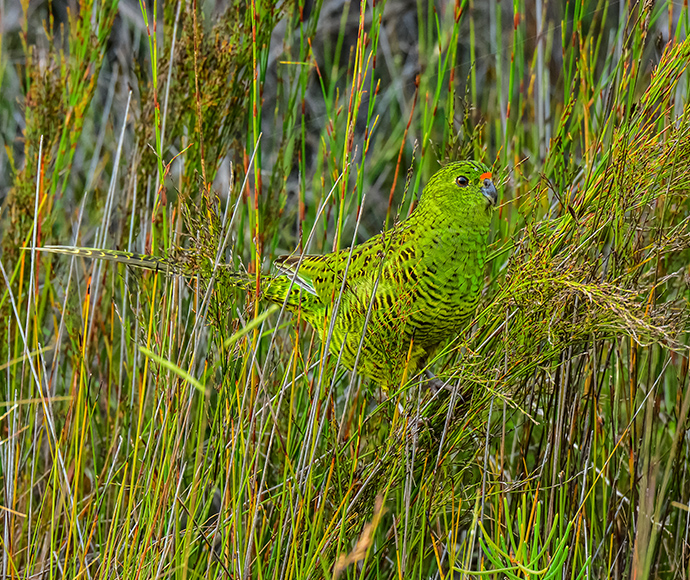
The pristine catchment around Nadgee River estuary supports many threatened species such as the eastern ground parrot.
Find out more about the biodiversity in our estuaries.