Narrawallee Inlet

Our water quality monitoring program has shown Narrawallee Inlet to have excellent water quality. Find out more about the estuary and its unique features.

Narrawallee Inlet is located on the south coast of New South Wales. It is classed as a barrier river with an intermittently closed entrance.

The estuary and adjacent national park offer great scenery as well as myriad opportunities for birdwatching, fishing, kayaking, swimming and bushwalking.

Estuary health and features

Water quality

As part of our water quality monitoring program we assess the water quality and ecosystem health of an estuary using a range of relevant indicators. We sample a subset of the estuaries between Wollongong and the Victorian border every 3 years. The most recent sampling in Narrawallee Inlet was completed over the 2017–18 summer when 2 sites were sampled on a monthly basis.

Narrawallee Inlet water quality report card for algae and water clarity showing colour-coded ratings (red, orange, yellow, light green and dark green, which represent very poor, poor, fair, good and excellent, respectively). Algae is rated 'excellent' and water clarity is rated 'excellent' giving an overall rating of 'excellent' or 'A'.

This report card represents 2 water quality indicators that we routinely measure: the amount of algae present and water clarity. Low levels of these 2 indicators equate with good water quality.

The report card shows the condition of the estuary was excellent with:

  • algae abundance graded excellent (A)
  • water clarity graded excellent (A)
  • overall estuary health graded excellent (A).

Find out more about our estuary report cards and what each grade means. Read our sampling, data analysis and reporting protocols and find out how we calculate these grades.

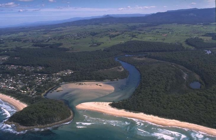
Physical characteristics

Estuary type: Barrier river

Entrance
location
Latitude (ºS) –35.3
Longitude (ºE) 150.47
Catchment area (km2) 80.9
Estuary area (km2) 1
Estuary volume (ML) 636.4
Average depth (m) 0.7

Tidal exchange volume

Tidal exchange volume or tidal prism data is available for this estuary. This tidal prism was measured in 1993.

Tide state Flow
(106 m3)
Local tidal
range (m)
Sydney Harbour
tidal range (m)
Ebb flow 0.32 0.94 1.1
Flood flow 0.38 0.93 1.1
Notes: km2 = square kilometres; m = metres; m3 = cubic metres; ML = megalitres.

Water depth and survey data

Bathymetric and coastal topography data for this estuary are available in our data portal.

Land use

The catchment of Narrawallee Inlet is moderately disturbed with about 40% of land cleared for grazing. Over half of the catchment is forested, some of which lies in Morton National Park.

National and marine parks

Citizen science projects

  • The Budawang Coast Nature Map is an online data platform the community can use to record and identify biodiversity. Data collected is used to map the distribution of native plant and animal species from Moruya up almost to Kiama.
  • Our South Coast Shorebird Recovery Program provides the opportunity for people to get involved in the protection and recovery of shore birds.

Community involvement

  • The Shoalhaven Landcare Association represents a range of volunteer groups working in and around the catchment for Narrawallee Inlet estuary.
  • Shoalhaven City Council’s Bushcare webpage provides links to a range of active groups in and around this catchment.
Narrawallee Inlet

Local government management

Local councils manage estuaries within their area unless the estuary is attached to a marine park. Shoalhaven City Council manage this estuary.