
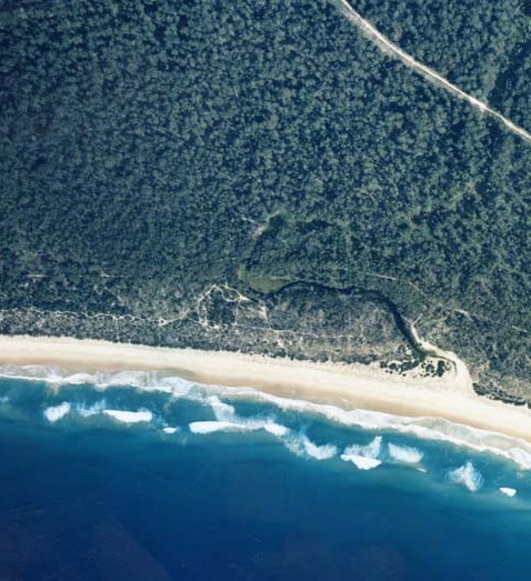
Bengello Creek is located on the south coast of New South Wales near the township of Broulee. It is classed as a small creek with an intermittently closed entrance.
Bengello Creek
Our water quality monitoring program has shown Bengello Creek to have fair water quality. Find out more about the estuary and its unique features.
Water quality
As part of our water quality monitoring program we assess the water quality and ecosystem health of an estuary using a range of relevant indicators. We sample 2 sites on a monthly basis over summer in Bengello Creek every 3 years. The most recent sampling was completed over the 2011–12 summer.

This report card represents 2 water quality indicators that we routinely measure: the amount of algae present and water clarity. Low levels of these 2 indicators equate with good water quality.
The report card shows the condition of the estuary was fair with:
- algae abundance graded fair (C)
- water clarity graded fair (C)
- overall estuary health graded fair (C).
Find out more about our estuary report cards and what each grade means. Read our sampling, data analysis and reporting protocols and find out how we calculate these grades.
Physical characteristics
Estuary type: Creek
| Entrance location |
Latitude (ºS) | –35.87 |
|---|---|---|
| Longitude (ºE) | 150.16 | |
| Catchment area (km2) | 16.3 | |
| Estuary area (km2) | 0.01 | |
| Estuary volume (ML) | 1.8 | |
| Average depth (m) | 0.2 | |
Water depth and survey data
Bathymetric and coastal topography data for this estuary are available in our data portal.
Land use
The catchment of Bengello Creek is relatively undisturbed, with most being forest and about 5% cleared for grazing or urban land use.
National and marine parks
- No conservation areas are located within this catchment.
- This estuary flows into Batemans Marine Park.
Citizen science projects
- The Plants of Eurobodalla project involves monitoring photos of native and invasive plant taken within the Eurobodalla area and uploaded to the iNaturalist app.
- The Budawang Coast Nature Map provides a platform (via the internet or the NatureMapr app) for people to use to collect biodiversity data and contribute to the mapping and knowledge of plants and animals in the local area (from Moruya in the south up almost to Kiama).
Community involvement
- Eurobodalla Landcare is an umbrella organisation for a series of smaller Landcare groups in the Eurobodalla Shire.
Local government management
Local councils manage estuaries within their area unless the estuary is attached to a marine park. Bengello Creek estuary is managed by Eurobodalla Council and the NSW Department of Primary Industries as part of the Batemans Marine Park.