
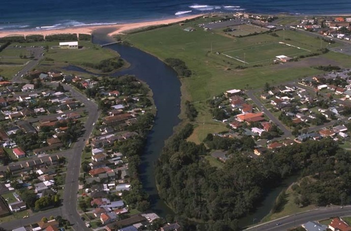
Towradgi Creek is a small saline coastal lagoon with an intermittently closed entrance located in the Illawarra region of Wollongong New South Wales.
Towradgi Creek
Our water quality monitoring program has shown Towradgi Creek to have fair water quality. Find out more about the estuary and its unique features.
Water quality
As part of our water quality monitoring program we assess the water quality and ecosystem health of an estuary using a range of relevant indicators. We sample a subset of the estuaries between Wollongong and the Victorian border every 3 years. The most recent sampling in Towradgi Creek River was completed over the 2011–12 summer when 2 sites were sampled on a monthly basis.
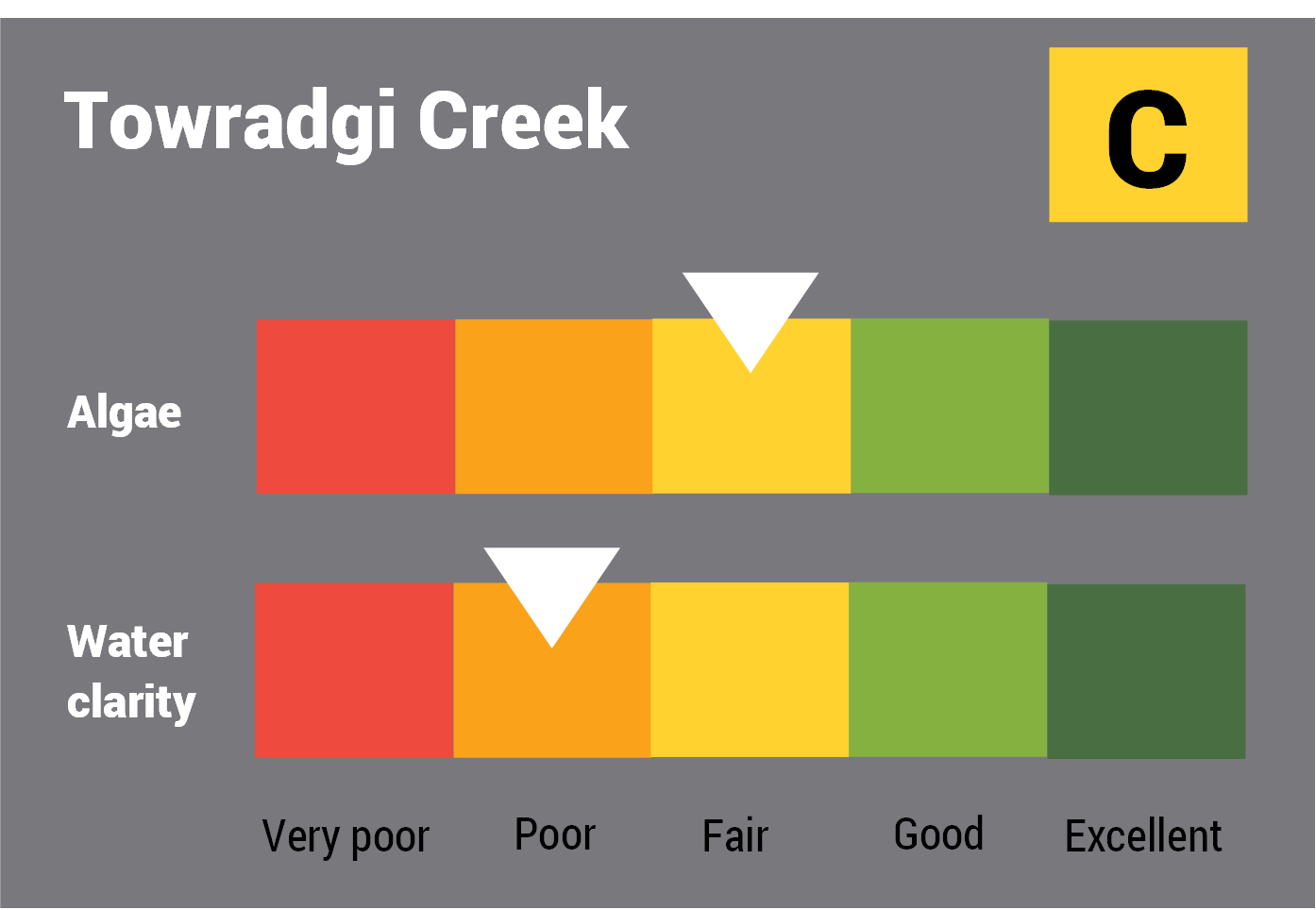
This report card represents 2 water quality indicators that we routinely measure: the amount of algae present and water clarity. Low levels of these 2 indicators equate with good water quality.
The report card shows the condition of the estuary was fair with:
- algae abundance graded fair (C)
- water clarity graded poor (D)
- overall estuary health graded fair (C).
Find out more about our estuary report cards and what each grade means. Read our sampling, data analysis and reporting protocols and find out how we calculate these grades.
We have monitored water quality in Towradgi Creek since 2007. This table shows the water quality grades for this estuary over that time.
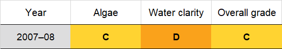
Grades for algae, water clarity and overall are represented as:
- A – excellent
- B – good
- C – fair
- D – poor
- E – very poor.
Physical characteristics
Estuary type: Creek
| Entrance location |
Latitude (ºS) | –34.38 |
|---|---|---|
| Longitude (ºE) | 150.92 | |
| Catchment area (km2) | 8.6 | |
| Estuary area (km2) | 0.04 | |
| Estuary volume (ML) | 11.2 | |
| Average depth (m) | 0.3 | |
Water depth and survey data
Bathymetric and coastal topography data for this estuary are available in our data portal.
Land use
The Towradgi Creek catchment is highly disturbed with urban development accounting for roughly two-thirds of land use. The townships of Towradgi and Tarrawanna to the north of Wollongong, are in this catchment. About one third of the catchment remains forested.
National and marine parks
- Illawarra Escarpment State Conservation area is the largest conservation area in the Towradgi Creek catchment.
- There is no marine park associated with the Towradgi Creek estuary.
Community involvement
- There are over 60 bushcare groups in the Wollongong area. Bushcare volunteers help regenerate and care for local bushland.
Local government management
Local councils manage estuaries within their area unless the estuary is attached to a marine park.
Wollongong City Council manage the Towradgi Creek estuary.