Some common terms and their meanings
Acid sulfate soil – is the common term for soils that contain sulfide minerals. In an undisturbed or waterlogged state, these soils pose little or no risk. However, if these soils are exposed to oxygen they undergo a chemical reaction called oxidation. Oxidation produces sulfuric acid which may lead to a decrease in oxygen from the water column, mobilisation of heavy metals and/or acidification (low pH).
Acoustic logger – a device that registers the movement of fish that have been tagged in the river. The data collected allows researchers to monitor the behaviour of fish in response to various flow patterns.
Airspace – a proportion of a water storage that is kept empty for the purpose of managing rapid inflows.
Allocation – the volume of water made available to water licence or environmental water accounts in a given year by DPI Water which is determined within the context of demand, inflows, rainfall forecasts and stored water.
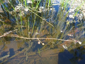
Biofilm – biofilm is the slimy substance which often appears on submerged logs or other debris during inundation. The slimy film is a mixture of algae and bacteria that bind together. In water management, it is sometimes referred to as the ‘fairy floss’ of the river as it provides much needed nutrients for the food web (see below).
Blackwater – occurs when water moves across the floodplain and releases organic carbon from the soil and leaf litter. The water takes on a tea colour as tannins and other carbon compounds are released from the decaying leaf litter. The movement of blackwater plays an important role in transferring essential nutrients from wetlands into rivers and vice versa. Blackwater carries carbon which is the basic building block of the aquatic food web and an essential part of a healthy river system.
Hypoxic blackwater occurs when dissolved oxygen (DO) levels fall below the level needed to sustain native fish and other water dependent species. Bacteria, which feed on dissolved organic carbon, use oxygen in the water. When they multiply rapidly their rate of oxygen consumption can exceed the rate at which oxygen can be dissolved in the water, oxygen levels fall and a hypoxic (low oxygen) condition occurs.
Dissolved oxygen is measured in milligrams per litre (mg/litre). Generally native fish begin to stress when DO levels fall below 4 mg/litre. Fish mortality occurs when DO levels are less than 2 mg/litre.
Carbon exchange – the process whereby carbon and other nutrients are released from leaf litter and/or soil on the floodplain and carried back into the river or vice versa.
Carrying capacity (of a section of river for fish) – some fish are sedentary and need access to stable habitat, others are highly mobile but still need to access habitat for different life purposes. Carrying capacity is determined by the availability of suitable habitat and necessary food to sustain the fish and refers to the number of fish a river or creek can support.
Carryover – water allocated to water licences or environmental water accounts that remains un-used in storage at the end of the water year which, under some circumstances, may be held over and used in the following water year.
Coldwater pollution – is the artificial lowering of water temperature that occurs downstream of dams. In older dams, particularly those with a depth greater than 15 metres, water is typically released from the bottom of the dam where water temperatures can be significantly lower than surface readings. For native fish, that respond to temperature cues to breed, the effects of coldwater pollution can be particularly harmful. Coldwater pollution can reduce the availability of food, increase fish mortality and reduce the frequency and success of breeding events. The impact of coldwater pollution can extend for hundreds of kilometres along the river from the point of release.
Constraints – refers to the physical or operational constraints that affect the delivery of water from storages to extraction or diversion points. Constraints may include structures such as bridges that can be affected by higher flows, or the volume of water that can be carried through the river channel, or scheduling of downstream water deliveries from storage.
Constraints Management Strategy (CMS) – CMS is an initiative under the Murray Darling Basin Agreement to optimise water delivery capacity through regulated river systems with the various constraints that limit or restrict the movement of water, in an equitable way. https://www.mdba.gov.au/publications/mdba-reports/constraints-management-strategy
Dissolved Organic Carbon (DOC) – DOC is a measurement of the amount of carbon from organic matter that is soluble in water. DOC is transported by water from floodplains to river systems and is a basic building block available to bacteria and algae that are food for microscopic animals, that are in turn consumed by fish larvae, small bodied fish species, yabbies and shrimp. DOC is essential for building the primary food webs in rivers and ultimately generates a food source for large bodied fish like Murray cod and golden perch and predators such as waterbirds.
In the central Murray River system, the normal DOC range is between 3 to 5 mg/litre. When large volumes of organic matter accumulated on floodplains are flushed into rivers, high levels of DOC can result, typically associated with large floods. High DOC levels combined with high water temperatures and bacterial and algal blooms are key factors for the occurrence of hypoxic blackwater in wetlands and waterways.
Ecosystem – a biological community of interacting organisms and their physical environment. It includes all the living things in that community, interacting with their non-living environment (weather, earth, sun, soil, climate and atmosphere) and with each other.
Entitlement – the volumetric or proportional share of water specified on a water licence that allows water to be taken from an associated account during a water year, subject to allocation of available water.
Environmental flow – a flow of water that is released from storage or otherwise protected from extraction in order to create a particular flow regime in a waterway over a period of time for particular environmental outcomes.
Flow meter – A gauge that measures volumetric flow of water, e.g. to measure an amount of water diverted or extracted, to a design level of accuracy.
Flow regime – flow regime refers to the pattern of flows in a waterway over time that will influence the response and persistence of plants, animals and their ecosystems.
General security – a category of water entitlement in NSW that provides access to water subject to rainfall and inflow to storages, and is influenced by dam storage levels. General security water is typically used for annually-planted crops and has a lower level of reliability than high security.
Gigalitre – one gigalitre equals one thousand megalitres.
High security – a category of water entitlement in NSW that provides high reliability of access to water in a high proportion of all years. High security water is typically used for permanent horticultural plantings such as fruit and nut trees.
Hydrograph - a hydrograph is a graph showing the rate of flow and/or water level over time past a specific point in a river. The rate of flow is typically expressed in megalitres per day.
Long-term water plan – a component of the Murray Darling Basin Plan, long-term water plans will give effect to a basin Watering Strategy for each river system, and will guide the management of environmental water over the longer term. These plans will identify the ecological assets that are dependent on water for their persistence, and match that need to the water available to be managed for or delivered to them. The plan will set objectives, targets and watering requirements for key plants, waterbirds, fish and ecosystem functions. Department of Planning, Industry and Environment is responsible for the development of nine plans for river catchments across NSW, with objectives for five, 10 and 20 year timeframes.
Megalitre – one megalitre equals one million litres of water, an Olympic-sized swimming pool contains approximately 2.5 megalitres of water.
Megalitres per day – is a standard flow measurement for the rate of managed water flows, recording the volume of water moving past a designated point in a 24-hour period.
Murray-Darling Basin Plan – a plan made under the Commonwealth Water Act 2007 to manage the water resources of the Murray-Darling Basin more sustainably to ensure long term social, economic and environmental viability. The plan seeks to strike a balance between human and environmental needs and identifies sustainable diversion limits for catchments within the Basin (replacing the previous Murray Darling Cap on extraction).
Plankton – zooplankton are microscopic animals found in water bodies and phytoplankton are microscopic plants found in water bodies. Plankton are a vital part of the aquatic food web and are food for fish larvae, small bodied fish like southern pygmy perch, and yabbies and shrimp.
Population structure – refers to the density and range of sex, ages and sizes of fish in rivers, creeks and other waterbodies. Assessing the population structure allows researchers to compare fish populations before and after environmental changes, including specific flow events.
Recession rate – the rate at which the level of river flow drops as a pulse of water moves away downstream. A managed recession flow will include water that is released from storage after the main flow to slow the rate at which the river level drops. This can be done to better reflect natural rates of recession, and to extend the period that creeks and wetlands are connected to the main river.
Regulated river – a waterway where flow is largely controlled by major dams, water storages and weirs. River regulation brings more reliability to water supplies but has interrupted the natural flow characteristics and regimes required by native fish and other flora and fauna to breed, feed and grow.
River operations – the procedures which control the management of water in regulated waterways.
River reach (also known as a river section) – a term to describe a length of river that is geographically or hydrographically similar e.g. a stretch of river between weirs or towns.
Unregulated river– a waterway where flow is mostly uncontrolled by dams, weirs or other structures.
River ‘shut-down’ – a period of time, usually in winter, when irrigation demand has ceased, and water flows from storages are reduced to low flow levels, allowing maintenance of regulating structures to be undertaken.
Salinity – refers to the concentration of dissolved salts in water or soil. The presence of high levels of salt in water and/or soil can affect aquatic ecosystems, impact vegetation growth and health, reduce crop yields and damage infrastructure.
Irrigation salinity - is the rise in saline groundwater and the build-up of salt in the soil surface in irrigated areas. Inefficient irrigation or applying more water than the plants can use means that this excess water leaks past the root zone to groundwater (recharge). This excess water can cause the water table to 'mound' under irrigation areas and in some cases the ground becomes waterlogged.
Dryland salinity - is the build-up of salts in the soil surface and groundwater in non-irrigated areas. Although salts are a natural part of the Australian landscape, dryland salinity refers to excess salt that affects soil, native vegetation, biodiversity, crops and water quality.
Supplementary access – a category of water entitlement where water is made available to licence holder accounts during periods of high river flows that cannot otherwise be controlled by river operations. Water can be taken and debited from licence accounts during a declared period of high flow.
Sustainable Diversion Limit (SDL) – refers to the grossed-up amount of water that can be extracted from Murray Darling Basin rivers for human uses while leaving enough water in the system to achieve environmental outcomes.
Uncontrolled flow (or unregulated flow) – water that has spilled from a storage or has come into the system via tributary inflows and cannot be controlled – usually during periods of high rainfall. Uncontrolled flows are surplus to consumptive and environmental orders.
Water resource plan (WRP) – a plan that gives effect to the Murray Darling Basin Plan and sustainable diversion limit for a particular area and outlines the system of infrastructure, entitlements, flow rules and management framework, consistent with the Basin Plan. Water resource plans are prepared by state authorities and accredited by the Commonwealth under the Basin Plan.
Water sharing plan (WSP) – a plan, similar to a water resource plan, made under the NSW Water Management Act 2000 that sets out specific rules for sharing and trading water between the various water users and the environment in a specified water management area. A water sharing plan will be a component of a water resource plan.
Partner agencies
Department of Planning and Environment – The Department is the lead agency for the delivery of water for the environment in NSW. The Department has strategic and practical roles in deciding where and when to provide environmental water to rivers, wetlands and floodplains to achieve a range of outcomes for waterbirds, native fish, vegetation, ecosystem services and system connectivity. The Department also has a monitoring role with respect to the use of environmental water.
Commonwealth Environmental Water Office – CEWO holds the largest portfolio of water for the environment on behalf of the Australian Government. CEWO contributes to environmental watering at sites across the whole Murray-Darling Basin, seeking basin-wide outcomes. It also has a monitoring role.
Murray Darling Basin Authority – The MDBA assists with environmental watering at a whole-of-basin scale and is responsible for the development of a long-term strategy for environmental water across the basin.
Department of Industry: Water – administers the Water Management Act 2000 and leads the NSW response to the implementation of the Basin Plan. Department of Industry (DoI Water) determines the volume of water available for allocation to water entitlements for towns, water users and the environment each year. DoI Water determines the water sharing rules between users, and policies for water trading. DoI Water also has a role in monitoring ecosystem health.
MLDRIN – the Murray Lower Darling Rivers Indigenous Nations (MLDRIN) is a confederation of Indigenous Nations or traditional owners in the lower southern part of the Murray Darling Basin. The group currently represents 24 nations.
NBAN – the Northern Basin Aboriginal Nations (NBAN) represents 22 Sovereign First Nations in the Northern Murray Darling Basin in Natural Resource and Water Management.
Department of Primary Industries: Fisheries – the lead agency for the management and protection of NSW fish populations. DPI Fisheries has a role in research, policy implementation, education and compliance.
WaterNSW – is a business unit of the NSW Government responsible for the operation and maintenance of dams and weirs to supply water and enhance its security.