Hazard reduction burn in Berowra Valley National Park
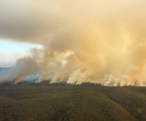
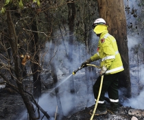
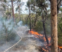
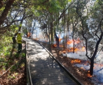
A 50-hectare hazard reduction burn is planned for Berowra Valley National Park, north of Mount Colah, on Friday 9 December, weather permitting.

NSW National Parks and Wildlife Service (NPWS) Area Manager Greg Kirby said the burn, planned for earlier in the week, is now due to go ahead on Friday (9/12) when more favourable conditions are expected.
"The purpose of the burn is to reduce naturally accumulated fuel loads in the park to help protect private properties and businesses in and around Mount Kuring-Gai and Mount Colah in the event of a wildfire," said Mr Kirby.
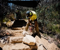
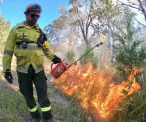
"It will involve around 60 NPWS firefighters and crews from the NSW Rural Fire Service (RFS) and Fire and Rescue NSW.
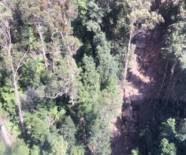
The following walking track and management trails will be closed for the duration of the burn:
- Lyre Bird Gully Track between the Great North Walk and Glenview Road.
- Arthurs Trail between Merlin Close and Excelsior Road, Banyula Trail, Galahad Trail, Yatala Trail, Lyrebird Gully Trail, Crawford Trail, Mundowie Trail, Gundah Ridge Trail and Gundah Ridge Rock Climbing Area.
There will also be partial road closures to Crawford Road, west of Glenview Road junction, Sue Place and Banyula Place. Access for local residents and fire fighters will be maintained.
"Tracks, trails and roads will be reopened when the area is assessed as safe," Mr Kirby said.
"Smoke may be visible in the area, particularly to motorists using the Pacific Highway, M1 and surrounding suburban streets. Drivers should use caution and obey all signage and direction from fire crews.
"People who are vulnerable to smoke are encouraged to remain indoors and keep their doors and windows closed to reduce exposure," Mr Kirby said.
The 2022–23 NPWS hazard reduction program focuses on essential burns to protect park neighbours, assets or significant habitat to ensure the ongoing recovery of wildlife impacted by the black summer bushfires.
All burns around the state are coordinated with the NSW RFS to ensure the impacts on the community, including from smoke, are assessed at a regional level. More information on hazard reduction activities is available at NSW RFS and on the RFS 'Fires Near Me' website and app.
For health information relating to smoke from bush fires and hazard reduction burning, visit the NSW Health website or Asthma Australia.