Tapin Tops National Park contains a high biodiversity. Twenty-eight forest ecosystems have been recorded within or on the boundary of the park. Approximately 44% of the park is mapped as old growth forest. Twenty species listed as vulnerable under the Threatened Species Conservation Act and seventeen significant animal species have been recorded in the park.
The area was traditionally used by the Biripi people and it is likely that a number of Aboriginal pathways traversed the area, connecting the tablelands with the coastal plains.
The park also contains a number of relics and plantings from its past use as State Forest. Recreation activities in the park include camping, picnicking, bushwalking sightseeing, vehicle touring and swimming.
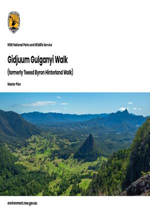
Photo: Tapin Tops National Park / John Spencer/OEH