Looking beneath the waves with lasers
When you stand on a beach and look out to sea, what do you imagine the seafloor looks like? LiDAR technology, pulsing laser beams through the waves, gives us a new view.
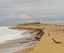
Using LiDAR to map the NSW coastal seafloor is showing features we've never seen before. New details on the character and processes that shape our coastline are being uncovered.
Seeing the seabed
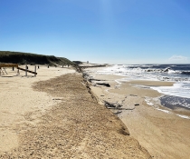
Mapping helps us 'see' the seafloor, revealing reef or sand habitats in our marine environment. Mapping the shape and landforms of the seabed helps us understand ocean processes such as erosion and sediment movement between beaches. We can use this information to understand coastal hazards like large storms and model future changes such as sea level rise so the community and infrastructure can be protected.
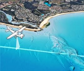 LiDAR (light detection and ranging) maps the shallow areas of the coast. "A plane flies in straight lines parallel to the coast, projecting a laser beam into the water at different angles. The beams go through the water column, bounce off the seabed and travel back to the plane, painting a picture of the underwater environment," said Department of Planning and Environment Coastal Scientist Dr Tim Ingleton.
The LiDAR technology functions best in shallower depths down to 20 to 30 metres but is affected by water clarity and breaking waves.
"When the water is rough or dirty because rainfall has increased the sediment, the laser struggles to see through that. When LiDAR surveys were run in 2018, we were coming towards the end of a long drought. Clarity of the NSW coastal waters was extraordinary; in some areas the lasers were getting high quality data down to depths of 47 metres," said Dr Ingleton.
Multibeam sonar is then used to map deeper waters, and this information is stitched together with the LiDAR data. To ground truth, if the final map is accurate, sediment samples and underwater video footage is taken.
Mapping the whole coast
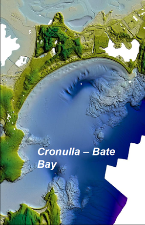 The Seabed NSW project aims to create a high-resolution map of the entire NSW coast from 0-60 metres. LiDAR was used to map the waters off Wollongong first. The department team uncovered colourful sponge gardens, ancient volcanic craters and relic watercourses full of river pebbles. They were surprised to find the shallow waters off Wollongong are 60% reef, this is helping others manage the marine environment.
"DPI Fisheries have used the coastal lidar data to get a more detailed understanding of how subtidal habitats, such as rocky reefs, are distributed in aquatic reserves and marine parks," said Joe Neilson, Senior Manager, NSW Department of Primary Industries.
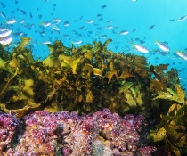
Dr Michelle Linklater, part of the DPE Coastal and Marine Unit, created a landform model. This takes layers of LiDAR data and automatically classifies areas such as pinnacle reefs or flat reefs. Pinnacle reefs and flat reefs are home to an array of seaweeds (algae), corals, sea whips, sponges and ascidians (sea squirts). These finer details help us better manage marine environments as different habitats contain different species.
"Coastal LiDAR data has proved very useful in identifying shallow reef areas along the NSW coast, enabling evaluation of the extent of kelp forests in NSW for the Marine Estate Management Strategy," said Dr Tom Davis, Research Scientist from the NSW Department of Primary Industries.
Around 40% of the nearshore NSW seafloor has been mapped using LiDAR technology. Future efforts will focus on erosion hotspots and areas with high coastal populations.