Arabian nights, and days (II)
Soil survey of the Northern Emirates.

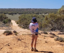
Following on from the successful Abu Dhabi soil survey, Abu Dhabi Environment Agency (EAD), in partnership with the Ministry of Environment and Water (MOEW), instigated a soil survey of 5 of the 6 emirates that make up the northern parts of the United Arab Emirates (UAE) - Sharjah, Ajman, Umm al-Qaiwain, Ras al-Khaimah and Fujairah (the emirate of Dubai was not included). I (David Morand) was again invited to participate as a senior soil surveyor from late February to the end of April 2011, based in the town of Al Dhaid, about 70 km east of Dubai.
The soil survey, which is an extension of the Abu Dhabi soil survey, will be used to aid broadscale land use and agricultural expansion. Scale of mapping is 1:50000. Total area mapped is about 5000 km2. Mountain and city areas were excluded.
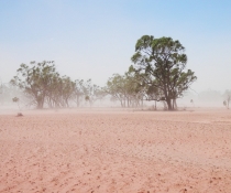
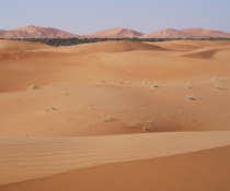
Unlike most of Abu Dhabi, this part of the UAE has a mixed geomorphic pattern. The Hajar Mountains flank the east coast of the UAE, extending into Oman. These mountains consist of ophiolite beds (exposed ancient oceanic crust), for which Oman and the UAE are geologically renowned. Most of the eastern side consists of mountains dropping directly into the Gulf of Oman. The western side of the mountains is characterised by extensive gravel plains and fans that merge into the predominantly sand dune country that extends to the Persian Gulf coast. Prominent wadis (dry watercourses) have incised the mountains, forming spectacular canyons.
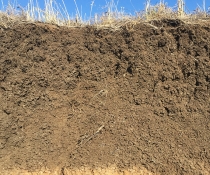
Observation site locations were generated by GIS on a grid basis. The majority of sites within the sand bodies were described using a hand auger. Although the mountains were excluded from the soil survey, the associated wadis, gravel plains and fans were included. These presented many challenges. Corers (mounted on trucks), used on the plains, were often damaged beyond repair due to the gravel.
Most of my work was office-based, organising each day's work for the field teams, preparing field maps, collating data, etc. However, the cemented, rock-like gravels of the wadis could only be observed where exposures were available. Unfortunately, these locations rarely aligned with the site allocated by the computer-generated grid. Therefore, a certain amount of sampling strategy modification was necessary. Consequently, I undertook the field work in these areas.
In all, about 10,000 profile descriptions were obtained. Two hundred of these sites were selected for further detailed type profile description using backhoe pits.
As for the Abu Dhabi soil survey, numerous theme-specific maps were derived from the base soil maps. All soil and land information were entered into the Abu Dhabi Soil Information System. Combined with the Abu Dhabi soil survey and the soil survey information from Dubai, complete coverage of soil and land information for the UAE is now available.
Slide controls: