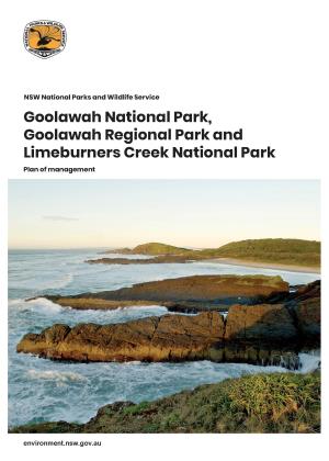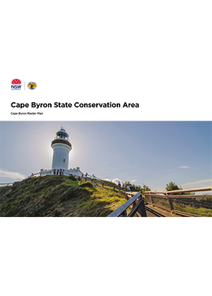
The study area encompasses the Cape Byron State Conservation Area, including the main visitor hubs located at the Lighthouse Precinct and day-use areas and beaches at Wategos Beach, Tallow Beach, and The Pass/Palm Valley. The park includes about 4 kilometres of coastline and the intertidal zone down to the mean low water mark. The Cape Byron Marine Park adjoins and overlaps the Cape between mean low and mean high water mark.
The National Parks and Wildlife Service commissioned the preparation of this master plan to explore preferred options that allow for a broad range of visitors to access and enjoy the Cape Byron State Conservation Area. Included in the master plan are proposals for high quality facilities to meet visitor demand, address access and transport, and protect the natural and cultural values of the Cape into the future. It integrates the Cape Byron Trust’s current concepts for the popular walking track network and Most Easterly Point and the recently released Byron Shire Council’s Byron Bay Town Centre Masterplan into the broader master planning for the Cape.
A key objective of this master plan is to transform existing walking tracks, lookouts and rest areas into a unique, world class walking experience. Consistent material and design will help create an easily navigable track for locals and visitors.
This master plan supports and complements the strategic framework and policies of the Cape Byron State Conservation Area Plan of Management 2002.
Cape Byron is located within the administration areas of the Arakwal people, the Tweed – Byron Local Aboriginal Land Council, North Coast Local Land Services and Byron Shire Council. Lighthouse Road and the Lighthouse Road up-road are managed by Byron Shire Council while the Lighthouse Road down-road, Brooke Drive and part of Tallow Beach Road are managed by National Parks and Wildlife Service.