Horton Falls National Park Community Conservation Area Zone 1 Plan of Management

The park is located 38 kilometres, by road, west of the town of Barraba and 10 kilometres east of Mount Kaputar National Park on the north-west slopes of the New England Tablelands in New South Wales.

Date
9 September 2019
Publisher
Department of Planning, Industry and Environment
Type
Publication, Plan of management, Final
Cost
Free
Language
English
Tags
  • ISBN 978-1-922317-05-6
  • ID EES20190490
  • File PDF 1.1MB
  • Pages 25
  • Name horton-falls-national-park-plan-of-management-190490.pdf

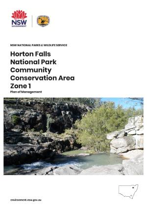
Horton Falls National Park CCA Zone 1 is 260 hectares. The boundaries of the national park are straight lines based on cadastral boundaries rather than landscape features. The Part 11 lands comprise 40 hectares. The park includes part of the bed of Horton River and a number of other smaller creeks and tributaries.

The park is located within the administrative areas of Anaiwan Local Aboriginal Land Council, North West Local Land Services and Tamworth Regional Council.