
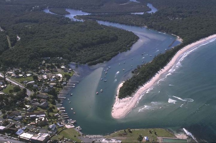
Currambene Creek is classed as a barrier river estuary with an intermittently closed entrance. It is located on the south coast of New South Wales.
Currambene Creek
Our water quality monitoring program has shown Currambene Creek to have good water quality. Find out more about the estuary and its unique features.
Water quality
As part of our water quality monitoring program we assess the water quality and ecosystem health of an estuary using a range of relevant indicators. We sample a subset of the estuaries between Wollongong and the Victorian border every 3 years. The most recent sampling in Currambene Creek was completed over the 2017–18 summer when 2 sites were sampled on a monthly basis.
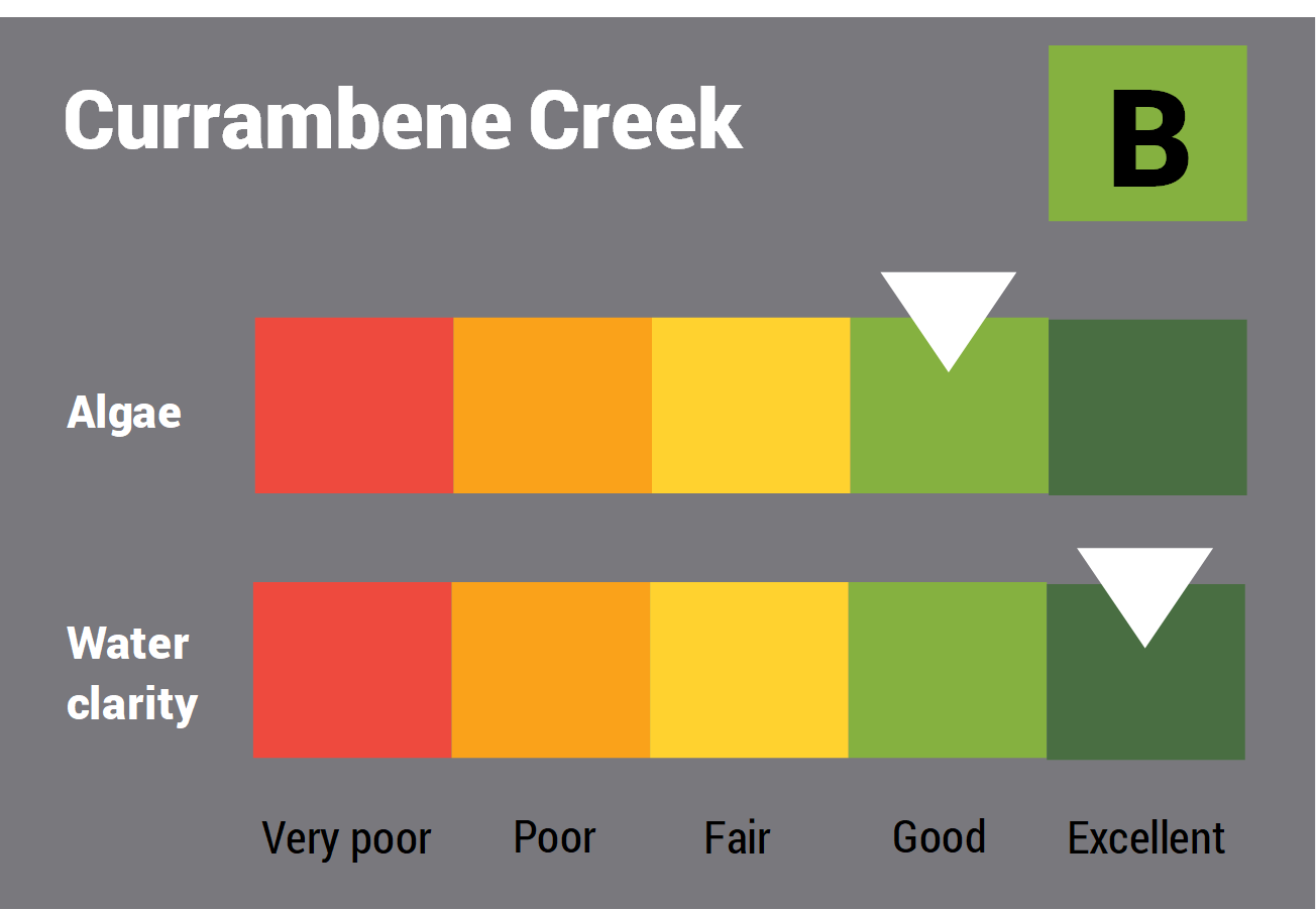
This report card represents 2 water quality indicators that we routinely measure: the amount of algae present and water clarity. Low levels of these 2 indicators equate with good water quality.
The report card shows the condition of the estuary was good with:
- algae abundance graded good (B)
- water clarity graded excellent (A)
- overall estuary health graded good (B).
Find out more about our estuary report cards and what each grade means. Read our sampling, data analysis and reporting protocols and find out how we calculate these grades.
We have monitored water quality in Currambene Creek since 2011. This table shows the water quality grades for this estuary over that time.
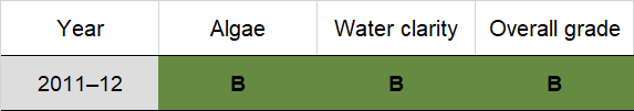
Grades for algae, water clarity and overall are represented as:
- A – excellent
- B – good
- C – fair
- D – poor
- E – very poor.
Physical characteristics
Estuary type: Barrier river
| Entrance location |
Latitude (ºS) | –35.04 |
|---|---|---|
| Longitude (ºE) | 150.67 | |
| Catchment area (km2) | 160 | |
| Estuary area (km2) | 2.2 | |
| Estuary volume (ML) | 2510.8 | |
| Average depth (m) | 1.1 | |
Tidal exchange volume
Tidal exchange volume or tidal prism data is available for this estuary. This tidal prism was measured in 1987.
| Tide state | Flow (106 m3) |
Local tidal range (m) |
Sydney Harbour
tidal range (m) |
|---|---|---|---|
| Ebb flow | 0.58 | 0.69 | 0.75 |
| Flood flow | 1.53 | 1.17 | 1.22 |
Water depth and survey data
Bathymetric and coastal topography data for this estuary are available in our data portal.
Land use
Currambene Creek receives runoff from a moderately disturbed catchment. Over half the catchment is forested and includes part of Parma Creek Nature Reserve. Grazing land at Currambene Creek and Parma account for 20% of land use. Urban areas make up about 10% of the catchment and include the townships of Woollamia and Falls Creek.
National and marine parks
- Parma Creek Nature Reserve is the largest conservation area in the Currambene Creek catchment area.
- The Currambene Creek estuary flows into the Jervis Bay Marine Park. The entrance of the estuary is included in the habitat protection zone for the bay.
Local government management
Local councils manage estuaries within their area unless the estuary is attached to a marine park.
Currambene Creek estuary is managed by Shoalhaven City Council and the Jervis Bay Marine Park.
