Tuross River

Our water quality monitoring program has shown the Tuross River estuary to have good water quality. Find out more about the estuary and its unique features.

The Tuross River estuary is located on the south coast of New South Wales. It is classed as a barrier river estuary with an open entrance. The entrance has been closed to the ocean in the past due to drought. 

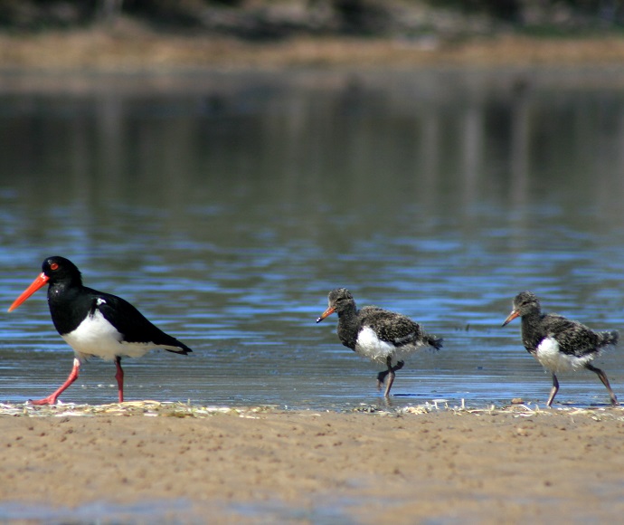
This estuary is made up of a series of shallow channels and lakes formed behind a large coastal sand barrier. Waterways that form part of the Tuross River estuary include Browns Creek, Browns Bay, Bumbo Lake, Borang Lake and Trunketabella Lake. These waterways are nursery grounds for many species of fish.

This estuary is protected under the Batemans Marine Park as a recreational fishing haven and habitat protection zone.
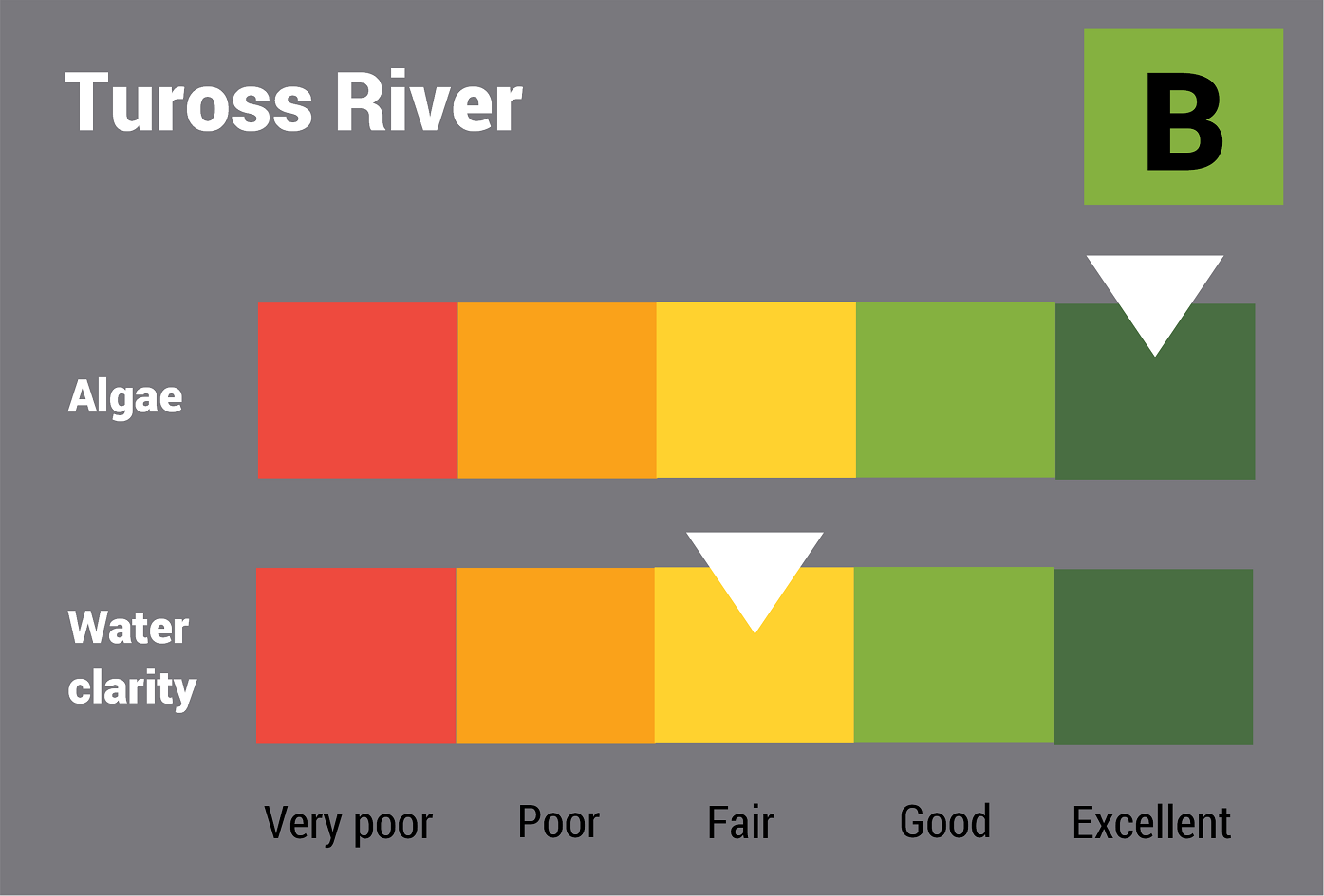
Estuary health and features

Water quality

As part of our water quality monitoring program we assess the water quality and ecosystem health of an estuary using a range of relevant indicators. We sample a subset of the estuaries between Wollongong and the Victorian border every 3 years. The most recent sampling in the Tuross River was completed over the 2021–22 summer when 2 sites were sampled on a monthly basis.

Tuross River water quality report card for algae and water clarity showing colour-coded ratings (red, orange, yellow, light green and dark green, which represent very poor, poor, fair, good and excellent, respectively). Algae is rated 'excellent' and water clarity is rated 'fair' giving an overall rating of 'good' or 'B'.

This report card represents 2 water quality indicators that we routinely measure: the amount of algae present and water clarity. Low levels of these 2 indicators equate with good water quality.

This report card shows the condition of the estuary was good with:

  • algae abundance graded excellent (A)
  • water clarity graded fair (C)
  • overall estuary health graded good (B).

Eurobodalla Shire Council have a long-term water quality monitoring program in the Tuross River, based on the same sampling and reporting methods as our state-wide program. The results of the monitoring program, including a detailed water quality report card, are available on the Eurobodalla Shire Council website.

Find out more about our estuary report cards and what each grade means. Read our sampling, data analysis and reporting protocols and find out how we calculate these grades.

We have monitored water quality in Tuross River since 2008. This table shows the water quality grades for this estuary over that time.

Tuross River historic water quality grades from 2008-09 for algae and water clarity. Colour-coded ratings (red, orange, yellow, light green and dark green represent very poor (E), poor (D), fair (C), good (B) and excellent (A), respectively).

Grades for algae, water clarity and overall are represented as:

  • A – excellent
  • B – good
  • C – fair
  • D – poor
  • E – very poor.

Physical characteristics

Estuary type: Barrier river

Entrance
location
Latitude (ºS) –36.07
Longitude (ºE) 150.13
Catchment area (km2) 1813.8
Estuary area (km2) 15.5
Estuary volume (ML) 18,208.2
Average depth (m) 1.2

Tidal exchange volume

Tidal exchange volume or tidal prism data is available for this estuary. This data was measured in 1994.

Tide state Flow
(106 m3)
Local tidal
range (m)
Sydney Harbour
tidal range (m)
Ebb flow 5.40 0.64 1.34
Flood flow 4.89 0.61 1.31
Notes: km2 = square kilometres; m = metres; m3 = cubic metres; ML = megalitres.

Water depth and survey data

Bathymetric and coastal topography data for this estuary are available in our data portal.

Land use

Tuross River has a large catchment that extends inland to Belowra. The catchment has relatively low disturbance with 85% remaining as forest, including a small area of the Wadbilliga National Park in the western catchment. Over 10% of land is used for grazing and rural residence and about 1% is urban including the townships of Bodalla and Tuross Heads.

Water use

Find out about water use in the Tuross River, including information about major water users, real-time flow data, and environmental and water sharing plans.

National and marine parks

Citizen science projects

Community involvement