Connectivity along waterways and support for native vegetation, native fish, frogs and other animals were the focus of the pattern of releases for the Snowy, Geehi, Goodradigbee and upper Murrumbidgee rivers in 2022–23.
Key outcomes
Under a wet scenario, environmental water managers worked with partner agencies and stakeholders to coordinate the delivery of water for the environment to:
- provide variable flows to the Snowy and upper Murrumbidgee rivers, with higher releases during winter and spring typical of snowmelt rivers
- improve the condition of the Snowy River channel and provide suitable habitat for water-dependent animals such as macroinvertebrates and native fish
- provide habitat diversity, suitable habitats and increase resource availability and productivity for water-dependent animals including macroinvertebrates, frogs, platypus, turtles and fish, as well as provide opportunities for breeding and recruitment
- inundate wetlands and ponds to provide breeding opportunities for several native frog species including the whistling tree frog (Litoria verreauxii)
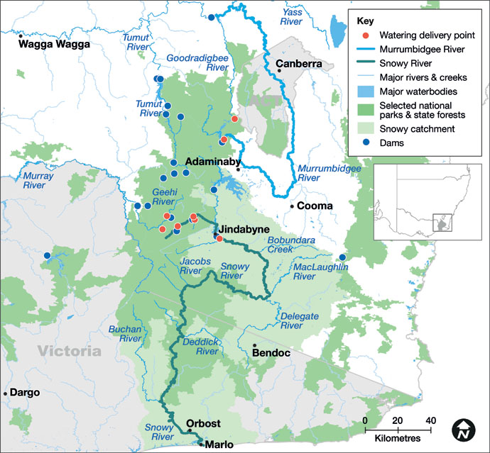
- facilitate connectivity along multiple rivers including the Snowy, upper Murrumbidgee, Geehi and Goodradigbee rivers.
Catchment conditions
The 2022–23 year La Niña weather conditions resulted in high rainfall in the Snowy and montane region.
Wet conditions in the southern Murray–Darling Basin provided an overall water allocation of 293,322 megalitres (ML) for the Snowy and Snowy montane rivers in 2022–23.
The pattern for releases included higher flow rates over winter, spring and early summer to reflect flow patterns typical of the mixed rainfall and snowmelt river system.
About the catchment
The Snowy River headwaters lie next to those of the Murray and Murrumbidgee rivers, together forming the alpine, sub-alpine and mountain catchments of these major rivers of south-east Australia. The Snowy catchment area totals 15,869 km² and the upper Murrumbidgee catchment covers 14,000 km².
The Snowy and Snowy montane rivers and tributaries have been diverted in full or part for hydro-electricity generation and irrigation purposes since the 1950s. In 2002, water for the environment releases were initiated in the Snowy River to help protect and restore some of its environmental values.
Unlike other inland river systems, annual daily releases of water for the environment for the Snowy and Snowy montane rivers are set before the start of the water year (i.e. 1 May to 30 April). A ‘natural flow scaling’ approach is applied to the Snowy River by using the Thredbo River as a reference. The Thredbo River is a snowmelt river and is a similar size to the modified Snowy River below Jindabyne. Water managers used historical flow data from 1992–93 and 2010–11 for Thredbo River to design releases for the Snowy. A modified natural scaling approach is used for the upper Murrumbidgee River because there isn’t sufficient environmental water available to release water every day of the year.

 In 2022–23 environmental water managers worked with stakeholders and the community to deliver water for the environment to the Snowy, upper Murrumbidgee, Geehi and Goodradigbee rivers. Environmental flows supported river connectivity to improve river health and provided important habitat for water-dependent native plants and animals including frogs, platypus and fish.