A year in the Barwon-Darling catchment: 2022-23

Outcomes from the use of water for the environment.

Connectivity, floodplain inundation and native fish outcomes were the focus for environmental water managers in the Barwon–Darling catchment in 2022–23.

Key outcomes

Under wet to very wet conditions, NSW environmental water managers worked with the Commonwealth Environmental Water Holder to protect water for the environment under licenses in the late part of the water year. However, for much of the year natural high flows delivered significant outcomes for the environment which included opportunities for fish movement throughout the system.

Outcomes included:

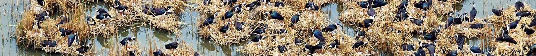
  • favourable conditions for native fish recruitment
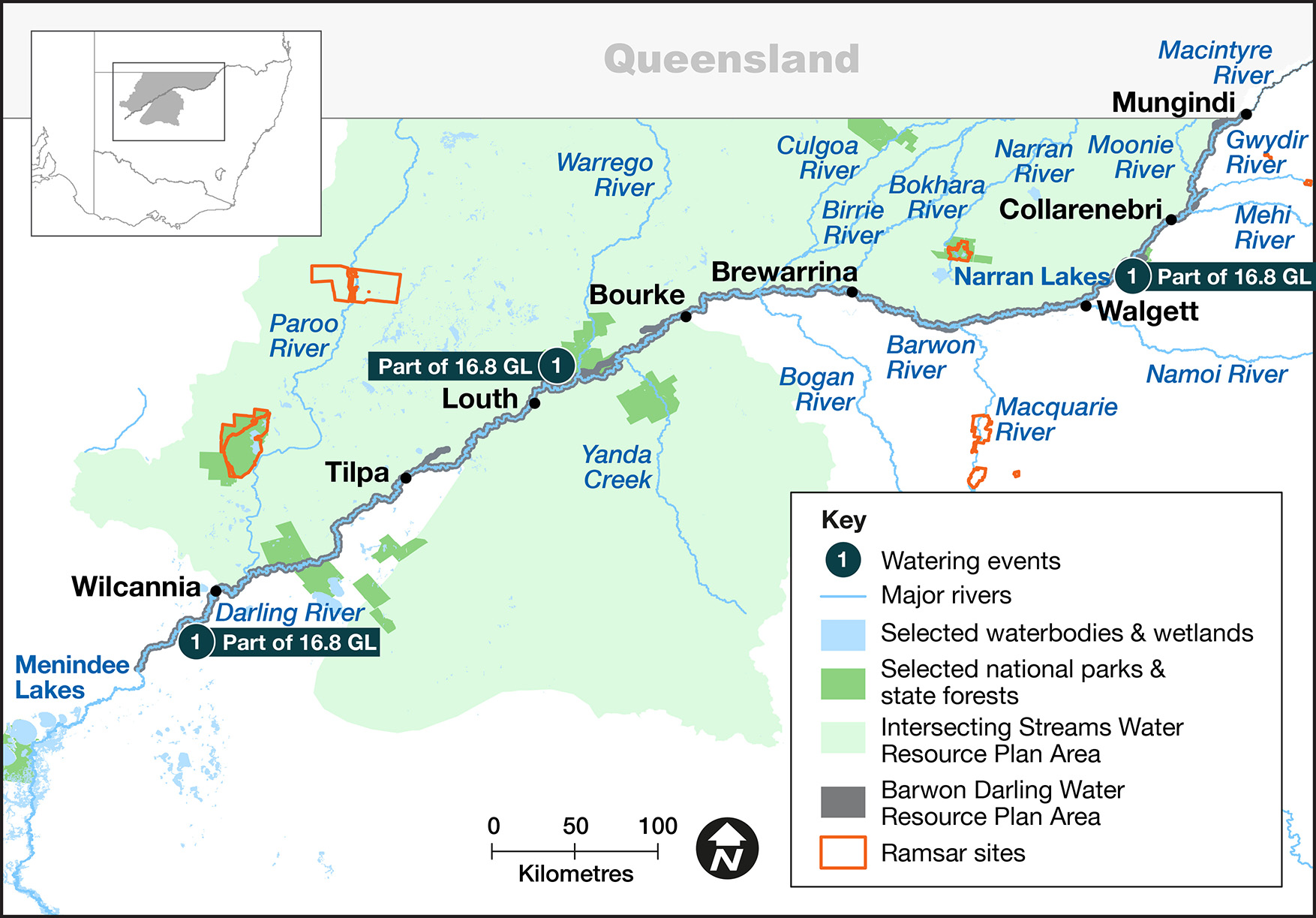
  • connectivity with Menindee Lakes and the Lower Darling – Baaka with 6,719 gigalitres (GL) passing Wilcannia and an additional 2,976 GL travelling down the Talyawalka Creek and reconnecting with the Lower Darling – Baaka
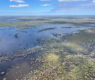
  • periodic inundation of riparian zones and floodplains improving vegetation condition
  • flows and inundation of instream and floodplain Aboriginal peoples’ priority sites.

Map of the Barwon–Darling catchment showing water events for the 2022–23 water year.

Catchment conditions

During the first half of the 2022–23 year, the Barwon–Darling catchment and its tributaries experienced La Niña weather conditions resulting in high rainfall and moderate temperatures.

Flows were consistently above small fresh levels and extended periods of large fresh and overbank flows also occurred. This negated the need to protect flows in Barwon–Darling throughout most of the water year. In early 2023, flows began to recede with only a few brief small fresh events.

About the catchment

The Barwon–Darling catchment is in the north-western part of NSW, running approximately 1,600 kilometres down the Barwon–Darling river system. Located in a semi-arid climatic zone, rainfall is typically low.

Several major river systems flow into the Barwon–Darling, including the Border, Moonie, Gwydir, Namoi, Wambuul (Macquarie), Culgoa, Warrego and Paroo, with the Barwon–Darling connecting the river systems of the northern Murray–Darling Basin with those of the south.

The Barwon–Darling catchment comprises the unregulated section of the river channel from the junction of the Macintyre and Weir rivers near Mungindi through to Lake Wetherell, which is part of the Menindee Lakes system. This includes distributary creeks and a myriad of floodplain wetlands, billabongs, and anabranches.

Water for Country

The Barwon–Darling catchment is Country to the Euahlayi, Barkindji, Murrawarri, Ngemba, Gomeroi/Kamilaroi and Ngiyampaa Aboriginal peoples.

Water for Country is environmental water use planned by the Department of Planning and Environment and Aboriginal people to achieve shared benefits for the environment and cultural places, values and/or interests. In the 2022–23 water year in the Barwon–Darling catchment, environmental water managers:

  • supported Aboriginal peoples between Bourke and Mungindi to identify priority sites for environmental watering
  • supported projects led by the Ngemba and Murrawarri nations, which form part of the Darling River Snail Survey Project
  • supported a tea tree mapping project with various nations led by the Dharriwaa Elders Group
  • supported nation-led planning for the Toorale Cultural Watering Plan
  • started to build relationships with Barkindji through the Toorale Joint Management Committee and various nations through Dharriwaa Elders Group with on Country meetings.

The Annual environmental water priorities in the Barwon–Darling Barwaan-Baaka rivers 2022–23 were developed in response to a moderate resource-availability scenario.

Objectives for the use of water for the environment were to:

  • increase connection between the Barwon–Darling River and the Lower Darling – Baaka downstream of Menindee Lakes
  • support flow events that help recruit native fish into the local population and support fish spawning in spring 2021 and help them survive to adulthood
  • where possible, support identified Aboriginal peoples’ priorities.

With wet to very wet conditions, environmental water managers used an adaptive approach to restore key floodplain and wetland connections and enhance opportunities for plants and animals to breed, move and thrive.

A total of 16,867 megalitres (ML) of water for the environment was protected in the Barwon–Darling catchment during the 2022–23 watering year using Commonwealth Environmental Water Holder licences. Further held environmental water from the Macquarie River, 4.3 gigalitres (GL) from the Namoi and 4.5 GL from the Gwydir was protected into the Barwon–Darling under active management.

Figures are accurate at the date of publishing, but may be adjusted. Watering event numbers in the table and bar chart relate to location numbers marked on the map.

Bar chart showing water delivery to the Barwon-Darling catchment in the 2022-23 water year.

Notes: CEW = Commonwealth licensed environmental water.

Watering event number Location Outcomes Start
date
Finish
date
1 Barwon–Darling refresh
Native fish icon Flow-dependent native vegetation icon Connectivity and water flow icon 14 Apr 2023 04 Jun 2023

In 2022–23, environmental water managers worked with stakeholders and the community to protect water for the environment to support assets across the catchment such as native fish, riparian and wetland vegetation, and system connectivity.

Commonwealth environmental water licenses were used to protect water for the environment to support connectivity along the Barwon–Darling River. Licenses were used in the latter part of the water year as flows receded, with protection of 16,582.7 megalitres of Commonwealth water.

Water was primarily protected in the reach upstream of Collarenebri and between Bourke and Louth. Active management protected flows beyond the river reach to Menindee Lakes.

Water for the environment contributed to meeting Aboriginal peoples’ priorities instream, whereas natural flows inundated priority sites on the floodplain and backed up water into tributaries such as Yanda Creek.

The Barwon–Darling inland sea returns

Barwon River Floodplain near Walgett

In late 2022, natural high flows from the northern tributaries combined to inundate the floodplains of the Barwon–Darling and lower areas of the tributaries creating what looked like an inland sea. These flows inundated the floodplains filling billabongs, anabranches, and wetlands. The event reached areas that had not been inundated in many years, with even greater levels of inundation than those experienced in the high flows of summer 2021–22. Flows peaked at more than 200,000 megalitres per day at Bourke with significant inflows from all northern tributaries.

The event saw significant flows break out into Cato Creek near Brewarrina and the Talywalka Creek near Wilcannia, both significant anabranches of the Barwon and Darling. This provided great benefits to the instream and riparian ecosystems of these areas before rejoining the system downstream and increasing instream productivity in the main channel.

The event provided a recovery opportunity for aquatic and floodplain flora and fauna. Floodplain wetlands and billabongs that received inundation will provide habitat for a number of frogs species to breed during spring 2022, as well as foraging sites for waterbirds. The event had a substantial positive effect on the system that will be felt for years to come.

Routine water quality monitoring by NSW Department of Planning and Environment – Water and opportunistic monitoring by environmental water managers found various areas of poor water quality with low dissolved oxygen from the vast amount of organic matter collected from the floodplain. Despite these areas of low dissolved oxygen water, only minor fish kills were recorded in the Barwon–Darling; however, significant fish kills occurred in the Lower Darling at Menindee in early 2023.

Contact us

Department of Planning and Environment