
The State Heritage Inventory is an online search tool that lets you look up and explore heritage-listed items (places and objects) and their details.
The inventory has more than 30,000 heritage records. It’s kept up-to-date by us, local councils, and NSW Government agencies that manage heritage items. We rely on them to provide the latest information about their heritage-listed items.
Use our interactive map to discover heritage-listed items across the state. Search, explore and learn about their stories – all in one easy-to-use viewer.
Search the State Heritage Inventory and map
Need help searching? Our tips explain how to use the State Heritage Inventory spatial viewer for exploring heritage information in New South Wales, covering how to navigate the map, manage layers, perform searches, view heritage item details and use advanced spatial tools.
Optimise your viewing experience
We recommend using Google Chrome (Version 66.0 or later). Other supported browsers include:
- Safari
- Mozilla Firefox
- Microsoft Edge 44.0.
Compatible mobile devices include:
- Google Android OS
- Apple OS
- Windows OS (Microsoft Edge).
Please note that not all functionality and features are available on mobile devices. For the best experience, view on a desktop computer.
Navigate the map view
Opening the map view automatically shows the location of heritage items across New South Wales.
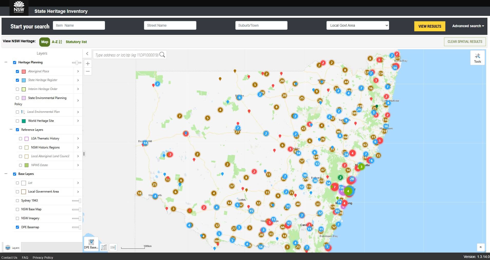
A single heritage item is shown by a pin which appears as a coloured teardrop. A cluster of heritage items is shown by a coloured circle with a white number in the centre. As you zoom in, clusters of heritage items will start to appear as single heritage item pins.
Click and hold to pan around New South Wales. Double-click on the map to begin zooming to a specific location.
Single-click on a point to select a heritage item and a pop-up window will show a summary of details.
Use the plus (+) or minus (-) tool at the top left of the map to zoom in or out.
Turn on map layers
Click the right arrow at the top left of the screen to expand the layers data frame and select the layer you wish to apply. Turning on layers by checking the box outlines the boundary of the heritage listing an item or place.
The Aboriginal Place (red) and State Heritage Register (blue) layers are always on by default and boundaries will turn on automatically at 1:18,000 scale.
Layers are colour coded to match the map view. For example, the State Environmental Planning Policy layer is purple.
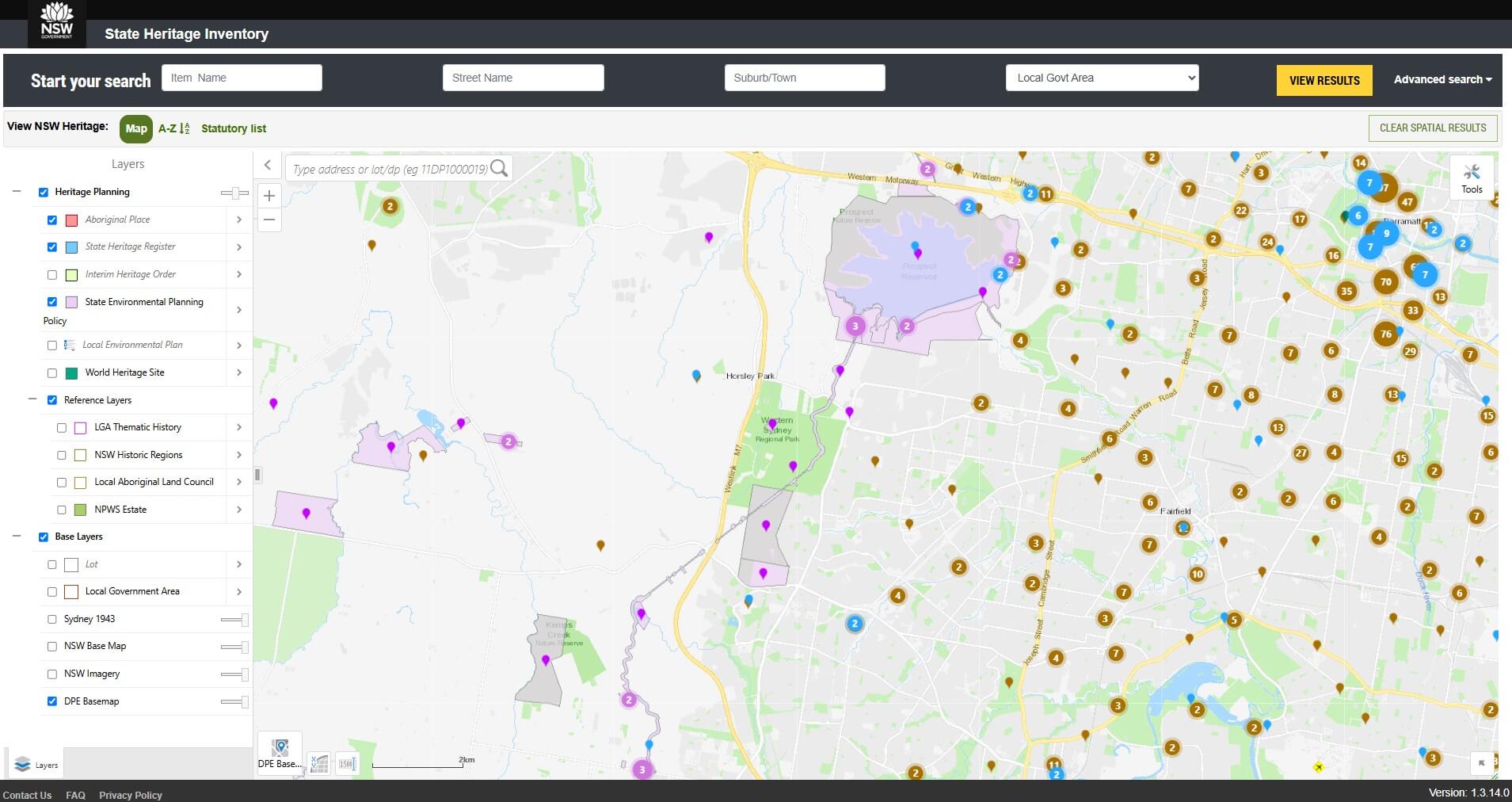
Use the slider bar at the top of the layers pane to adjust the opacity (that is, the degree of transparency) of the layer.
Tips
Click on the legend icon immediately left of the Local Environmental Plan layer to see different local environmental plan colour codes.
Spatial information is not available for Section 170 Heritage and Conservation Registers. This information is only available in the A–Z and Statutory list views.
Available map layers
There are many base map layers to choose from which display, for example:
- declared Aboriginal Places
- items listed on the State Heritage Register
- places protected under interim heritage orders
- items listed on local council local environmental plans
- local government boundaries
- local Aboriginal land council boundaries
- national parks estate
- World Heritage areas
- state environmental planning policies
- NSW historic regions
- thematic histories
- cadastre
- aerial photography
- aerial imagery of Sydney from 1943
- general reference similar to a street directory view showing street address
- points of interest.
Change the base maps
Click the base map shortcut icon at the bottom of the screen or click the right arrow at the top left of the screen to expand the layers data frame and select the base map to apply.
Opening the layers data frame will enable multiple base maps to be turned on at the same time and the opacity of each map can be adjusted.
Start a new basic search or advanced search
For a basic search, enter the street name and select the local government area in the grey bar at the top of the screen. Click View Results.
Tips
You’ll get the best results by using as few search filters as possible.
Do not enter a street number. The combination of a street name and local government is sufficient for searching.
Avoid searching by the Item Name unless you are certain of the exact name and spelling.
For an advanced search, click Advanced Search in the grey bar at the top of the screen.
Enter criteria in one or more of the search fields by clicking the down arrow, which expands to show more fields you can fill in.
Click View Results.
Tips
Advanced and basic searches don’t combine – they work independently.
Basic search gives you broad results based on simple options like local government area. Advanced search fields are extra filters that narrow down the results.
Choose basic for broad searches and advanced for detailed searches.
The exact location and boundary of culturally sensitive Aboriginal Places are not provided. The location approximates the general locale and the boundary is not shown. Contact us if you need to access culturally sensitive information.
Clear a search
To clear previously used search criteria, click Reset Parameters.
Click Clear Spatial Results to remove all map results and reload all available heritage items.
View search results
The results can be viewed in 3 different ways:
- Map view visually shows your search results on a map.
- A–Z view shows the search results in a single table.
- Statutory list view shows the search results in 3 groupings:
• Aboriginal Places declared under the National Parks and Wildlife Act 1974
• items listed under the Heritage Act 1977
• items managed by local councils and state agencies.
In the map view, single-click on a point to select a heritage item and a pop-up window will show a summary of details.
Click View Additional Details to open a new tab and view more information.
Tips
There is no map information available for items listed by state agencies. Choose either the A–Z or Statutory list view for a more complete search result.
Sometimes an error message may show ‘the heritage item is not available’. This is because not all mapped heritage items are joined to additional information. We are continually updating the State Heritage Inventory as new information becomes available from local councils and state agencies.
Print, export or save search results
In Map view: to print, click Tools and then click Print.
In A–Z view: to print, export or save, click on the printer icon or click on the download icon to the top right of the search results.
In Statutory view: to print, export or save, click on the printer icon or click on the download icon to the top right of each section of the search results.
Search a property address
- Enter the street address in top left corner of the map.
- Click the predictive text address.
- Click the magnifying glass.
- The search will zoom and highlight the address in yellow.
- Turn on the associated heritage layers to determine if the property is heritage listed.
Search a property lot and DP number
- In the top left corner of the map, enter the lot/DP numbers (for example, 16DP1255419).
- Click the predictive text number.
- Click the magnifying glass.
- The search will zoom and highlight the lot/DP in yellow.
- Turn on the associated heritage layers to determine if the property is heritage listed.
View NSW regional histories
- Click on NSW Historic Regions to turn the layer on.
- Click within a black-outlined boundary and a pop-up box will appear.
- Click on Document 1 to open the document in a new tab. Do not click on View Additional Details as no results will appear for this search. This feature is set up for other uses, and we’re unable to change it at this time.
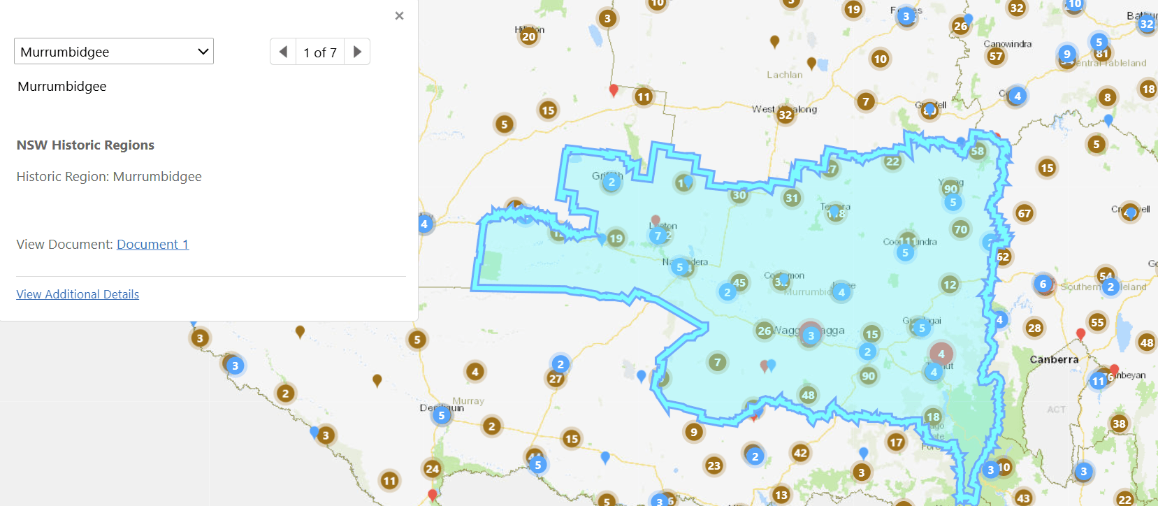
The boundaries of the 17 regions identified in Regional histories of New South Wales and corresponding documents are available to download. Regional histories of New South Wales assists in the assessment of environmental heritage and provides an overview of the history of New South Wales from a heritage perspective.
View local government area thematic histories
- Click on LGA Thematic History to turn the layer on.
- Click within a boundary and a pop-up box will appear.
- Click on Document 1 to open the document in a new tab. In some cases, there may be multiple documents to open. Do not click on View Additional Details.
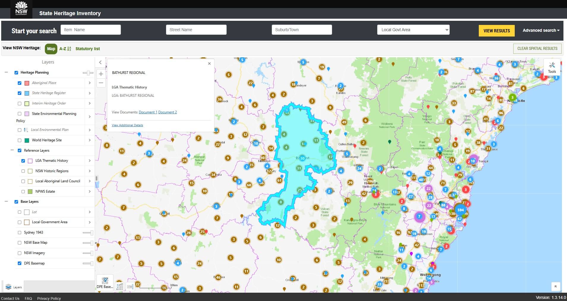
Over 140 local council thematic histories are available to download. Local government area thematic histories explain the main events and influences that shaped the area and help show why certain places and items are important.
Use the map tools
Click on Tools to access additional tools and the spatial tools tab.
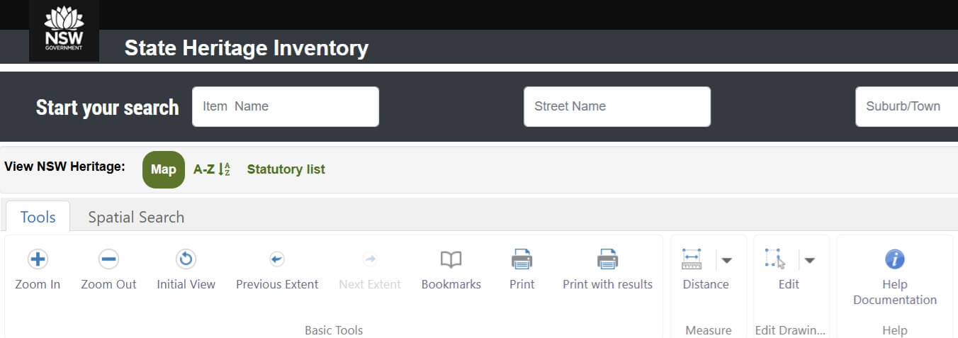
Tools tab
Click Zoom In or Zoom Out to drag and drop a rectangle.
Click Initial View to return to the start of the map viewer session.
Click Previous Extent or Next Extent to move forward or back between map views.
Click Bookmarks to save a particular location extent for future reference.
Click Print to print the map to a PDF or image.
Click Print with results to print the map to a PDF or image and include text search results.
Click Distance to measure the distance between 2 points or measure the area of a polygon.
Spatial tools tab
Spatial Search
Select one or more layers (by pressing Ctrl and clicking the mouse).
Select your geometry (polygon, polyline or rectangle) and draw your area on the map.
Click Next.
In the Spatial Search result, click Panel Action Menu to export results.
Spatial Search by Buffer
Select your geometry (polygon, polyline, rectangle or point).
Select one or more layers (by pressing Ctrl and clicking the mouse).
Enter your buffer distance in metres.
Draw your area on the map.
Click Continue.
In the Spatial Search result, click Panel Action Menu to export results.
Spatial Search by File Upload
Search for multiple lot/DPs.
Select one or more layer (by pressing Ctrl and clicking the mouse).
Upload either an XLSX or CSV file.
The file must have a separate column for each lot, section and plan.
Where there is no section, enter Null.
An example of a file upload is as follows.
| A | B | C |
|---|---|---|
| lot | section | plan |
| 3 | 6 | DP599646 |
| 10 | Null | DP1085031 |
The search results will be outlined in red. If an incorrect lot/DP is entered, an error message will appear and a null search result will be returned.
Spatial Search by Shapefile Upload
Select your ZIP file and click Continue.
Select all your shapes or select individual ones by checking the box.
Click Continue.
Select one or more layers (by pressing Ctrl and clicking the mouse).
In the Spatial Search result, click the Panel Action Menu to export results.
Before a new search, you must click Clear Results and Clear Graphics.
How current is the information?
We are continually updating the State Heritage Inventory as new information becomes available from local councils and state agencies. It is recommended that you check with the relevant local council or state agency for the most up-to-date information.
Find out more about Aboriginal sites
The State Heritage Inventory has general information only about declared Aboriginal Places, without showing exact locations and boundaries. This is due to the sensitivity of many sites. For a detailed search of Aboriginal Places and other significant sites, use the Aboriginal Heritage Information Management System (AHIMS).
Find out more about maritime heritage sites
For shipwrecks, submerged aircraft and other maritime sites that are not listed on the State Heritage Register, search the Maritime heritage database.