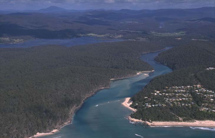
Pambula River is located on the far south coast of New South. This estuary is classed as a barrier river and flows into the southern end of Merimbula Bay at Pambula Beach.
The estuary supports a range of recreational and commercial uses yet retains a range of near-pristine habitats, including nationally recognised wetlands.
Water quality report card
As part of our water quality monitoring program we assess the water quality and ecosystem health of an estuary using a range of relevant indicators. We sample a subset of the estuaries between Wollongong and the Victorian border every 3 years. The most recent sampling in the Pambula River was completed over the 2017–18 summer, when 2 sites were sampled on a monthly basis.
This report card represents 2 water quality indicators that we routinely measure: the amount of algae present and water clarity. Low levels of these 2 indicators equate with good water quality.
The report card shows the condition of the estuary was excellent with:
- algae abundance graded (B)
- water clarity graded (A)
- overall estuary health graded (A).
Grades for algae, water clarity and overall are represented as:
- A – excellent
- B – good
- C – fair
- D – poor
- E – very poor.
Go to estuary report cards to find out what each grade means, read our sampling, data analysis and reporting protocols, and find out how we calculate these grades.
We have monitored water quality in Pambula River since 2008. This table shows the water quality grades for this estuary over that time.
| Year | Algae | Water clarity | Overall grade |
|---|---|---|---|
| 2008–09 | A | A | A |
| 2017–18 | B | A | A |
Physical characteristics
| Estuary type | Barrier river |
|---|---|
| Latitude (ºS) | –36.95 |
| Longitude (ºE) | 149.92 |
| Catchment area (km2) | 296.5 |
| Estuary area (km2) | 4.7 |
| Estuary volume (ML) | 9773.7 |
| Average depth (m) | 2.2 |
Tidal prism
Tidal prism data is available for this estuary. This tidal prism was measured in 1979.
| Tide state | Flow (ML) | Local tidal range (m) | Sydney Harbour tidal range (m) |
|---|---|---|---|
| Ebb flow | 2,510 | 0.91 | 1.35 |
| Flood flow | 3,410 | 1.16 | 1.58 |
Notes: km2 = square kilometres; m = metres; m3 = cubic metres; ML = megalitres.
Water depth and survey data
Bathymetric and coastal topography data for this estuary are available in our data portal.
Land use
The catchment of Pambula River is slightly disturbed. Grazing and urban areas constitute less than 20% of the catchment, including the township of Pambula, and 80% remains forested, including areas within South East Forests National Park and Ben Boyd National Park.
National and marine parks
- The largest conservation area in the Pambula River catchment is the South East Forests National Park.
- Large parts of the lower estuary, including Pambula Lake, flow through the northern section of Ben Boyd National Park.
- This estuary does not flow into a marine park.
Citizen science projects
- The Far South Coast Conservation Management Network supports the local community to better manage native biodiversity. The network organises citizen science projects, provides information for private landowners, manages a local plant database, and coordinates events.
Community involvement
- The Bega River and Wetlands Landcare Group is a volunteer group dedicated to improving the health of the Bega River, wetlands and floodplains.
- The Far South Coast Landcare Association is a volunteer environmental and conservation organisation that works to improve management of local land and water.
Seafood harvest area status
The NSW Food Authority website lists the current status of oyster/shellfish harvest areas.
Local government management
Local councils manage estuaries within their area unless the estuary is attached to a marine park.
Bega Valley Shire Council manages this estuary. More information about can be found on the council’s Estuary management webpage.
Threatened species
This catchment supports 3 critically endangered species of the Zieria genus, which are shrubs or small trees. This includes the shapely zieria, which is only known to exist in the Pambula River catchment in New South Wales.
Find out more about the biodiversity in our estuaries.