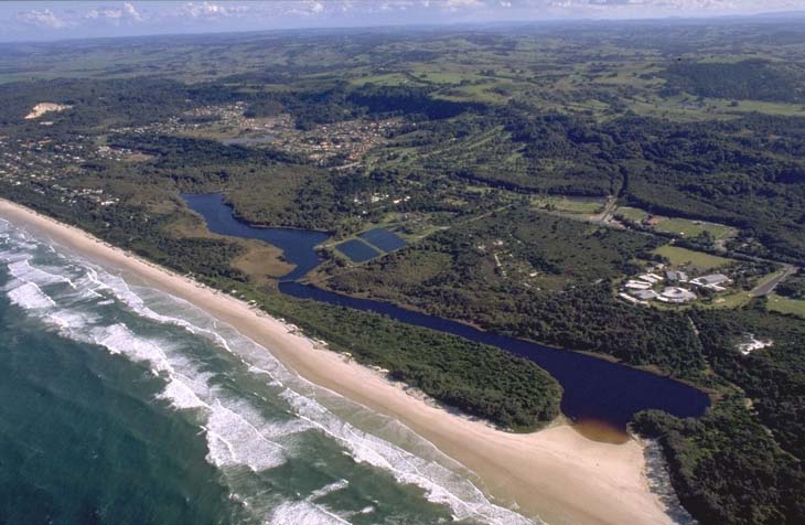
Tallow Creek is a lagoon with an intermittently closed/open entrance that meets the sea just south of Byron Bay on the north coast of New South Wales. The lagoon entrance is a popular swimming spot.
The lower reaches of the estuary are encompassed by the Arakwal National Park, which is jointly managed by the Bundjalung of Byron Bay (Arakwal) People and NSW National Parks and Wildlife Service.
Water quality report card
As part of our water quality monitoring program we assess the water quality and ecosystem health of an estuary using a range of relevant indicators. We sample a subset of the estuaries located between the Queensland border and Taree every 3 years. The most recent sampling in Tallow Creek was completed over the 2021–22 summer, when 2 sites were sampled on a monthly basis.
This report card represents 2 water quality indicators that we routinely measure: the amount of algae present and water clarity. Low levels of these 2 indicators equate with good water quality.
The report card shows the condition of the estuary was poor with:
- algae abundance graded very poor (E)
- water clarity graded good (B)
- overall estuary health graded poor (D).
Grades for algae, water clarity and overall are represented as:
- A – excellent
- B – good
- C – fair
- D – poor
- E – very poor.
Go to estuary report cards to find out what each grade means, read our sampling, data analysis and reporting protocols, and find out how we calculate these grades.
We have monitored water quality in Tallow Creek since 2009. This table shows the water quality grades for this estuary over that time.
| Year | Algae | Water clarity | Overall grade |
|---|---|---|---|
| 2009–10 | C | A | B |
| 2012–13 | B | A | A |
| 2015–16 | C | B | B |
| 2018–19 | C | A | B |
Physical characteristics
| Estuary type | Lagoon |
|---|---|
| Latitude (ºS) | –28.67 |
| Longitude (ºE) | 153.62 |
| Catchment area (km2) | 5.34 |
| Estuary area (km2) | 0.1 |
| Estuary volume (ML) | 46.6 |
| Average depth (m) | 0.4 |
Notes: km2 = square kilometres; m = metres; ML = megalitres.
Water depth and survey data
Bathymetric and coastal topography data for this estuary are available in our data portal.
Land use
The catchment of Tallow Beach is highly disturbed. The main land use is urban development, which makes up over half of the catchment. The suburb of Suffolk Park falls within the catchment, along with other low-density urban development. Worth noting is the now defunct sewage treatment plant, which operated adjacent to the estuary.
National and marine parks
- Arakwal National Park covers the lower reaches of Tallow Creek, including its mouth, and is part of the Cape Byron Marine Park.
Community involvement
- Byron Bird Buddies is a volunteer community group involved with bird monitoring, conservation and education in the Northern Rivers region.
Local government management
Local councils manage estuaries within their area unless the estuary is attached to a marine park. Byron Bay Council and Cape Byron Marine Park manage this estuary.
Threatened species
Shorebirds congregate around the entrance of Tallow Creek, such as pied oystercatchers and little terns.
Read more about the biodiversity in our estuaries.