The Murrumbidgee Environmental Water Advisory Group (the group) met at Leeton in September 2024. The meeting was chaired by Anna Wilson and included a field trip to the Ramsar-listed Fivebough Wetlands on the edge of town. Ramsar wetlands are internationally significant.
Environmental water update
The 2024–25 Murrumbidgee environmental water annual plan was approved at the group’s June meeting and water managers are implementing the plan. Large floodplain wetlands such as Gayini (formerly known as Nimmie-Caira), North Redbank and Western Lakes in the Lower Murrumbidgee will receive environmental flows in spring.
The NSW Department of Climate Change, Energy, the Environment and Water has also planned a spring fish pulse in the Murrumbidgee River and Yanco/Colombo/Billabong creeks to promote spawning and recruitment of large-bodied native fish species such as Murray and trout cod and golden and silver perch.
Monitoring update
A new environmental water monitoring program (Flow-MER2.0) funded by the Commonwealth Environmental Water Holder is due to start in September 2024. It is a continuation of Flow-MER1.0 and the previous long-term intervention monitoring programs.
Like the previous programs, Flow-MER2.0 monitors the environmental benefits achieved using Commonwealth environmental water in the Murray-Darling Basin. The focus will remain on native fish, waterbirds, and vegetation responses to water for the environment. The program will inform real-time decision-making and allow for long-term trend analysis.
NSW Department of Climate Change, Energy, the Environment and Water will continue to monitor waterbirds and fish at sites not covered by Flow-MER2.0 and continue the annual waterbird counts and rookery monitoring they have conducted in previous years.
Mapping the Murrumbidgee
The Department of Primary Industries and Regional Development, Fisheries and Forestry gave a presentation on aquatic habitat mapping in NSW rivers, including the upper Murrumbidgee. The project has mapped 6,500 kilometres of riverine habitat, which is an impressive 3.69% of New South Wales.
The mapping will be used to develop objectives and a restoration strategy for NSW rivers. If funded, future mapping may include parts of the Murrumbidgee that are within our environmental watering footprint. Information from mapping will help inform how water for the environment can be used to more effectively maximise and maintain critical habitats for fish.
Group update on Reconnecting River Country Program
The group was given an update on the Reconnecting River Country Program. For further information and the latest updates on the program, visit the Reconnecting River Country Program webpage.
Group membership recruitment update
The NSW Minister for the Environment has approved the membership of the Murrumbidgee Environmental Water Advisory Group, which should be formalised before the next group meeting.
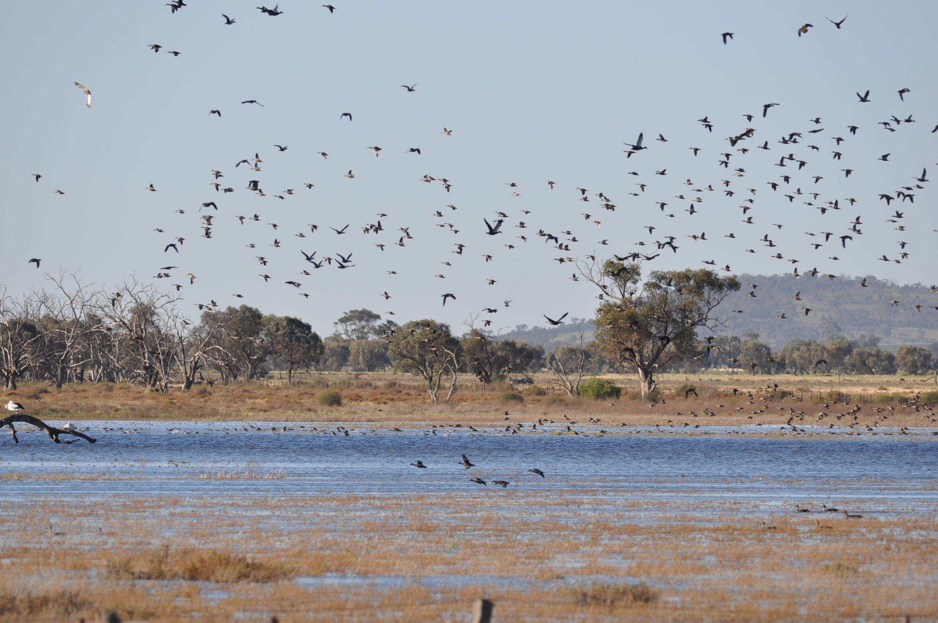
Fivebough field trip
Rain affected the proposed field trip to the Fivebough Wetlands, so the group only visited one all-weather site at Fivebough Swamp. The group observed the recent flood repair works at the location and noted that the walking paths were in excellent condition.
The group saw a large variety of waterbirds including swans, ducks, egrets, ibis, herons, swamp hens, stilts, and magpie geese.