Plant community types are widely used to support biodiversity assessment and land management activities.
For more information, visit the NSW PCT classification webpage.
How to access the tool
Anyone can access the Plot to PCT Assignment Tool.
Purpose of the tool
The tool provides a standardised repeatable method for identifying quantitative plant community types using the floristic survey methods required under the NSW Biodiversity Assessment Method.
New standard floristic survey sites can be evaluated against quantitative approved plant community types for the coast and tablelands bioregions of eastern New South Wales, using a combination of floristic, environmental and spatial attributes.
The tool helps users assess plant community type options by providing detailed information on the 10 most closely matched types. This includes statistics for the strength of the match and interactive maps of reference locations.
Matching results and summary information can be downloaded from the tool in spreadsheet form.
Watch the video: Demonstration of the Plot to PCT Assignment Tool.
Where does the tool apply?
The tool currently applies to native vegetation in the coast and tablelands bioregions of eastern New South Wales.
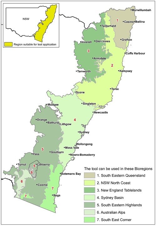
As quantitative plant community type classification revisions are undertaken further west, more bioregions will be added.
Where do plant community type data in the tool come from?
All data embedded in and presented by the tool are sourced from BioNet. The tool is maintained to ensure alignment with the current version of the PCT master list and associated data in BioNet.
How to prepare plot data for use in the tool
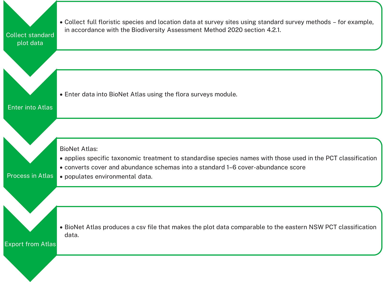
The Plot to PCT Assignment Tool runs as part of BioNet.
BioNet Atlas is set up to receive and prepare your flora survey plot data before using the tool.
Using BioNet Atlas to prepare your data provides the maximum potential to retrieve interpretable match results in the tool. Running the tool on plot data that has not first been processed in BioNet Atlas is likely to generate inaccuracies and obscure relationships to the plant community type reference data.
For additional guidance on contributing and extracting plot data from BioNet Atlas, there are instructional videos on Vimeo and a downloadable user guide.
User guide
The Plot to PCT Assignment Tool User Guide provides detailed information about preparing data for the tool, uploading and analysing data, and evaluating matching results.
Send any questions or feedback to the BioNet team.