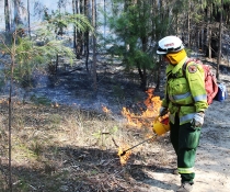
NPWS hazard reductions in Pilliga West State Conservation Area
The NSW National Parks and Wildlife Service is planning two hazard reduction burns in the Pilliga West State Conservation Area from tomorrow (Thursday 29 March), weather permitting.
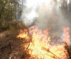
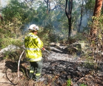
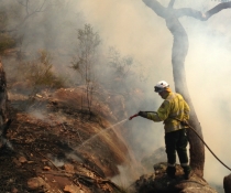
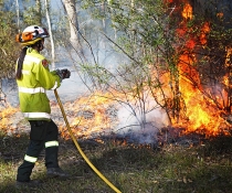
The burns will treat approximately 1,555 hectares and will reduce the fuel load in the park, adding to protection for the community of Gwabegar should a wildfire occur.
Crews will use aerial and ground ignition to treat the site, about 30 kilometres west of Gwabegar.
People travelling on the Coonamble – Pilliga Road should use caution, with some smoke haze possible depending on wind.
Several localised park road closures will be implemented within the Pilliga West State Conservation Area. Check www.nationalparks.nsw.gov.au/alerts for more details.
People vulnerable to smoke are encouraged to remain indoors and keep their doors and windows closed to reduce exposure.
Hazard reduction burns are essential to reduce bushfire fuel loads to help protect parks, neighbours and communities from future bushfires.
This week's burns are among 12 planned this autumn to cover 6,400 hectares in local national parks, pending favourable weather.
All burns around the state are coordinated with the NSW Rural Fire Service to ensure the impact on the community is assessed at a regional level.
People with known health conditions can sign up to receive air quality reports, forecasts and alerts via email or SMS from the Department of Planning and Environment.
For health information relating to smoke from bush fires and hazard reduction burning, visit the NSW Health website or Asthma Australia.
More information on hazard reduction activities is available at: NSW Rural Fire Service and the NSW Government 'Hazards Near Me' website and app.