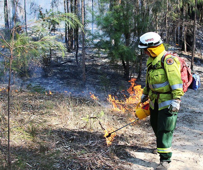
Hazard reduction burning in Boonalla Aboriginal Area
The NSW National Parks and Wildlife Service (NPWS) is carrying out a hazard reduction burn in Boonalla Aboriginal Area, north of Gunnedah over the next 3 days (24-26 May) weather permitting.
The 100 hectare burn is taking place approximately 25 kilometres from Gunnedah and smoke may impact Kelvin Road, depending on wind.
Boonalla Aboriginal Area will be closed to visitors during burning operations.
The burn is to reduce fuels and to create a mosaic across the landscape within Boonalla Aboriginal Area.
Visitors should not enter closed areas until it is assessed as safe by NPWS. Visitors can also check NPWS Alerts for up-to-date information on temporary closures.
Smoke may be visible in the Aboriginal Area and from surrounding areas and motorists should use caution.
All NPWS hazard reduction burns are coordinated with the NSW Rural Fire Service to ensure the impact on the community is assessed at a regional level.
People with known health conditions can sign up to receive air quality reports, forecasts and alerts via email or SMS from the Department of Planning and Environment.
For health information relating to smoke from bush fires and hazard reduction burning, visit the NSW Health website or Asthma Australia.
More information on hazard reduction activities is available at NSW Rural Fire Service and the NSW Government Hazards Near Me website and app.