Botany Bay and its surrounding areas have important recreational, commercial, colonial and traditional heritage values. The bay and its foreshore areas provide opportunities for a variety of recreational activities, serves as Greater Sydney’s main sea port and hosts.
Australia's busiest airport is on the north-western side, with 2 runways that extend into the bay.
First Nations people have lived in the Botany Bay area for thousands of years.
Port Botany was where Captain James Cook made landfall in 1770, signalling the early beginnings of present-day Australia.
Water quality
Botany Bay has not been sampled as part of our monitoring program. We monitor water quality in the Cooks River and the Georges River, the main tributaries to Botany Bay, which were last sampled in 2020.
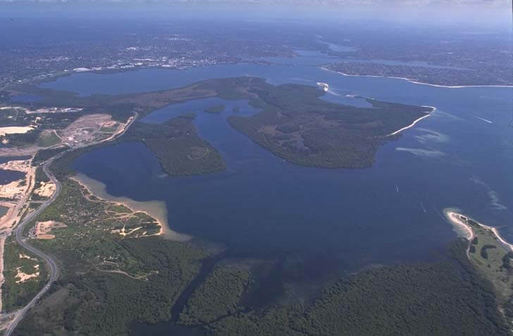
Physical characteristics
| Estuary type | Bay |
|---|---|
| Latitude | –34 (ºS) |
| Longitude | 151.23 (ºE) |
| Catchment area | 54.9 km2 |
| Estuary area | 39.6 km2 |
| Estuary volume | 480,815.8 ML |
| Average depth | 11.4 m |
Notes: km2 = square kilometres; m = metres; m3 = cubic metres; ML = megalitres.
Land use
The Botany Bay catchment has been heavily disturbed, with a significant amount of the land cleared for urban and industrial use. On the north side are the historic site of La Perouse and various industrial operations, including Port Botany and Sydney Airport. To the south is Kurnell, where land use includes a mixture of conservation areas, heavy industry and residential areas. To the west is Brighton Le Sands, which consists of a mix of residential and commercial businesses.
National and marine parks
- Kamay Botany Bay National Park is the largest conservation area in the Botany Bay catchment.
- Towra Point Nature Reserve supports the largest wetland of its type in the greater Sydney region and is a Ramsar wetland of international importance.
- Cape Banks Aquatic Reserve is located on the north headland of Botany Bay and aims to conserve biodiversity and protect habitat.
- There is no marine park associated with this estuary.
Community involvement
- Bayside Bushcare is a community group that provides volunteers with the opportunity to get involved in bushcare work such as weed removal, planting of native species, mulching, animal surveys and seed collection.
- Cooks River Alliance is a partnership of 4 councils dedicated to improving the health of the Cooks River. The alliance runs programs and supports volunteers who want to get involved in environmental projects. Its website includes and list of links to other community groups working to restore and protect the health and biodiversity of the Cooks River.
- Georges Riverkeeper is a catchment management group that works with 8 member councils to improve the environment of the Georges River. They raise community awareness about protecting and restoring the natural environment and provide links for volunteers to get involved.
Local government management
Local councils manage estuaries within their area, unless the estuary is attached to a marine park. This estuary spans multiple local government areas and is therefore managed by Bayside, Sutherland Shire and Randwick City councils.
Protected species
This estuary provides habitat for the protected weedy sea dragon, which is the only known sea dragon in NSW waters.
Read more about the biodiversity in our estuaries.