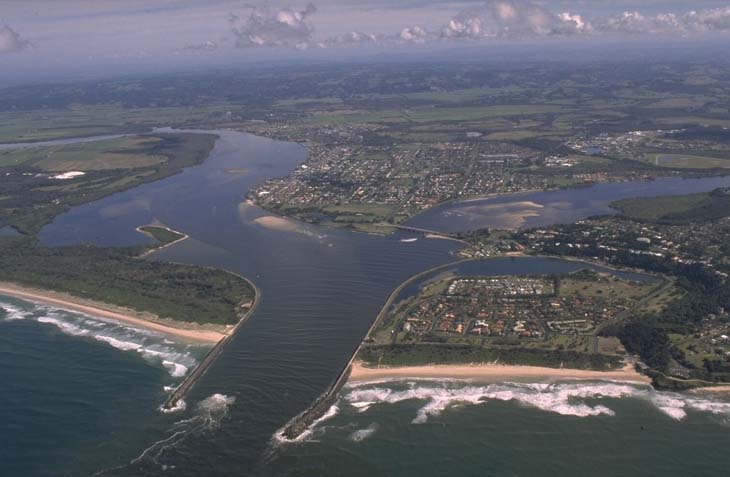
The Richmond River is one of the dominant rivers on the New South Wales north coast. It flows for 170 kilometres from the New South Wales/Queensland border and enters the sea at the township of Ballina.
The entrance to Richmond River estuary is trained using break walls and remains permanently open. It is classed as a barrier river. Wilsons River, which flows through the township of Lismore, is the main tributary into the Richmond River.
Richmond River is a focal point for local commerce, tourism and recreation. Despite its history of large-scale disturbance and development, this large estuary supports a diversity of seagrass, mangrove and saltmarsh communities, and provides important shorebird habitat.
Water quality report card
As part of our water quality monitoring program we assess the water quality and ecosystem health of an estuary using a range of relevant indicators. We sample a subset of the estuaries located between the Queensland border and Taree every 3 years. The most recent sampling in the Richmond River was completed over the 2018–19 summer, when 24 sites were sampled on a monthly basis.
This report card represents 2 water quality indicators that we routinely measure: the amount of algae present and water clarity. Low levels of these 2 indicators equate with good water quality.
The report card shows the condition of the estuary was fair with:
- algae abundance graded poor (D)
- water clarity graded good (B)
- overall estuary health graded fair (C).
Grades for algae, water clarity and overall are represented as:
- A – excellent
- B – good
- C – fair
- D – poor
- E – very poor.
Go to estuary report cards to find out what each grade means, read our sampling, data analysis and reporting protocols, and find out how we calculate these grades.
We currently collaborate with a number of local councils within the Richmond River catchment area to develop a comprehensive water quality monitoring program across the entire Richmond River estuary and some of the major inflowing rivers and streams as part of the NSW Marine Estate Management Strategy. Additionally, Rous County Council, in collaboration with the University of New England’s EcoHealth program, has carried out detailed ecosystem health monitoring in the Richmond River. The results of the monitoring program, including a detailed water quality report card, are available on the Rous County Council website.
We have monitored water quality in Richmond River since 2012. This table shows the water quality grades for this estuary over that time.
| Year | Algae | Water clarity | Overall grade |
|---|---|---|---|
| 2012–13 | C | B | B |
| 2015–16 | D | B | C |
Physical characteristics
| Estuary type | Barrier river |
|---|---|
| Latitude (ºS) | –28.8 |
| Longitude (ºE) | 153.59 |
| Catchment area (km2) | 6861.8 |
| Estuary area (km2) | 38.4 |
| Estuary volume (ML) | 119,314.4 |
| Average depth (m) | 3.2 |
Tidal exchange volume
Tidal exchange volume or tidal prism data is available for this estuary. This tidal prism was measured in 1994.
| Tide state | Flow (ML) | Local tidal range (m) | Sydney Harbour tidal range (m) |
|---|---|---|---|
| Ebb flow | 21,900 | 1.53 | 1.67 |
| Flood flow | 24,990 | 1.56 | 1.61 |
Notes: km2 = square kilometres; m = metres; m3 = cubic metres; ML = megalitres.
Water depth and survey data
Bathymetric and coastal topography data for this estuary are available in our data portal.
Land use
The Richmond River has a highly disturbed catchment due to a long history of vegetation changes, hydrological modifications, agriculture and urban development. Much of the lower coastal plain has been cleared for agriculture whereas the upper catchment remains largely forested. Major towns within the catchment include Ballina and Lismore.
Water use
Find out about water use in the Richmond River, including information about major water users, real-time flow data, and environmental and water sharing plans.
Web cam
The Ballina bar crossing web camera, located at the mouth of the Richmond River, provides real-time video of conditions within the river entrance immediately offshore to help with bar crossings and boat safety.
National and marine parks
- Bungawalbin National Park is the largest conservation area in the Richmond River catchment.
- Ballina Nature Reserve and Richmond River Nature Reserve protect extensive areas of wetlands and mangroves around the estuary.
- There is no marine park associated with this estuary.
Community involvement
- Richmond Landcare is an umbrella landcare organisation that supports other Landcare and environmental groups in the local area.
- Richmond River Floodplain Management is a long-term project coordinated by North Coast Local Land Services and Conservation Volunteer Australia, in collaboration with Richmond River County Council and NSW Department of Primary Industries – Fishing. It involves working with local land holders to restore the health of floodplain wetlands and open swamps within the Richmond River catchment.
- is a volunteer community group working to improve river health.
- Ballina Coastcare is an active community group involved in restoration and regeneration of the coastal environment around East Ballina.
Seafood harvest area status
The NSW Food Authority website lists the current status of oyster/shellfish harvest areas.
Local government management
Local councils manage estuaries within their area unless the estuary is attached to a marine park. Ballina Shire Council manages this estuary.
Threatened species
Richmond River Nature Reserve protects important shorebird habitat and nesting areas for sea turtles, including loggerhead and green turtles. Dugongs have also been recorded within the estuary.
Read more about the biodiversity in our estuaries.