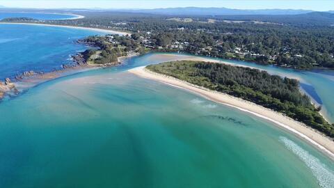
Estuaries are complex and interconnected ecosystems. Our scientists conduct research on estuarine water quality, habitats, biodiversity, and threats, to better understand and protect these important waterways for the people of New South Wales.
We collect a range of data to assess the structure, function, composition and condition of estuaries.
This data helps guide decision-making to manage estuaries effectively. For example, we use this data to provide local councils with advice to help them make land-use planning decisions to better protect estuaries.
Foundational work to establish a statewide estuaries monitoring program was completed for the NSW Monitoring Reporting and Evaluation Program. Outputs of the monitoring program allow us to track the condition of estuaries over time by comparing observed data to a range of guideline values specific to NSW estuaries. This monitoring work is now continued through the Marine Estate Management Strategy.
Biodiversity assessments provide a broad picture of the aquatic ecosystem health of estuaries. We measure:
- habitat availability by mapping the habitats of NSW estuaries (PDF 6.7MB) – we map the extent of seagrass, mangroves and saltmarsh
- fish assemblages – with the NSW Department of Primary Industries and Regional Development fisheries research, we assess fish diversity, fish populations and nursery habitats
- eutrophication, which occurs when an estuary becomes overloaded with nutrients such as nitrogen and phosphorous and an algal bloom or excessive growth of algae occurs – we measure macroalgal abundance to assess the risk of eutrophication.
We record and map physical features of estuaries such as:
- size
- location
- boundaries of waterways and catchments
- estuary type
- entrance condition.
A description of the physical features of each NSW estuary is available – see the Health of our estuaries page for more information.
Maps of estuary waterway boundaries, the location of estuary entrances and estuary catchment boundaries are available on the Sharing and Enabling Environmental Data (SEED) portal.
Water quality monitoring allows us to assess the aquatic ecosystem health of an estuary in response to pressures, such as urbanisation, intensive agriculture or land-clearing. We measure algae (chlorophyll a) and water clarity (turbidity) to produce an ecological health report card for each estuary in New South Wales.
A range of other physico-chemical and biological indicators are also collected in our monitoring programs. The objective of our monitoring is to assess the overall condition of an estuary at a scale that reflects the:
- cumulative impact of pressures on the system
- benefits of management actions across the catchment.
A compilation of water quality data collected in estuaries between 2007 and 2024 is available on the SEED data portal.
To measure how estuary function is affected by tides, we collect data on water level, tidal flow and velocity. We also map the upstream extent of tidal flow.
In addition, tidal exchange volume or tidal prism data is collected to calculate the volume of water exchanged between the ocean and an estuary within a tidal cycle. This data helps us understand how long water and any pollutants are likely to reside in an estuary before another exchange with seawater.
Tidal survey data for a number of estuaries will soon be available on the SEED data portal.
We measure the depth (bathymetry) and bottom configuration (hydrography) of estuaries.
The shape and size of an estuary and condition of the estuary entrance, or mouth, provides useful information for understanding estuary function and processes. This information is an important tool in coastal zone management.
Bathymetry survey data is available for some estuaries and extensive parts of the NSW coast on the Australia Ocean Data Network website.
Manly Hydraulics Laboratory
The Manly Hydraulics Laboratory is a specialist NSW Government agency that helps the NSW Department of Climate Change, Energy, the Environment and Water (DCCEEW) collect and publish data, including:
- flow and water quality measurement and investigations
- oceanographic, coastal, estuarine and riverine process studies
- investigation and design of hydraulic, coastal and maritime structures.
The Manly Hydraulics Laboratory maintains a network of water level recorders on behalf of DCCEEW. The location of recorders and water level data for these sites can be found on the Manly Hydraulics Laboratory website.
We monitor the impact and the recovery of estuarine ecosystems following unexpected events, such as flooding, blackwater events and bushfire. As part of the NSW Government’s response to the 2019–2020 bushfire recovery, we measured water quality and aquatic ecosystem health in a number of fire-affected waterways. We also work closely with local councils to advise them on how to measure ongoing impacts and plan for minimising future impacts.
Water quality data collected in estuaries that were affected by fire can be found on the SEED data portal.
Data from monitoring programs is used to develop waterway health report cards. These report cards present the ecological health for each estuary, when data is available. Report card grades can be found on our individual estuary webpages. Go to the Health of our estuaries page to find your estuary of interest.
We collaborate extensively with local councils to assess aquatic ecosystem health of estuaries in their local government areas and assist them in reporting the condition back to the local community – for example, the MidCoast Council’s 2020 Waterways and Catchment Report Card.