
The Namoi catchment covers an area of approximately 42,000 square kilometres.
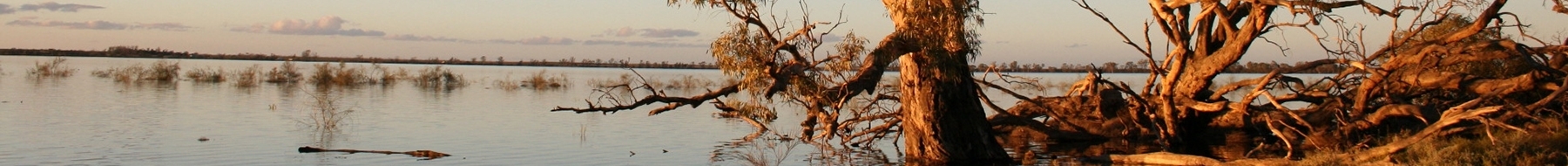
The Namoi and Peel rivers are regulated, with major water storages being Keepit, Split Rock and Chaffey dams. Significant environmental values in the catchment include the Namoi River between Gunnedah and Narrabri which provides critical habitat for native fish and threatened species.
Also, many small lagoons, wetlands and anabranches on the floodplain downstream of Narrabri provide habitat for waterbirds. Lake Goran, in the unregulated Mooki catchment, is listed as a wetland of national significance.
The Namoi catchment wetlands and rivers also support important Aboriginal cultural values for the Kamilaroi (Gomeroi) people.
Water for rivers and wetlands
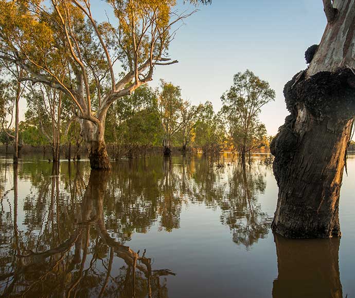
Improved weather conditions and return of natural river flows at the end of 2020–21 continued into 2021-22 with large scale floods occurring in December. No water for the environment was delivered during the year as dam spills, combined with downstream tributaries, provided for environmental demands in the Lower Namoi and Peel rivers. Large end-of-system flows also contributed to environmental water demands in the Barwon-Darling River.
With ongoing support of natural inflows, water managers will respond to catchment conditions to determine the most appropriate use of water for the environment. It is likely water managers will continue to support native fish recovery, particularly below Wee Waa. In the year ahead, water managers will focus on providing movement and dispersal opportunities for native fish in the system.
Management of water for the environment in the Peel Valley will continue to focus on in-channel productivity, habitat quality and native fish drought recovery upstream of Tamworth. Water managers will likely deliver flows in spring.
Weather and water forecast
The El Niño–Southern Oscillation (ENSO) outlook remains at La Nina, with a return to neutral ENSO during winter. However, atmospheric indicators remain above La Nina threshold, meaning the La Nina influence continues.
The short-term rainfall outlook is likely to be above median for the Namoi which will maintain the current soil moisture and run-off efficiency within the catchment.
Water managers have prepared watering plans that consider a range of weather and water availability scenarios. This is known as resource availability scenario planning. As dam levels remain moderate, a significant degree of uncertainty remains around resource availability. However, on balance, the Namoi catchment outlook is rated as ‘wet’.
1. ENSO: The interaction between the sea surface and atmosphere over the Pacific Ocean which results in dryer or wetter conditions (El Nino or La Nina).
Resource availability scenario
 |
Very dry Main aim: Protect Avoid critical loss |
 |
Dry Main aim: Maintain Maintain river functioning |
 |
Moderate Main aim: Recover Improve ecological health and resilience |
 |
Wet to very wet Main aim: Enhance Restore key floodplain and wetland linkages |
Key planned actions for 2022–23
Waterbirds
Water managers have no specific action planned. They expect an improvement in the diversity and abundance of waterbirds in response to natural flooding of warrambools, high floodplain and riparian vegetation.
Refuge pools will support some minor waterbird habitat.
Native fish
Water managers will look for opportunities to help support the recovery of native fish populations.
Vegetation
Overland flow from recent flooding events will support riparian and floodplain vegetation as will areas where regulated flows extend.
Connectivity
Water managers will look for opportunities to provide connection with the Barwon River to encourage dispersal of native fish into the Namoi River.
Figure 1 Map of proposed annual priority targets in the Namoi Water Resource Plan area 2022–23.
