The Gwydir valley catchment extends from the Northern Tablelands to the Northern Plains, where it joins the Barwon River, covering an area of 26,596 square kilometres.
Water for the environment focus
Water for the environment is generally focused on the river and wetlands systems west of Moree, where the Gwydir River branches into two defined systems:
- the Gwydir Wetlands, consisting of the Gingham Watercourse and Lower Gwydir (Big Leather) River
- the Mehi River, which includes the Mallowa and Moomin systems to the south.
Providing habitats for wildlife
Water for the environment in the Gwydir valley supports a range of native plants and animals including:
- coolibah woodlands, river cooba, water couch marsh and common reeds
- the state's largest stand of marsh club-rush sedgeland
- breeding habitat for colonial nesting waterbirds, as well as habitat for migratory bird species listed under international agreements
- native fish such as Murray cod, silver perch, olive perchlet, purple spotted gudgeon and eel-tailed catfish.
Important wetlands
There are 4 Ramsar-listed wetlands within the Gwydir wetland system: Windella, Crinolyn, Goddard's Lease and Big Leather (on Old Dromana, which is also part of the Gwydir Wetlands State Conservation Area).
Indigenous connection
The Gwydir wetlands are the country of the Kamilaroi people, and include more than 160 cultural heritage sites that have been recorded in and around the wetlands, including burial sites, scar trees and stone artefacts.
Working together
The Gwydir Environmental Water Advisory Group (EWAG) provides local input into Department of Planning and Environment (the department) decision-making and water management as a recognised EWAG.
The Gwydir EWAG helps prepare annual watering plans and advises on specific water releases throughout the year.
The Department manages water for the environment in the Gwydir catchment in partnership with the Gwydir EWAG, Commonwealth Environmental Water Holder, WaterNSW, Department of Primary Industries and Regional Development, National Parks and Wildlife Service, and local land managers and water users.
Planning for the future
We have developed a long-term water plan for the Gwydir catchment.
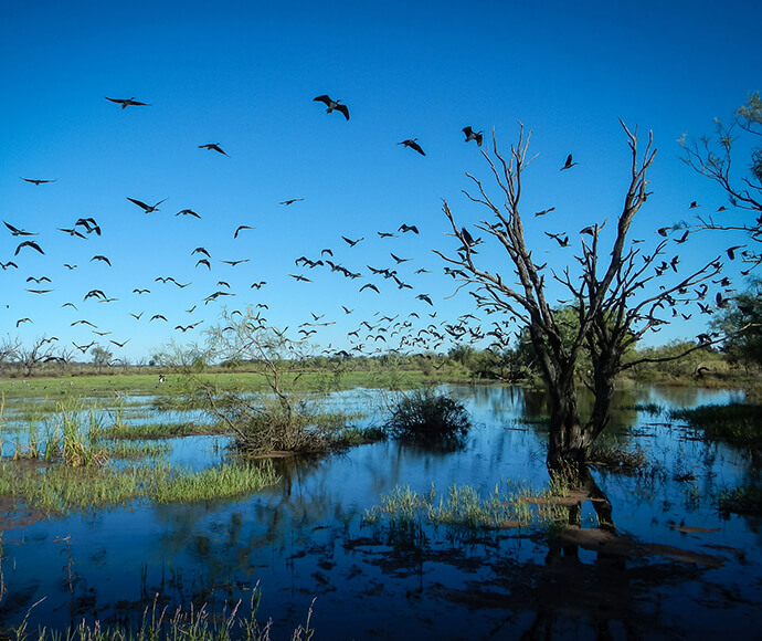
Fledged ibis (Threskiornis moluccus) on the wing, Gingham Wetlands 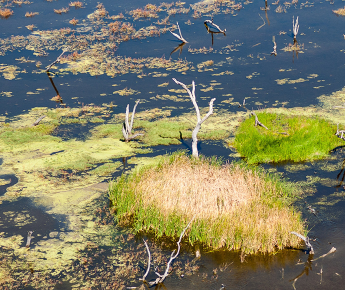
Flooded reedbeds, Gwydir wetlands 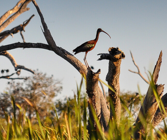
Fledged bronze (glossy) ibis (Plegadis falcinellus) on a branch in the Gingham wetlands 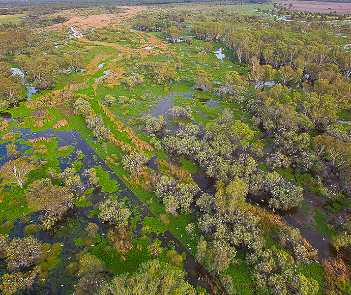
Aerial photo of egret (Ardea alba) colony in the Upper Gingham Wetlands 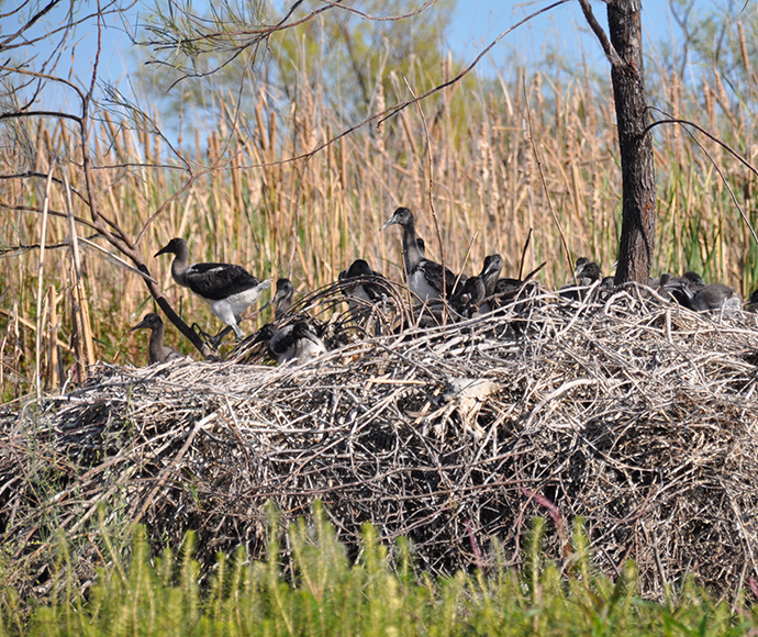
Wary Ibis chicks (Threskiornis moluccus) in the Gingham wetlands 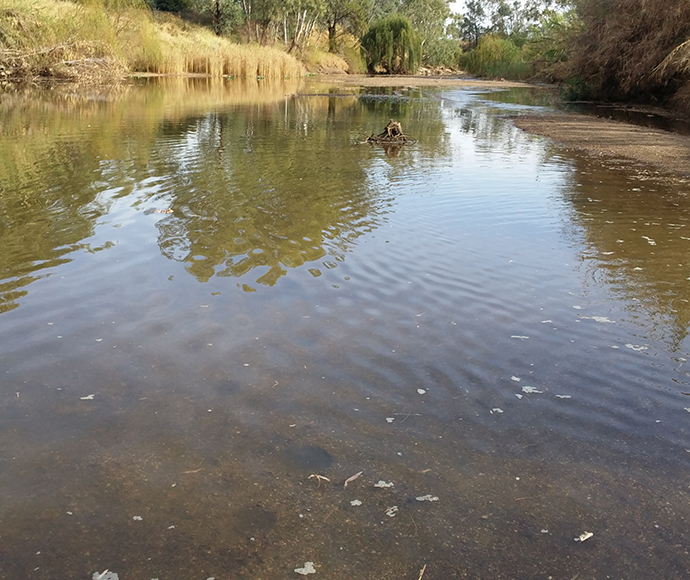
Low flows connecting pools on the Gwydir between Boolooroo and Yarraman, April 2016 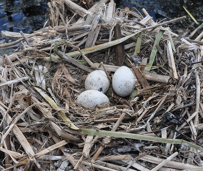
Straw-necked ibis (Threskiornis spinicollis) eggs begin to hatch on reeds in the lower Gwydir wetlands. 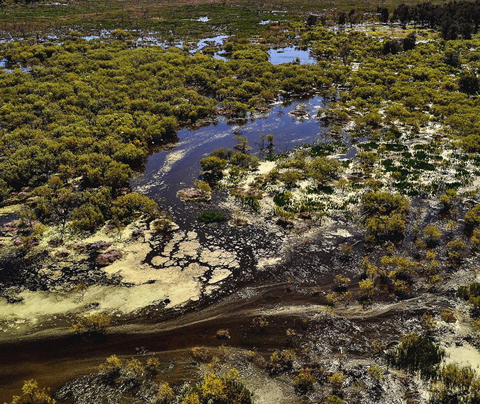
The Lower Gwydir wetlands in flood 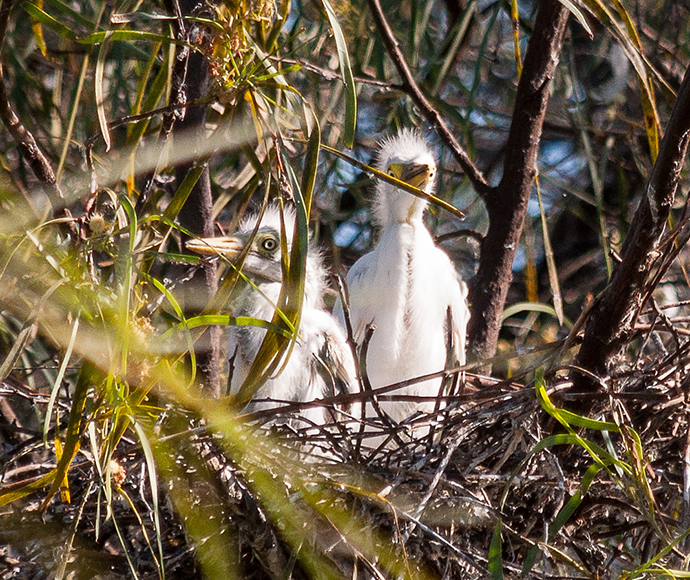
Intermediate egret chicks (Ardea intermedia) wait to be fed in the upper Gingham wetlands. 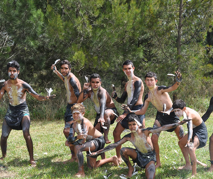
A group of dancers from Clontarf Academy, Armidale
More information
- Gwydir Water Resource Plan Area
- Cooperative management of environmental water to improve river and wetland health in NSW
- Vegetation Mapping Project: Executive summary
- Long-term water plans
- Gwydir Long-Term Water Plan
- Water Sharing Plan for the Gwydir Regulated Water Source (PDF 952KB)download file
- Murray Darling Basin Planopens a new window
- Murray Darling Basin Authorityopens a new window