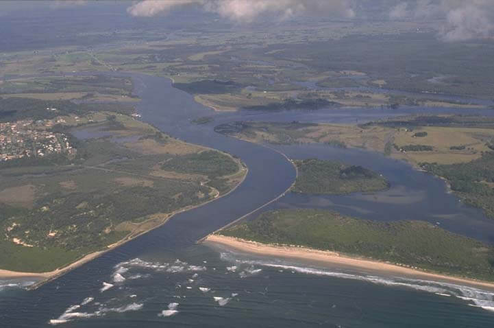
The Macleay River is situated on the mid-north coast of New South Wales. It is a large barrier river with a permanently open, trained entrance. It is the fourth largest coastal river in New South Wales.
The Macleay River and its tributaries, aptly named the Wild Rivers, crash and fall through rugged and mountainous terrain in the Great Dividing Range. Further downstream, a large estuarine zone supports diverse assemblages of vegetation communities, including wetlands in the Clybucca Creek estuary that are listed in the Australian Directory of Important Wetlands.
Water quality report card
As part of our water quality monitoring program, we assess the water quality and ecosystem health of an estuary using a range of relevant indicators. We sample a subset of the estuaries located between the Queensland border and Taree every 3 years. The most recent sampling in the Macleay River was completed over the 2018–19 summer, when 2 sites were sampled on a monthly basis.
The report card shows the condition of the estuary was excellent with:
- algae abundance graded excellent (A)
- water clarity graded excellent (A)
- overall estuary health graded excellent (A).
Grades for algae, water clarity and overall are represented as:
- A – excellent
- B – good
- C – fair
- D – poor
- E – very poor.
Go to estuary report cards to find out what each grade means, read our sampling, data analysis and reporting protocols, and find out how we calculate these grades.
We have monitored water quality in the Macleay River since 2009. This table shows the water quality grades for this estuary over that time.
| Year | Algae | Water clarity | Overall grade |
|---|---|---|---|
| 2009-10 | B | B | B |
Physical characteristics
| Estuary type | Barrier river |
|---|---|
| Latitude (ºS) | –30.87 |
| Longitude (ºE) | 153.03 |
| Catchment area (km2) | 11,287 |
| Estuary area (km2) | 31.6 |
| Estuary volume (ML) | 70,235.2 |
| Average depth (m) | 2.6 |
Tidal exchange volume
Tidal exchange volume and tidal prism data is available for this estuary. This tidal prism was measured in 2003.
| Tide state | Flow (ML) | Local tidal range (m) | Sydney Harbour tidal range (m) |
|---|---|---|---|
| Ebb flow | 16,480 | 1.39 | 1.68 |
| Flood flow | 16,650 | 1.38 | 1.71 |
Notes: km2 = square kilometres; m = metres; m3 = cubic metres; ML = megalitres.
Water depth and survey data
Bathymetric and coastal topography data for this estuary are available in our data portal.
Land use
The Macleay River flows from the agriculture-dominated Northern Tablelands through a rugged and sparsely populated mid-catchment. The wider valleys of the lower catchment are used for livestock grazing, agriculture and dairying. Grazing accounts for over half of land use within the catchment, and forest accounts for around 40% of land use. The major towns in the catchment are Armidale, Walcha and Kempsey.
Water use
Find out about water use in the Macleay River, including information about major water users, real-time flow data, and environmental and water sharing plans.
South West Rocks and Macleay River web cam
The South West Rocks and Macleay River web camera provides real-time video of conditions within the river entrance immediately offshore to help with bar crossings and boat safety.
National and marine parks
- Oxley Wild Rivers National Park is the largest conservation area in the Macleay River catchment.
- This estuary does not flow into a marine park.
Community involvement
- The Macleay Landcare Network coordinates a range of projects in the Macleay Valley to help protect and enhance the natural environment.
Seafood harvest area status
The NSW Food Authority website lists the current status of oyster/shellfish harvest areas.
Local government management
Local councils manage estuaries within their area unless the estuary is attached to a marine park. Kempsey Shire Council manages this estuary. Many relevant publications and information are available on their Coasts, estuaries and wetlands webpage.
Threatened species
Many threatened species live in the Macleay River catchment, such as the brush-tailed rock-wallaby. The largest confirmed population of these cute creatures exists in the Oxley Wild Rivers National Park.
Read more about the biodiversity in our estuaries.