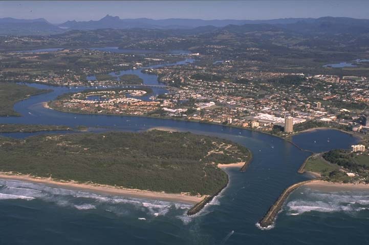
The Tweed River estuary is one of the busiest waterways in New South Wales. The estuary is classed as a barrier river estuary with an open, trained entrance. Major tributaries to the estuary include the Cobaki Creek and Terranora Creek systems.
Located between Tweed Heads and Murwillumbah on the far north coast, the Tweed River estuary is valued for its recreational activities by the local community and is used for commercial fishing and diving operations.
The Tweed River and catchment environment has high biodiversity. It has significant subtropical rainforest habitat and over 140 species of fish have been recorded in the estuary. The estuary also provides habitat for mammal, bird, reptile and plant communities.
Water quality report card
As part of our water quality monitoring program we assess the water quality and ecosystem health of an estuary using a range of relevant indicators. We sample a subset of the estuaries located between the Queensland border and Taree every 3 years. The most recent sampling in the Tweed River was completed over the 2018–19 summer, when 2 sites were sampled on a monthly basis.
This report card represents 2 water quality indicators that we routinely measure: the amount of algae present and water clarity. Low levels of these 2 indicators equate with good water quality.
This report card shows the condition of the estuary was good with:
- algae abundance graded good (B)
- water clarity graded excellent (A)
- overall estuary health graded good (B).
Grades for algae, water clarity and overall are represented as:
- A – excellent
- B – good
- C – fair
- D – poor
- E – very poor.
Go to estuary report cards to find out what each grade means, read our sampling, data analysis and reporting protocols, and find out how we calculate these grades.
We have monitored water quality in Tweed River since 2009. This table shows the water quality grades for this estuary over that time.
| Year | Algae | Water clarity | Overall grade |
|---|---|---|---|
| 2009–10 | B | B | B |
Physical characteristics
| Estuary type | Barrier river |
|---|---|
| Latitude (ºS) | –28.17 |
| Longitude (ºE) | 153.56 |
| Catchment area (km2) | 1054.8 |
| Estuary area (km2) | 22.7 |
| Estuary volume (ML) | 59,954.6 |
| Average depth (m) | 2.6 |
Tidal exchange volume
Tidal exchange volume or tidal prism data is available for this estuary. This data was recorded in 1988.
| Tide state | Flow (ML) | Local tidal range (m) | Sydney Harbour tidal range (m) |
|---|---|---|---|
| Ebb flow | 13,490 | 1.55 | 1.83 |
| Flood flow | 6,910 | 1.02 | 1.34 |
Notes: km2 = square kilometres; m = metres; m3 = cubic metres; ML = megalitres.
Water depth and survey data
Bathymetric and coastal topography data for this estuary are available in our data portal.
Land use
The Tweed River catchment is highly disturbed. It supports a broad range of agricultural industries such as sugarcane, beef, dairy, fruit and vegetable growing. The township of Murwillumbah is located in the centre of the catchment and the large urban area of Tweed Heads surrounds the estuary. The parks and reserves within the catchment are recognised for their ancient ecological communities with evolutionary links to Gondwana.
Water
Find out about water use in the Tweed River, including information about major water users, real-time flow data, and environmental and water sharing plans.
Tweed Heads webcam
The Tweed Heads bar crossing web camera provides real-time video of conditions within the river entrance immediately offshore to help with bar crossings and boat safety.
Tweed Sand Bypass
Tweed Sand Bypassing is a joint project of the NSW and Queensland governments that aims to maintain a safe and navigable entrance to the Tweed River. It involves a sand transport system that collects sand from the southern side of the river entrance and transports it to the northern side to help maintain beaches on the Gold Coast.
National and marine parks
Conservation areas in the Tweed River catchment include:
- Wollumbin National Park, which is the largest conservation area in the Tweed River catchment area and is part of the World Heritage-listed Gondwana Rainforests of Australia.
- Stotts Island Nature Reserve, located in the Tweed River, is listed in the Directory of Important Wetlands in Australia. This reserve contains the largest remaining remnant of sub-tropical floodplain rainforest in New South Wales and provides habitat for a number of threatened species.
- Ukerebagh Nature Reserve, which is on Ukerebagh Island, a former Aboriginal settlement and reserve.
There is no marine park associated with this estuary.
Citizen science projects
- Platypus are found in freshwater streams in the Tweed River catchment. The Tweed Platypus Project aims to protect and restore platypus habitat in the Tweed area and secure populations in the shire.
Community involvement
- Tweed Shire Landcare is a community organisation that works to manage and protect the local natural environment. The Tweed Shire local group list includes Landcare, Dunecare and Coastcare groups.
- BirdLife Northern Rivers is a volunteer group that observe, survey and monitor threatened bird species in the region.
Seafood harvest area status
The NSW Food Authority website lists the current status of oyster/shellfish harvest areas.
Local government management
Local councils manage estuaries within their area unless the estuary is attached to a marine park.
Tweed Shire Council manages this estuary. The council has produced several reports that focus on the estuary, including ecological assessments, recreational-use studies and coastal management action plans.
Threatened species
The Tweed River catchment is home to many native and threatened species such as the Mitchell’s rainforest snail and a koala population located between the Tweed and Brunswick Rivers.
Find out more about biodiversity in our estuaries.