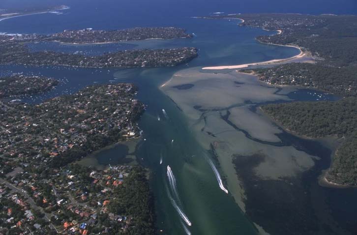
Port Hacking marks the southern coastal boundary of the Sydney Metropolitan region of New South Wales. This estuary is classed as a drowned valley.
Port Hacking is tidal up until the Audley Weir, which is located about 12 kilometres from the mouth as the river runs. The estuary offers high aesthetic and recreational value to residents and visitors to the region, and its extensive tidal reaches and fringing bushland support significant biodiversity.
Water quality report card
As part of our water quality monitoring program we assess the water quality and ecosystem health of an estuary using a range of relevant indicators. We sample a subset of the estuaries located between Taree and Wollongong every 3 years. The most recent sampling in the Port Hacking River was completed over the 2022–2023 summer, when 2 sites were sampled on a monthly basis.
This report card represents 2 water quality indicators that we routinely measure: the amount of algae present and water clarity. Low levels of these 2 indicators equate with good water quality. The numerical scores for these 2 indicators are averaged to give the overall grade.
The report card shows the condition of the estuary was excellent with:
- algae abundance graded good (B)
- water clarity graded excellent (A)
- overall estuary health graded excellent (A).
Grades for algae, water clarity and overall are represented as:
- A – excellent
- B – good
- C – fair
- D – poor
- E – very poor.
Go to estuary report cards to find out what each grade means, read our sampling, data analysis and reporting protocols, and find out how we calculate these grades.
We have monitored water quality in Port Hacking since 2010. This table shows the water quality grades for this estuary over that time.
| Year | Algae | Water clarity | Overall grade |
|---|---|---|---|
| 2022–23 | B | A | A |
| 2019–20 | B | A | A |
| 2016–17 | B | B | B |
| 2013–14 | B | A | A |
| 2010–11 | B | B | B |
Physical characteristics
| Estuary type | Drowned valley |
|---|---|
| Latitude (ºS) | –34.7 |
| Longitude (ºE) | 151.16 |
| Catchment area (km2) | 165.3 |
| Estuary area (km2) | 11.7 |
| Estuary volume (ML) | 105,261.5 |
| Average depth (m) | 9.1 |
Tidal exchange volume
Tidal exchange volume or tidal prism data is available for this estuary. This tidal prism was measured in 1978.
| Tide state | Flow (ML) | Local tidal range (m) | Sydney Harbour tidal range (m) |
|---|---|---|---|
| Ebb flow | 5,530 | 0.6 | 0.6 |
| Flood flow | 6,980 | 0.67 | 0.7 |
Notes: km2 = square kilometres; m = metres; m3 = cubic metres; ML = megalitres.
Water depth and survey data
Bathymetric and coastal topography data for this estuary are available in our data portal.
Land use
The Port Hacking catchment is relatively undisturbed. The lower estuary dissects a catchment which has the protected bushland of the Royal National Park to the south and the southern edge of Sydney’s suburban sprawl – the Sutherland Shire – to the north. Over 80% of this catchment is undisturbed forest.
National and marine parks
- Royal National Park is the largest conservation area in this catchment.
- This estuary does not flow into a marine park.
Community involvement
- Sutherland Shire Council’s Bushcare Volunteers webpage provides information on the many bush care groups active around Port Hacking.
- Greater Sydney Landcare Network is a community organisation and umbrella group for a host of Landcare organisations in the region. They have a number of projects listed on their website and support volunteers to get involved in work to protect, restore and improve the natural environment of Greater Sydney.
Local government management
Local councils manage estuaries within their area. Where an estuary is attached to a marine park, marine park management teams are responsible for ensuring compliance with marine park zoning.
Sutherland Shire Council manages this estuary.
Threatened species
Port Hacking catchment supports habitat for the endangered Bauer’s midge orchid and an endangered population of the small green chrysomelid beetle, Menippus darcyi.
Read more about the biodiversity in our estuaries.