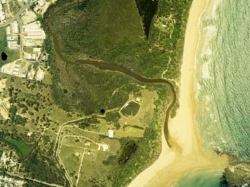
Flat Top Point Creek is situated on the southern outskirts of Woolgoolga on the north coast of New South Wales. It is classed as a lagoon with an intermittently closed/open entrance.
This estuary is also sometimes named Willis Creek.
Water quality report card
As part of our water quality monitoring program we assess the water quality and ecosystem health of an estuary using a range of relevant indicators. We sample a subset of the estuaries located between the Queensland border and Taree every 3 years. The most recent sampling in Flat Top Point Creek was completed over the 2021–22 summer, when 2 sites were sampled on a monthly basis.
This report card represents 2 water quality indicators that we routinely measure: the amount of algae present and water clarity. Low levels of these 2 indicators equate with good water quality.
The report card shows the condition of the estuary was very poor with:
- algae abundance graded poor (D)
- water clarity graded very poor (E)
- overall estuary health graded very poor (E).
Grades for algae, water clarity and overall are represented as:
- A – excellent
- B – good
- C – fair
- D – poor
- E – very poor.
Go to estuary report cards to find out what each grade means, read our sampling, data analysis and reporting protocols, and find out how we calculate these grades.
We have monitored water quality in Flat Top Point Creek since 2009. This table shows the water quality grades for this estuary over that time.
| Year | Algae | Water clarity | Overall grade |
|---|---|---|---|
| 2009–10 | D | E | E |
| 2012–13 | B | D | C |
| 2015–16 | D | D | D |
| 2018–19 | E | E | E |
Physical characteristics
| Estuary type | Creek |
|---|---|
| Latitude | –30.13 (ºS) |
| Longitude | 153.2 (ºE) |
| Catchment area | 2.6 km2 |
| Estuary area | 0.02 km2 |
| Estuary volume | 4.7 ML |
| Average depth | 0.2 m |
Notes: km2 = square kilometres; m = metres; ML = megalitres.
Water depth and survey data
Bathymetric and coastal topography data for this estuary are available in our data portal.
Land use
Flat Top Point Creek catchment is highly disturbed, with the main pressures being industrial and urban development. The upper catchment is used mostly for banana plantations and blueberry growing. The nearby sewage treatment plant released treated sewage into the creek from 1973 to 2005.
National and marine parks
- Flat Top Point Creek is located within Coffs Coast Regional Park.
- Flat Top Point Creek is part of the Solitary Islands Marine Park.
Community involvement
- Coffs Harbour Regional Landcare provides workshops and volunteer work opportunities along the Coffs Coast, with a nursery located in Woolgoolga.
Local government management
Local councils manage estuaries within their area unless the estuary is attached to a marine park. Flat Top Point Creek is managed by Solitary Islands Marine Park and Coffs Harbour City Council, and is referred to as Willis Creek by the council.
The Willis Creek Estuary Coastal Zone Management Plan and Estuary Management Study Willis Creek are available on the council’s website.
Threatened species
The joint entrance area Flat Top Point Creek and Hearnes Lake is a significant little tern breeding site.
Read more about the biodiversity in our estuaries.