The 2019–20 bushfire season was extreme and severely affected ecosystems across New South Wales. Following several years of drought over much of the state, over 5.3 million hectares burnt between July 2019 and March 2020.
The recovery effort after the 2019–20 bushfires has been hampered by:
- the scale of damage to the landscape
- limited resources
- lack of understanding of the impacts of bushfire on aquatic systems.
Building resilience
This project aims to build resilience in aquatic systems to help them cope with disturbances like fire and flood.
To do this we’re developing research-informed management tools for use by land and water managers. The tools will help prioritise where management strategies can be put in place to improve the resilience of waterways.
Bushfires impact waterways in different ways. For example, water quality can decline immediately after a fire, whereas erosion and sediment slugs (large amounts of sediment that slowly move downstream in a waterway) may occur well after a fire has moved through the landscape.
We’re assessing the impacts of bushfire on:
- erosion, using field assessments and modelling to show areas at higher risk
- water flow and flood risk in catchments
- critical ecosystems, like upland swamps and coastal wetlands
- ecological and chemical processes in estuaries
- carbon and nutrient dynamics, particularly where elevated levels can reduce water quality
- aquatic ecosystem health.
The outcomes of this work will inform the development of the management tools and decision-support datasets. For example, the development of broad-scale maps to help identify areas of a catchment that are more vulnerable to severe erosion and debris flows after fire.
A better understanding of the relative vulnerability or resilience of different waterways to the impacts of fire will enable more targeted management strategies to be used with maximum environmental benefit.
Monitoring water quality
The effects bushfires have on aquatic ecosystems can occur over long timeframes.
Our water quality monitoring buoys collect data on water quality which is helping us assess the ecological health of estuaries, including the long-term impacts of bushfire.
The 6 estuaries we are monitoring are intermittently closed and open lakes and lagoons, or ICOLLs. They all have relatively deep basins and their catchments were extensively burnt in the 2019–20 black summer, except for Avoca Lake.
This monitoring work will help us work out whether ICOLLs are more susceptible to increases in ash, sediment and nutrient input from bushfires because they are not flushed by seawater as often as some other estuaries.
Early results indicate that these ICOLLs are naturally prone to stratification – the distribution of water into different layers.
Stratification particularly occurs in deeper estuaries where oxygen-depleted, nutrient-rich bottom water persists for most of the time. When water in these deeper ICOLLs ‘turns-over’, or becomes mixed due to flooding or sharp temperature changes, this can stir up nutrients and trigger large algal blooms.
Work is continuing to establish to what extent post-fire sediment and nutrients exacerbate these processes, and perhaps contribute to ongoing water quality issues.
See our Real-time water quality monitoring webpage for more information on the buoys, including real-time data links.
Impacts of bushfires on water quality
Bushfires play a fundamental role in shaping many Australian landscapes. They can also have significant impacts on terrestrial and aquatic ecosystems, particularly when there is an increase in sediment, nutrients, and contaminants entering waterways from fire-impacted areas.
Potential source-pathway-ecosystem relationships
Below is a conceptual model of bushfire impacts on estuarine receiving environments. This model explains the connectivity between catchments and waterways, and how the potential effects of bushfires on water quality and aquatic ecosystems.
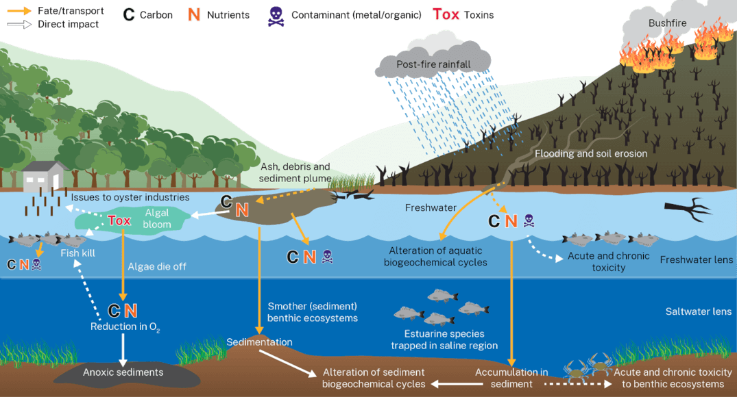
Initial findings on water quality impacts from NSW bushfires
An assessment of water quality data collected before, during and after the 2019–2020 bushfires is underway by the department's Estuaries and Catchments Team. Below are some key findings emerging from this assessment.
- Short-term decrease in dissolved oxygen levels, lasting from days to weeks. This is attributed to elevated levels of organic matter decomposition in waterways post-bushfires. Reduced oxygen can stress and threaten aquatic organisms, potentially leading to mortality events such as fish kills.
- Elevated turbidity and reduced clarity caused by higher sediment and debris input from burned, eroding catchments. Increased turbidity levels can impede photosynthesis due to reduced light penetration through the water column, obstruct fish gills, and smother sediment ecosystems.
- Increased levels of nitrogen and phosphorus in estuaries originating from burned soils and vegetation washed into waterways. These can trigger the formation of potentially harmful algal blooms.
- Increased levels of chlorophyll-a and blue-green algae pigments, likely due to nutrient driven algal blooms. These blooms can pose risks to aquatic life and human health.
The data collected in estuaries before, during, and after the 2019–20 Black Summer bushfires along the NSW South Coast has provided valuable insights into the short, medium, and long-term water quality impacts. Early findings suggest that water quality changes observed in intermittently closed and open lakes and lagoons (ICOLLs) are more pronounced compared to open estuaries like rivers. This is attributed to the relatively higher rate and amount of water exchanged with the ocean in open estuaries. ICOLLs will still exchange water with the ocean, and their entrances stay open for the longest when they open naturally rather than when artificially opened.
Datasets
These datasets are available on our Sharing and Enabling Environmental Data (SEED) portal:
- Aridity dataset – developed by our scientists, this high-resolution index of dryness in the landscape has potential application for habitat and refugia mapping, water resource management and climate change research
- Bushfire-related datasets – collected and produced by our scientists to support decision-makers in response to the 2019–20 bushfire recovery and conservation efforts
- Fire extent and severity mapping – developed by the Remote Sensing Team and NSW Rural Fire Service using satellite imagery for the fire seasons between 2016 and 2021
- Bushfire impact on water quality – water quality loggers, installed in 7 bushfire-affected estuaries in January 2020, collect data on water quality to monitor impacts in the short term.
-
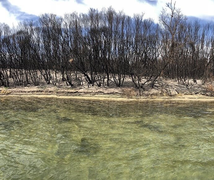
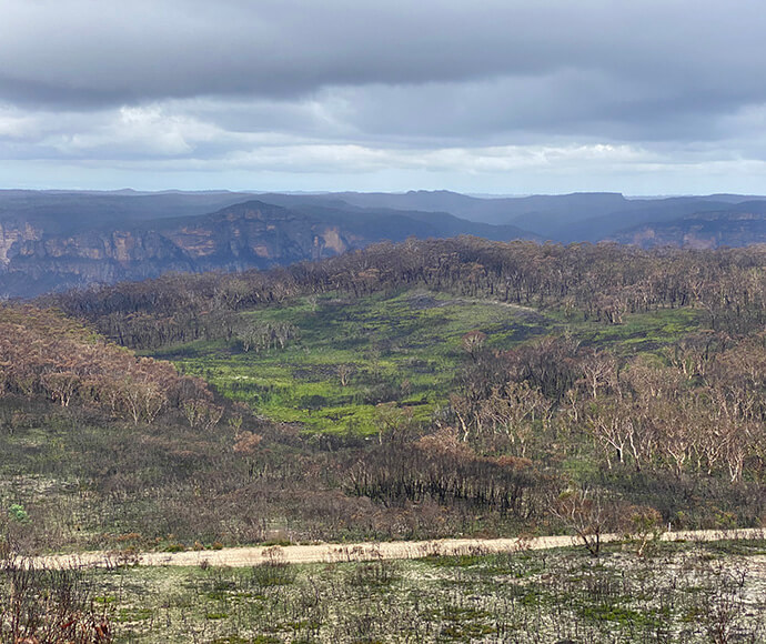
Burnt vegetation on the shore of Wonboyn Lake. -
Burnt vegetation on the shore of Wonboyn Lake. -
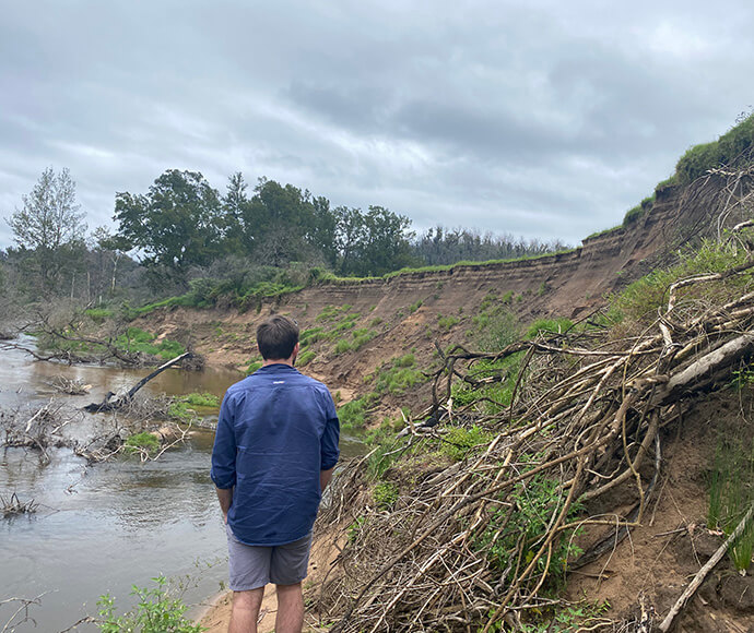
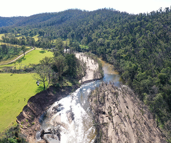
Post-fire bank erosion on the Tuross River. -
Burnt creek in the Wonboyn catchment early 2020. -
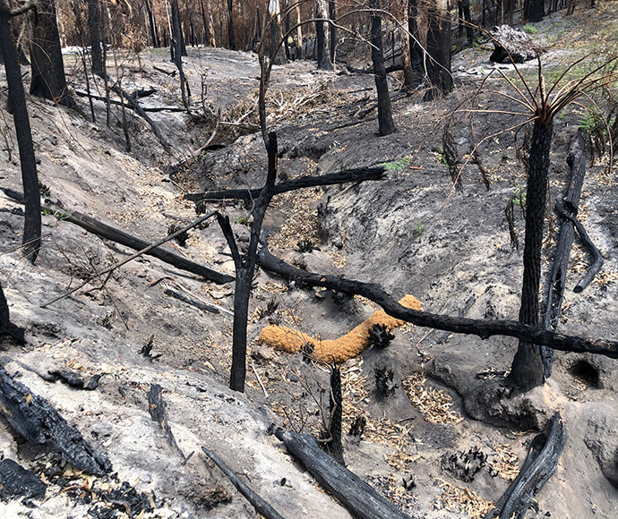
Burnt upland swamp, Blue Mountains. -
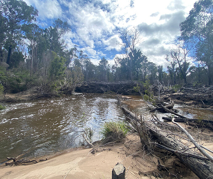
Post-fire log jam and sediment slug in the Wonboyn River. -
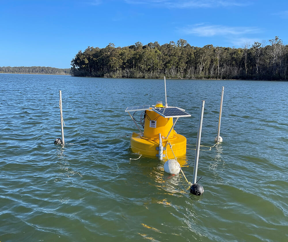
Water quality monitoring buoy at Durras Lake. -
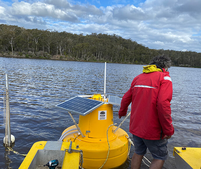
Deploying a water quality monitoring buoy in Wonboyn Lake.