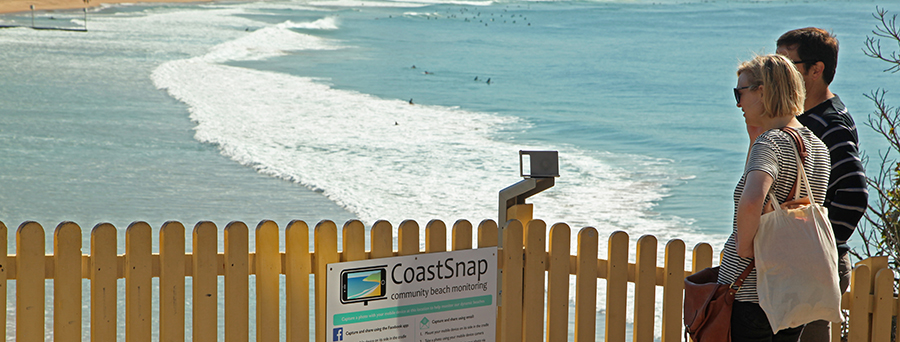
The next time you visit a NSW beach, why not become a beach scientist by helping us measure how beaches erode and recover over time due to changing ocean conditions?
Visit a CoastSnap station to measure the shoreline and amount of sand on the beach by taking a photo with your smartphone and sharing it through our app or on social media.
Your snap will add to a community database that we use to map shoreline change and learn how different beaches respond to changing ocean conditions. Community beach monitoring can help to improve how we manage treasured coastal environments.
Download the CoastSnap app
Download the free app from the Apple App Store or Google Play, visit CoastSnap stations in New South Wales, and add your snap:
- Visit one of our CoastSnap stations.
- Open the app and create an account with your email address.
- Select the CoastSnap station for your location.
- Add your snap using the plus (+) button to 'update spot'.
- Place your phone in the cradle and take a landscape photo using the app. You could also upload a recent photo from your gallery.
- Share your snap. Complete the 'update spot' form in the app and save your snap to submit it.
Find a CoastSnap station
CoastSnap stations are popping up all along the NSW coast at iconic beaches and in pristine coastal national parks.
Browse the gallery below to see stunning views at CoastSnap stations from north to south and discover where you can become a beach scientist.
You can find the locations of CoastSnap stations using the Spotteron map and see how community beach scientists are recording coastline change at each site.
-
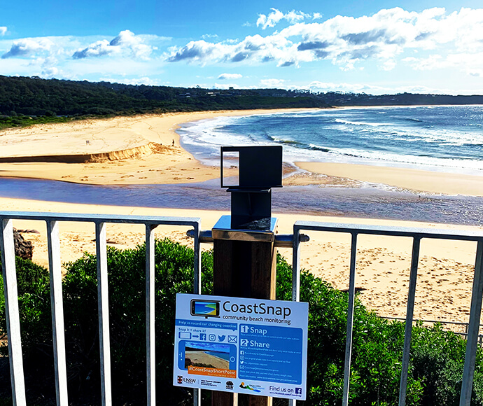
Bega - Short Point Beach. -
Manly Beach - South Steyne. -
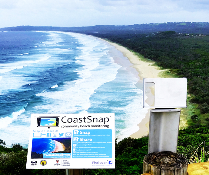
Cape Byron - Tallow Beach.
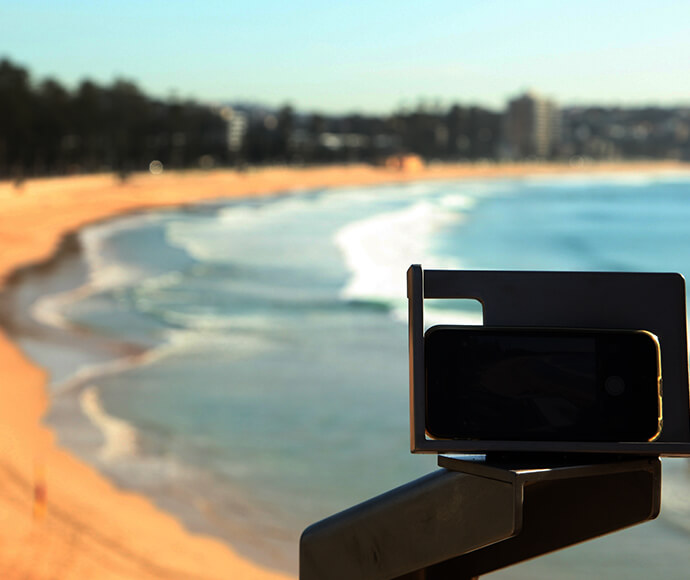
How does it work?
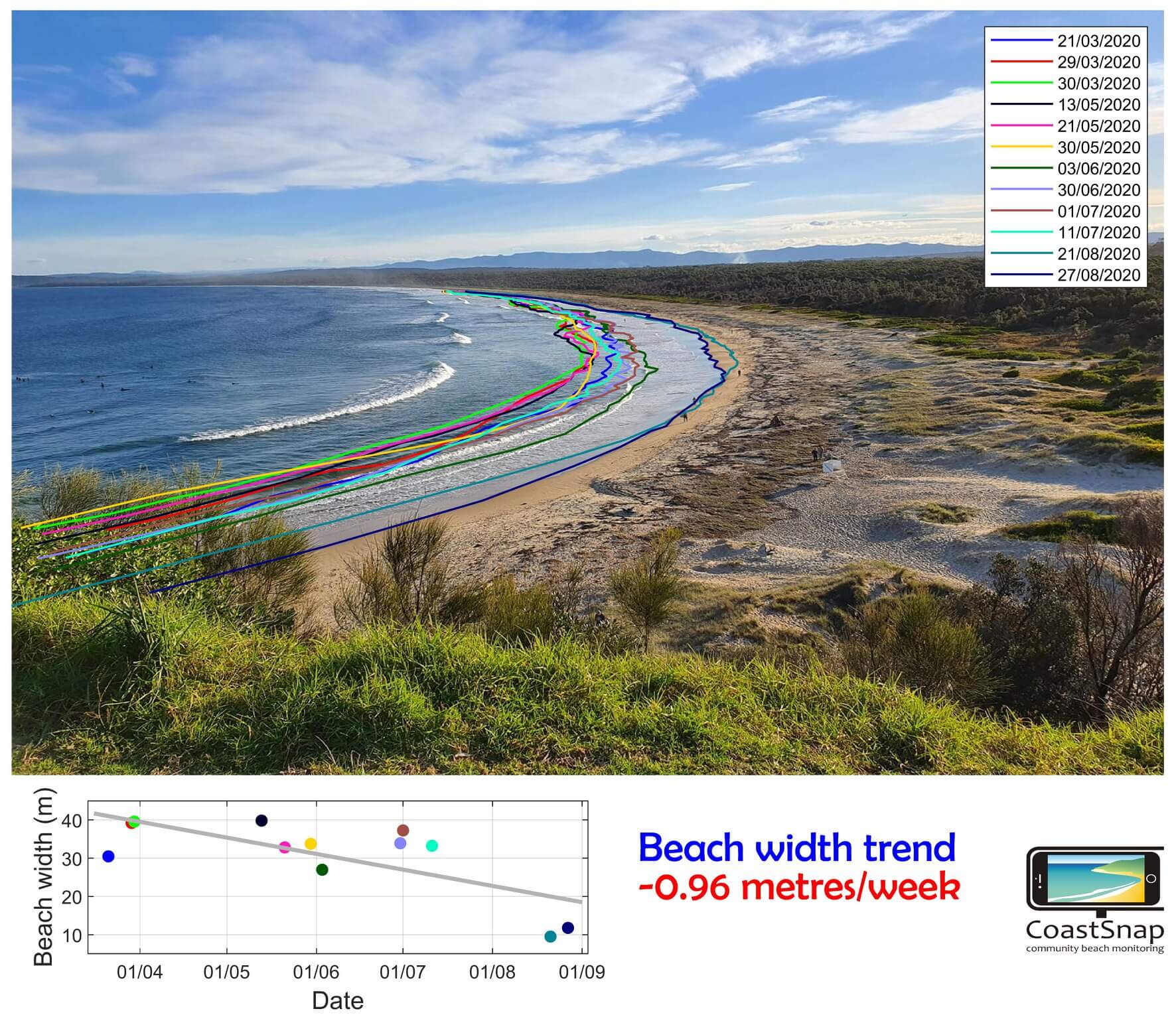
Our innovative photo-point cradles and image processing turn your smartphone into a precision beach monitoring tool. By fixing the position of your device we ensure that all community photo records are captured from the same location. We normalise images from different smartphone cameras and map the shoreline in each photo accounting for the tide level at the time of capture.
Over time our community scientist's build accurate records of how beaches erode and recover with varying ocean conditions. The community shoreline mapping is similar in accuracy to professional surveys using expensive GPS equipment.
What do we learn?
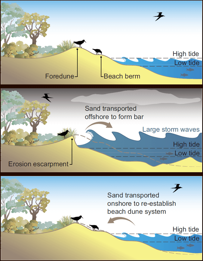
The amount of sand on the beach and in the surf zone where waves break is constantly changing. Sand bars migrate in and out and change their shape in response to changing waves and tides. Sand is often removed from the beach by large waves and high tides and scattered offshore, leaving a narrow or eroded beach. The sand is usually returned by calmer waves and the beach builds out again.
By mapping beach change over time using your CoastSnaps we can learn how different beaches respond to changing ocean conditions. Coastal researchers and managers use that information to investigate how much a beach might erode during storms, or in response to long-term environmental change such as sea level rise.
About CoastSnap
The UNSW Water Research Laboratory and the NSW Government partnered to develop CoastSnap in 2017. Beginning with 2 pilot sites at Manly and North Narrabeen beaches we developed the tools and techniques to make simple and accurate community beach monitoring a reality. We also discovered that communities and their visitors love learning about dynamic coasts by getting involved as community beach scientists.
From its humble beginnings on Sydney's Northern Beaches, CoastSnap is now a global phenomenon. See how communities around the world are measuring and learning about their beaches on the CoastSnap Spotteron page.
CoastSnap data
Visit the CoastSnap Spotteron page to see how our community scientists are recording how NSW beaches change over time.