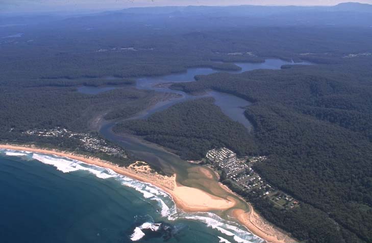
Durras Lake is located on the south coast of New South Wales between Ulladulla and Batemans Bay. It is classed as a lake with an entrance that is intermittently open and closed to the ocean.
The estuary is recognised as near pristine and contains large areas of saltmarsh. It is a popular fishing spot for locals and visitors to the region. The entrance is occasionally opened artificially by council when water height exceeds a trigger level.
Water quality report card
As part of our water quality monitoring program we assess the water quality and ecosystem health of an estuary using a range of relevant indicators. We sample a subset of the estuaries between Wollongong and the Victorian border every 3 years. The most recent sampling in Durras Lake was completed over the 2023–24 summer, when 2 sites were sampled on a monthly basis.
This report card represents 2 water quality indicators that we routinely measure: the amount of algae present and water clarity. Low levels of these 2 indicators equate with good water quality. The numerical scores for these 2 indicators are averaged to give the overall grade.
The report card shows the condition of the estuary was excellent with:
- algae abundance graded excellent (A)
- water clarity graded excellent (A)
- overall estuary health graded excellent (A).
Grades for algae, water clarity and overall are represented as:
- A – excellent
- B – good
- C – fair
- D – poor
- E – very poor.
Go to estuary report cards to find out what each grade means, read our sampling, data analysis and reporting protocols, and find out how we calculate these grades.
We have monitored water quality in the Durras Lake since 2007. This table shows water quality grades for the most recent 7 sampling seasons. Previous water quality data is available at NSW Estuary Water Quality Data Compilation: 2007–2020.
| Year | Algae | Water clarity | Overall grade |
|---|---|---|---|
| 2023–24 | A | A | A |
| 2022–23 | A | B | A |
| 2021–22 | A | B | B |
| 2020–21 | A | C | B |
| 2019–20 | C | B | B |
| 2018–19 | A | B | B |
| 2017–18 | B | C | B |
Physical characteristics
| Estuary type | Lake |
|---|---|
| Latitude | –35.64 (ºS) |
| Longitude | 150.31 (ºE) |
| Catchment area | 58.4 km2 |
| Estuary area | 3.8 km2 |
| Estuary volume | 5050.9 ML |
| Average depth | 1.4 m |
Notes: km2 = square kilometres; m = metres; ML = megalitres.
Water depth and survey data
Bathymetric and coastal topography data for this estuary are available in our data portal.
Land use
The catchment of Durras Lake has relatively low disturbance, with almost 90% located in Murramarang National Park. A small part of the catchment around the lower estuary is urban, and another small area of grazing/rural residence occurs around the Princes Highway.
National and marine parks
- Durras Lake is situated within Murramarang National Park.
- This estuary flows into the Batemans Marine Park.
Citizen science projects
- The Budawang Coast Nature Map is an online data platform the community can use to record and identify biodiversity. Data collected is used to map the distribution of native plant and animal species from Moruya up almost to Kiama.
- iNaturalist Plants of Eurobodalla is a citizen science project that monitors plants found in the Eurobodalla region.
- The South Coast Shorebird Recovery Program provides the opportunity for people to get involved in the protection and recovery of shore birds.
Community involvement
- Eurobodalla Landcare is a network of 24 Landcare groups in the Eurobodalla shire, including one at South Durras.
- South East Landcare is an umbrella organisation that represents a network of Landcare groups stretching along the NSW south coast from the Illawarra to the Victorian border.
Local government management
Local councils manage estuaries within their area. Where an estuary is attached to a marine park, marine park management teams are responsible for ensuring compliance with marine park zoning.
Eurobodalla Shire Council manages this estuary, which is located in Batemans Bay Marine Park.
Threatened species
The Durras Lake estuary supports substantial coastal saltmarsh, an endangered ecological community.
Read more about the biodiversity in our estuaries.