The landscape of the New South Wales coastline is spectacularly varied. There are 184 estuaries along our coastline, which works out at one estuary for every 10 kilometres of coast.
Each estuary has its own geomorphological, hydrological and physical features. We use these features, as well as characteristics of estuary entrances and the catchments that surround them to assign estuaries into different groups or types.
Estuary entrances
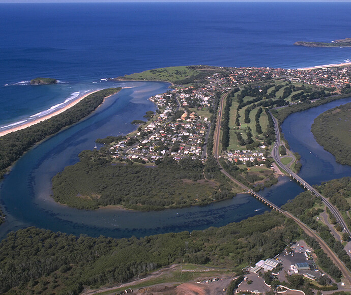
The entrance of an estuary is the point where it meets the ocean. Estuary entrances control patterns of water exchange between estuaries and the ocean. At some point in time, every estuary will open to the ocean.
Estuaries are classified into types based on the characteristics of their entrances and the characteristics of freshwater inputs from the surrounding catchment area.
Entrances can be ‘trained’, which means infrastructure such as a seawall or break-wall has been put in place to keep the mouth of the estuary open. This can help with boat access as it helps maintain water depth but it can impact the habitats and ecology of an estuary.
Some estuaries maintain a natural permanent opening to the ocean; others need to be artificially opened when foreshore structures, homes and businesses are at risk of inundation when water levels rise in response to rainfall, swell run-up and washover, or tidal activity.
Even though there are different types of estuaries, each estuary in New South Wales is unique and needs to be managed to best suit its unique characteristics.
Catchments
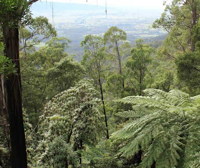
A catchment is a natural boundary of a waterway, defined by the shape of the landscape. Rainfall in a specific catchment generates rainfall-runoff, that eventually flows into the estuary downstream through a network of streams, creeks and rivers, as well as through underlying groundwater and stormwater drains in built-up areas.
Not all rainfall runoff ends up in estuaries. Water can infiltrate land and be stored in aquifers, or surface runoff can be stored in reservoirs. Soil type, land use and the slope of the landscape influence this. The balance between the amount of rain that falls on a catchment area and the responding volume of water flowing into an estuary downstream is complex.
This surface water runoff and groundwater from a catchment may contain sediments, nutrients and other pollutants. The condition or health of an estuary is influenced to a certain extent by the condition of its catchment.
The size of a catchment area is important in determining the:
- amount of water that flows into an estuary
- amount of pollutants, such as sediment and nutrients, that enter an estuary
- physical shape of an estuary
- condition of the opening to the ocean.
Some catchments are small, and others cover thousands of hectares. Larger catchments are a collective of many smaller sub-catchments. Sub-catchments typically surround a single small stream or creek, and a larger catchment surrounds multiple streams and creeks – sometimes hundreds! Upland catchment areas are inland away from the coast and are often hilly and steep, and floodplain catchment areas are flat areas of land next to a stream, river or estuary.
Estuary types and characteristics
| Subtype | Description | Entrance description | Freshwater input source from catchments | Examples |
|---|---|---|---|---|
| Drowned river valley | Large and usually deep, form by ocean flooding of river valleys | Usually deep and wide and does not close |
| |
| Barrier river | Form in small to large rivers that are usually shallow | Affected by sand moving along the coast, and some can close during periods of low freshwater flow Commonly have training walls |
|
| Subtype | Description | Entrance description | Freshwater input source from catchments | Examples |
|---|---|---|---|---|
| Creek | Small and usually narrow in shape | Can close frequently but readily open to the ocean after rainfall |
| |
| Lake | Moderate to large in size and tend to have a broad, open shape. Can be shallow to moderately deep | Tend to be open, but are affected by sand moving along the coast and some can close during periods of low freshwater flow; some have training walls |
| |
| Lagoon | Usually small to moderate in size with a broad, open shape and tend to be shallow | Often closed and will open after heavy rainfall in the catchment, but remain open for a short time due to sand moving along adjacent beach |
| |
| Back-dune lagoon | Usually small to moderate in size with a broad, open shape. Tend to be shallow | Often closed for a long time (years), but will open after heavy rainfall in the catchment; remain open for a short time due to sand moving along the adjacent beach |
|
| Subtype | Description | Entrance description | Freshwater input source from catchments | Examples |
|---|---|---|---|---|
| Bay | Large sheltered coastal embayments that are oceanic most of the time and only influenced by freshwater during floods or after major rainfall. | Usually deep, wide and constantly open |
|
Misleading names
The names of estuaries can sometimes be misleading. For example, an estuary may have the word ‘Lake’ or ‘Creek’ in its name but be classed as a lagoon.