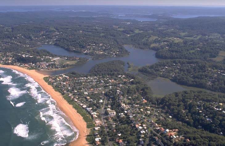
Avoca Lake is situated on the Central Coast of New South Wales between the townships of Avoca Beach and North Avoca. It is classed as a back-dune lagoon with an intermittently open entrance to the sea.
Water quality report card
As part of our water quality monitoring program we assess the water quality and ecosystem health of an estuary using a range of relevant indicators.
The most recent sampling was completed over the 2020–21 summer. The results of the monitoring program, including a detailed water quality report card for Avoca Lake, are available on the Central Coast Council website.
Go to estuary report cards to find out what each grade means, read our sampling, data analysis and reporting protocols, and find out how we calculate these grades.
Physical characteristics
| Estuary type | Back-dune lagoon |
|---|---|
| Latitude | –33.46 (ºS) |
| Longitude | 151.44 (ºE) |
| Catchment area | 10.8 km2 |
| Estuary area | 0.7 km2 |
| Estuary volume | 293.2 ML |
| Average depth | 0.4 m |
Notes: km2 = square kilometres; m = metres; ML = megalitres.
Water depth and survey data
Bathymetric and coastal topography data for this estuary are available in our data portal.
Land use
The catchment of Avoca Lake is moderately disturbed. Around half remains as forest, especially around the relatively steep slopes of the upper catchment. Land-use changes in the other half of the catchment have been driven by urban and rural-residential development, horticulture and grazing.
National and marine parks
- No conservation areas are located within this catchment.
- This estuary does not flow into a marine park.
Community involvement
- The Central Coast Council Landcare Program helps coordinate a number of volunteer environmental groups, such as North Avoca Bushcare, Bulbararing Bushcare and Willdenow Bushcare, that work to conserve, protect and remediate the environment.
Local government management
Local councils manage estuaries within their area unless the estuary is attached to a marine park. Central Coast Council manages this estuary.
More information about this estuary can be found on the council’s Coastal lagoons webpage.
Threatened species
Avoca Lake provides habitat for a population of the endangered green and golden bell frog.
Find out more about the biodiversity in our estuaries.