A new soil landscape map for the Mid North Coast
The soil and landscape assessment team at the Department of Climate Change, Energy, the Environment and Water is excited to announce the release of the Soil landscapes of the Wingham–Camden Haven 1:100,000 sheet.
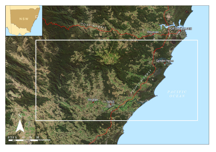
Wingham–Camden Haven 1:100,000 sheet area
This new map is part of the NSW Soil landscape series and provides valuable information on soil and landscape properties, major soil and landscape constraints, and recommendations for sustainable land management.
Located in the Mid North Coast of New South Wales, the Wingham–Camden Haven area is rich in history and diverse in its environments and ecosystems. From coastal estuaries and lakes to rugged, forested escarpments, the area is home to a wide range of land uses, including forestry, farming, recreation, and fishing. With increasing development pressure and land use conflict, there is a need for information about the natural environment to guide planning, decision-making, and development.
The Wingham–Camden Haven map sheet is made up of 110 different soil landscapes, each described in detail in the accompanying report. Information was collected from 321 soil descriptions across the region, many of which have comprehensive soil laboratory test results. The report provides a range of background information, including landscape evolution, climate, native vegetation, and the history of land use. It also includes detailed descriptions of the landscapes of the region, including landform and topography, geology, native vegetation, hydrology, land use, and land degradation.
Brian Jenkins, senior team leader of the soil and landscape assessment team, says, ‘Underpinned by robust science, and using a proven methodology developed over many years, the Wingham–Camden Haven soil landscape map and report allow land to be evaluated for planning, agricultural use, or environmental protection. Products like this are a powerful tool to drive sustainable development and natural resource management.’
Find out more
The Wingham–Camden Haven soil landscape map and report are available:
For more information about the soil mapping program or to talk to someone about soils, reach out to the team at [email protected].
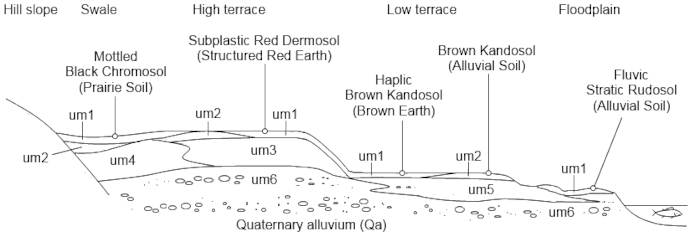
A cross-section of the Upper Manning soil landscape described in the report. Each soil landscape in the report has an associated cross-section illustrating the landscape
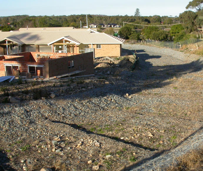
High risk of flooding from adjacent steep slopes, as identified by the Wingham–Camden Haven soil landscape report, meant construction of this floodway at Laurieton was necessary to safeguard residential properties | Credit: Michael Eddie/DCCEEW 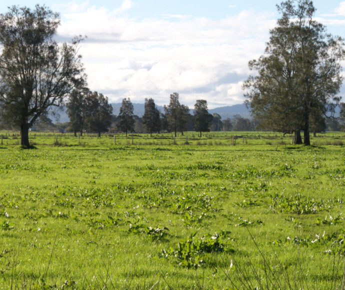
Example of the Jones Island soil landscape on the floodplains of the Manning River, which is described in the report | Credit: Michael Eddie/DCCEEW 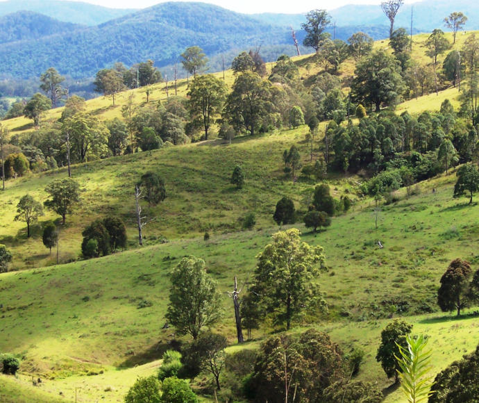
Example of the rolling hills in the Belbora soil landscape described in the report | Credit: Michael Eddie/DCCEEW 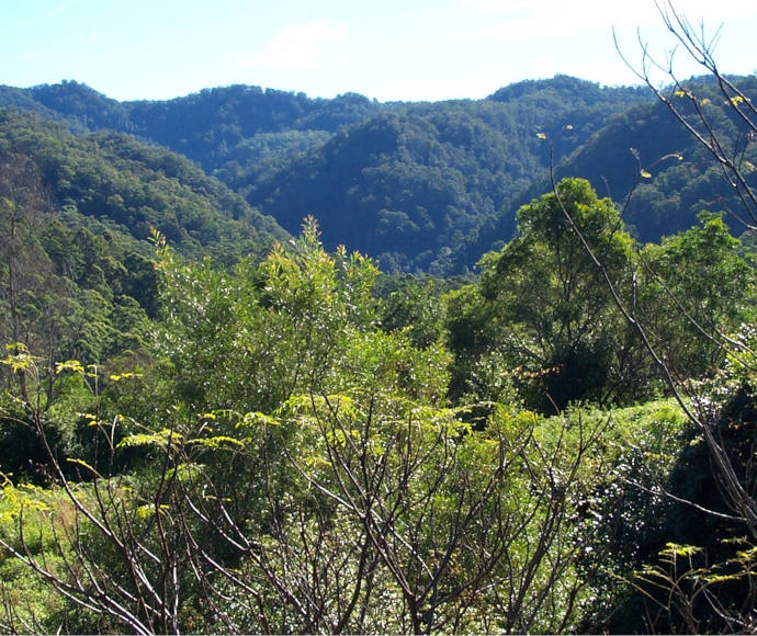
Example of the steep hills and precipitous mountains in the Tamarind soil landscape described in the report | Credit: Michael Eddie/DCCEEW 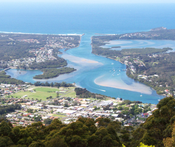
Coastal development at Camden Haven | Credit: Michael Eddie/DCCEEW