Large hazard reduction burn in Blue Mountains National Park
The NSW National Parks and Wildlife Service (NPWS) is planning a 1500-hectare hazard reduction burn in Blue Mountains National Park from Tuesday 23 April, weather permitting.
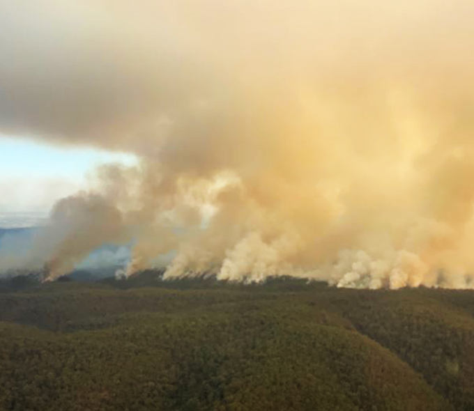
The planned burn, south of the Great Western Highway in the Springwood area of the park, will be carried out to minimise impacts on ANZAC Day commemorations.
The aim is to reduce fuel loads in the park, helping to provide strategic protection for the residential areas of Linden, Faulconbridge, and Springwood in case of future wildfire.
The Woodford Oaks fire trail in Blue Mountains National Park will be closed during the burning operation.
The closure extends to mountain biking along the Woodford Oaks and the Lost World Walking Track (west of Glenbrook Creek).
Visitors must check NPWS Alerts for up-to-date information on track, trail and park closures, noting areas will be re-opened when deemed safe by fire crews.
Smoke may be visible along the Great Western Highway and the M4 for the duration of the burn. Motorists in the area advised to use caution and drive to conditions.
People vulnerable to smoke are encouraged to remain indoors and keep their doors and windows closed to reduce exposure.
This burn is one of many hazard reduction operations undertaken by NPWS each year, many with assistance from the Rural Fire Service and Fire and Rescue NSW.
People with known health conditions can sign up to receive air quality reports, forecasts and alerts via email or SMS from the Department of Climate Change, Energy, the Environment and Water.
For health information relating to smoke from bush fires and hazard reduction burning, visit NSW Health or Asthma Australia.
More information on hazard reduction activities is available at NSW Rural Fire Service and the NSW Government's Hazards Near Me website and app.