Significant outcomes for MidCoast Council koala habitat mapping surveys
MidCoast Council completed koala habitat mapping surveys across the region, funded by a $300,000 grant from the NSW Koala Strategy.
The surveys identified and provided detailed information on koala habitats, making them essential for koala conservation. The mapping involved the analysis of plant communities, extensive community consultation and on-ground surveys using trained detection dogs. It also linked private landholders with advice and funding to protect and improve koala habitat on their properties. The data was used to inform MidCoast Council's Koala Conservation Strategy.
We conducted on-ground surveys at 126 sites across 3 priority study areas: private land, NSW National Parks and Wildlife Service estate, and council reserves. The survey results were relatively low, with only 12 sites (18%) recording koala scats.
We conducted additional surveys using thermal drones. These surveys covered over 3,600 ha across 56 sites. Several high-density koala sites were identified, altogether discovering 210 koalas and 10 joeys. Koalas were also detected at sites with no previous koala records.
The local community provided excellent support for the habitat mapping surveys. Many of these landholders further contributed to on-ground koala conservation actions by registering for MidCoast Council's Koala Safe Spaces initiative to plant trees and protect existing koala habitat.
The program was significant due to its scientific rigour and extensive on-ground work. It took over 12 months to complete and has resulted in significant outcomes, such as the discovery of high-density koala sites, excellent local community support and informing the MidCoast Council's Koala Conservation Strategy.
MidCoast Council, in collaboration with the NSW Koala Strategy, is planning additional koala surveys to identify more high-density and key populations, supporting long-term koala conservation in the MidCoast region.
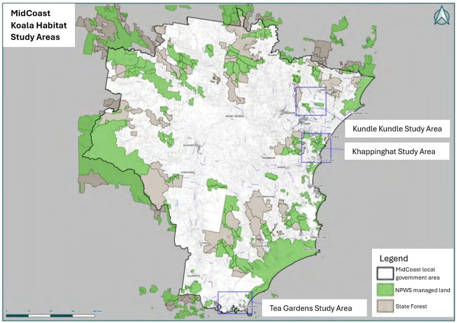
MidCoast Council koala habitat study areas map