Soil classification and why it matters
A key element of the National Soil Strategy is to strengthen soil knowledge. But what does this really mean?
In May 2021 the Australian Government announced its first national policy on soil, the National Soil Strategy. The policy outlines Australia’s commitment to soil research and management.
Soil knowledge has a greater impact when it is shared with others to improve awareness and understanding of soils - not just among scientists, but also land managers, planners, decision makers and the community. Soil classification is a vital tool to help us do just that.
Why we classify soils
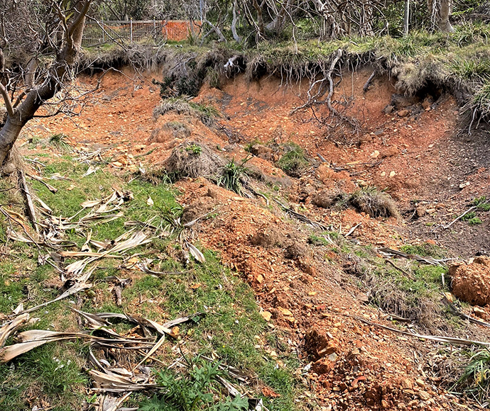
Australian soils are incredibly diverse. They are also unique and ancient compared to soils around the world.
Our scientists assess many aspects of soils. We use the Australian Soil Classification (ASC) to organise our knowledge of soils and to provide a common language.
International soil classification schemes are generally not a good fit for Australian soils because they reflect northern hemisphere temperate zone soils and past climates.
The ASC is the current standard and most widely accepted classification system for Australian soils. It was preceded by several Australian systems that had various levels of acceptance including Great Soil Groups and The Factual Key.
Development of the ASC began in the 1980s, led by soil scientist Ray Isbell (1928–2001). Our soil scientists were involved in testing the first draft and the first edition was published in 1996. Now in its third edition, responsibility for maintaining and updating the ASC resides with the Australian Soil Classification Working Group, a subcommittee of the National Committee on Soil and Terrain. The ASC Working Group comprises esteemed soil scientists from across Australia, including our own David Morand!
How we apply soil classification
Soil classification is like a language which uses consistent and standardised names and groups for different soil types. This means we can talk about soils and know that we understand each other.
Our Soil and Landscape Assessment Team (SALAT) use soil classification to underpin many of their soil projects and products, including:
- soil and landscape assessments for diverse environmental programs and mapping
- understanding the soil impacts of cultural burning and hazard reduction burns
- biophysical strategic agricultural land assessments for potential mining areas
- predicting potential habitat for threatened species for the Saving Our Species Program.
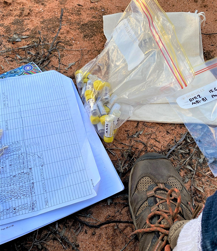
SALAT uses soil classification to support field assessments for priority environmental programs. Previous mapping programs have generated soil classifications which are used to understand the soils of an area. For example:
- the soil types we would expect to find at a particular site or landscape
- the soil and land capability we expect to occur, and
- how we expect the soils to behave in terms of erosion.
Soil classification conveys a picture of a soil including its limitations and capability. Soil classification is also used in Saving our Species projects. By understanding which soil type/s a plant species prefers, we have some idea of that species’ environmental requirements. This can help scientists find appropriate conditions and potential locations to support endangered or threatened vegetation populations.
What’s next for soil information
SALAT collects, stores, and shares soil data for the state of NSW.
Classifying soils provides a basis for organising soil data and analytical results. This soil information allows us to:
- adopt better land management practices
- monitor trends in agricultural and ecosystem health and resilience
- support effective and integrated land use planning and sustainable land management.
This data has many applications. For example, SALAT soil scientists recently created predictive models for soil conditions in forests under future climate scenarios. The predictive models were fitted using soil profile information and environmental variables.
Emerging technologies such as remote sensing and machine learning provide promising opportunities to obtain and predict soil information. Although these advances have many benefits, quality soil information lies at the heart of their potential for success. There is no substitute for field data. If we wish to manage our global soil resources sustainably, we must continue to study our soils and keep our field data current.