Important wetlands
The Macquarie and Castlereagh catchments are home to the iconic Macquarie Marshes – one of the largest remaining semi-permanent wetland systems in inland Australia, which has hosted some of the largest-scale waterbird breeding ever recorded on the continent.
The breeding is assisted by targeted delivery of water for the environment to the creeks, rivers, lagoons and wetlands that make up the unique Macquarie valley ecosystem.
Managing water for the environment
The Macquarie and Cudgegong Regulated Water Sharing Plan establishes a total allowance for water for the environment of 160,000 megalitres, which accrues water at the same rate as general security water holdings. It is complemented by over 170 gigalitres of licensed water managed by the NSW and Australian Governments, recovered through voluntary buyback and infrastructure improvement programs.
These flows are co-ordinated by the Department of Climate Change, Energy, the Environment and Water in consultation with the Macquarie–Cudgegong Environmental Water Advisory Group (EWAG), which is made up of community members, alongside other government and non-government organisations.
To deliver the flows, the department collaborates with the Commonwealth Environmental Water Holder and Department of Primary Industries and Regional Development.
While water for the environment in the Macquarie plays a vital role in supporting the Macquarie Marshes and river, the flows are insufficient to meet the needs of all the water-dependent ecosystems in the catchment. Flows from tributary streams downstream of Burrendong Dam, such as the Bell, Little and Talbragar rivers, as well as spills from Burrendong Dam, are critical in sustaining the health of the catchment.
Along with the marshes, flows are targeted to sites such as the Cudgegong and Macquarie river channels, and the Lower Macquarie river downstream of the marshes, with potential for the unregulated distributary systems of the Lower Crooked and Marra creeks.
Water for the environment in the Macquarie valley is mainly used to:
- support riverine and wetland ecosystems along the river system, including River red gum forests, reed beds and water couch meadows
- support critical water-needs of colonies of nesting waterbird species in the marshes, including egrets, ibis, cormorants and herons
- provide feeding and breeding habitat for a range of waterbirds including ducks, herons, bitterns, magpie geese and brolgas
- provide opportunities for breeding and movement of native fish, including Murray cod and golden perch
- provide a harbour for several species of international migratory shorebirds that visit the catchment each summer from the northern hemisphere.
A number of sites within the Macquarie valley are recognised under international agreements, including parts of the Macquarie Marshes Nature Reserve, and 2 privately owned properties Wilgara and U-Block, which are listed on the Convention on Wetlands of International Importance (known as Ramsar).
Additionally, more than 500 Aboriginal cultural heritage sites are recorded in the Macquarie Marshes area, which is the traditional country of the Wailwan people.
Planning for the future
We have developed a long-term water plan for the Macquarie and Castlereagh catchments.
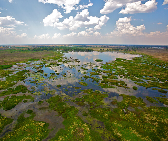
A lagoon in the South Marsh, Macquarie Marshes 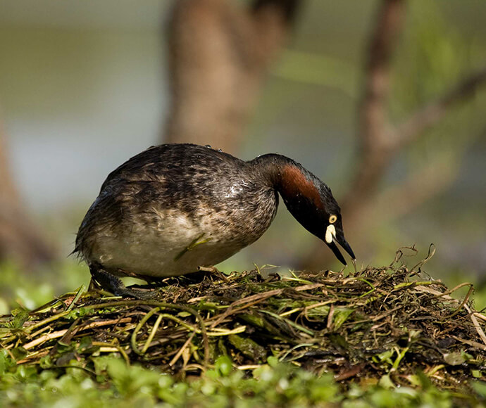
An Australasian Grebe (Tachybaptus novaehollandiae) nests on the Macquarie Marshes 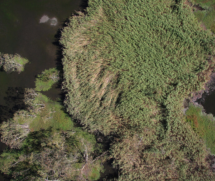
An aerial photo of reeds in the Northern Marsh, Macquarie Marshes 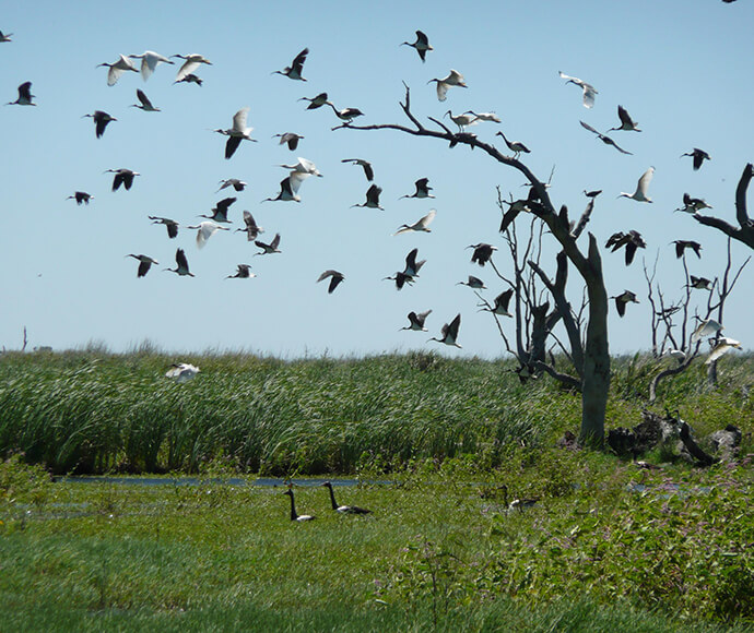
Birds take flight over the southern Macquarie Marshes 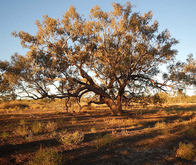
Coolibah (Eucalyptus coolabah) woodland in the Macquarie Marshes 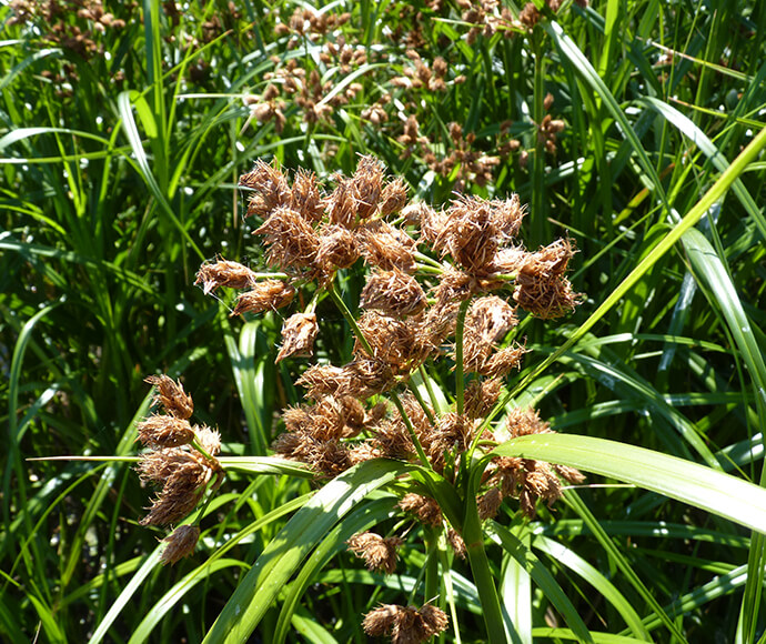
Club rush (Bulboschoenus) flowering in the Macquarie Marshes 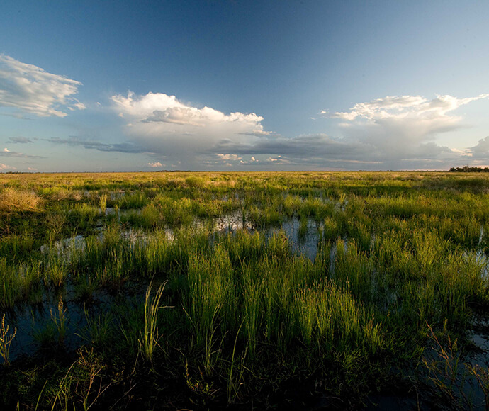
Inundated grasslands in the southern Macquarie Marshes 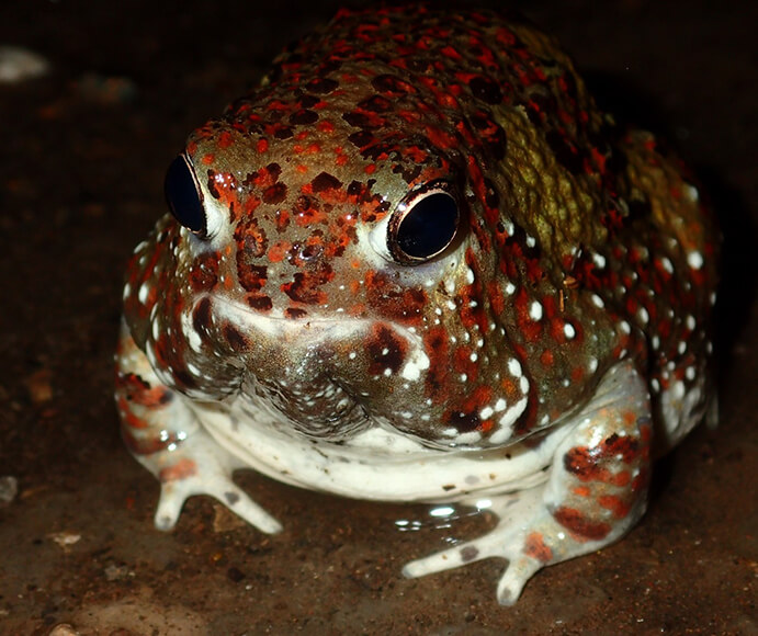
Front view of Crucifix frog (Notaden bennettii) at night 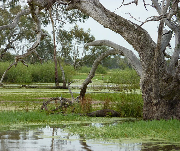
An ancient River Red Gum (Eucalyptus camaldulensis) in the Eastern Macquarie Marshes 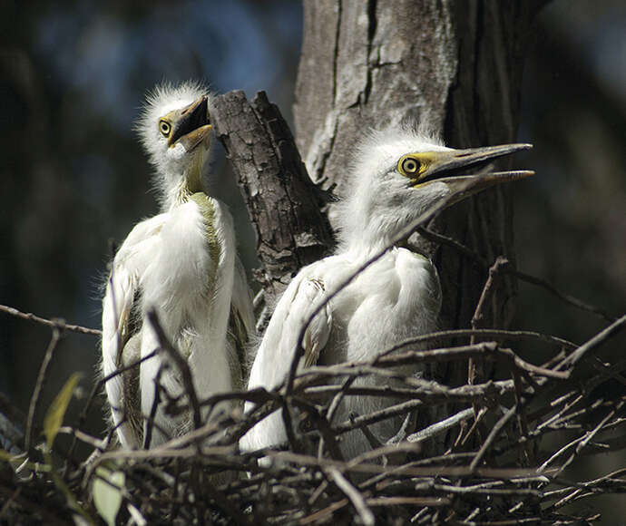
Great egret chicks (Ardea alba) in a nest in the Macquarie Marshes
More information
- Macquarie Marshes Adaptive Environmental Management Plan
- Macquarie-Castlereagh Water Resource Plan Area
- Cooperative management of environmental water to improve river and wetland health in NSW
- Vegetation Mapping Project: Executive summary
- Long-term water plans
- Macquarie-Castlereagh Long-Term Water Plan
- Water Sharing Plan for the Macquarie and Cudgegong Regulated River Water Source (PDF 1.1MB)download file
- Murray Darling Basin Authorityopens a new window
- Murray Darling Basin Planopens a new window
- Commonwealth Environmental Water Holder – Macquarieopens a new window