Warrabah National Park Plan of Management
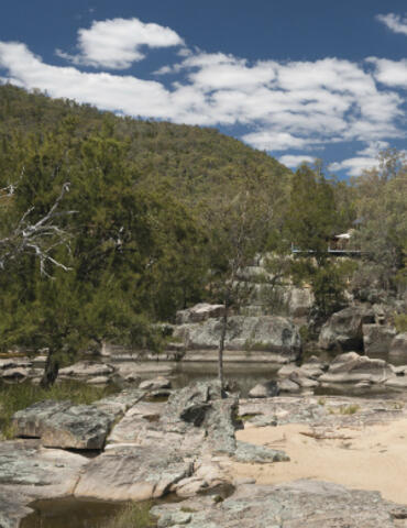
Warrabah National Park is located on the northern tablelands near Manilla. It covers an area of 3,984 hectares and is bisected by the Namoi River. It was initially established in April 1971 as the Warrabah Nature Reserve, however, following the dedication of additional lands the nature reserve was declared as Warrabah National Park in 1984.
Date:
Publisher: Department of Environment and Conservation (NSW)
Cost: Free
Language: English
ISBN: 0-73136-5755
/
ID: DEC20030128
File: PDF 318.79 KB / Pages 27
Name: warrabah-national-park-plan-of-management-030128.pdf
The park was reserved for its range of woodland associations, recreational opportunities associated with the Namoi River, aesthetic qualities of the riverine environment and outstanding topographic features with isolated granite boulders scattered throughout the park rising to massive tor forms on the ridgelines to the north and west.
Photo: Warrabah National Park / David Young/OEH