Thurloo Downs in the state's far north-west is being acquired by the NSW Government for addition to the national parks estate. At 437,394 hectares – almost twice the size of the Australian Capital Territory – it is the largest acquisition of private land for national parks in NSW history.
The property contains exceptional biodiversity values, filling important gaps in the national park estate and protecting landscapes and ecosystems not found in any other national park. These habitats support an array of threatened species, including black falcon, flock bronzewing, bustard, stripe-faced dunnart and woma python.
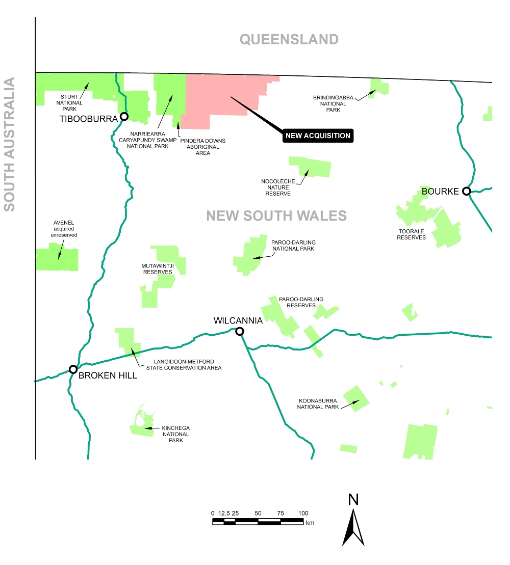
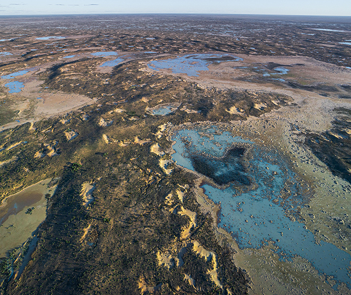
Located between Bourke and Tibooburra and boasting spectacular scenery, the property will become a must-see destination in a network of national parks in far western New South Wales. It includes a complex network of rivers, salt lakes and floodplains, fringed with coolibah and decorated with billabongs and waterholes. Long parallel sand dunes overlook a mosaic of woodlands, transitioning into sandplains and gibber country.
The property has extensive Aboriginal cultural heritage with evidence of artefacts, including hearth remains, flakes, grinding plates and other items of significance across the property. The National Parks and Wildlife Service will work with the Aboriginal community to protect these important cultural sites.
Thurloo will transition to a national park over the next 2 years as the pastoral operation winds down. During this period, we will deliver targeted feral animal and weed control, undertake ecological and cultural heritage surveys, and plan visitor infrastructure.
We will employ 5 staff to manage the property and invest $4 million in capital works to support park management and visitor infrastructure such as campgrounds, day-use areas, observation points and outback driving routes.
The park will open to visitors from 2025–26.
- Thurloo Downs is 437,394 hectares or 1.08 million acres in size – the single largest acquisition in NSW national parks history.
- It is located 250 kilometres north-west of Bourke, via Wanaaring.
- Once Thurloo Downs and other secured lands are gazetted, the national parks estate will be more than 8.2 million hectares (10.2% of the state) – a growth of 15% over 4 years.
- The land lies in the traditional country of the Karenggapa and Parundji people.
- It straddles 2 bioregions (Channel Country and Mulga Lands) and 3 subregions.
- A large area of arid zone wetlands meets the requirements for listing as a Wetland of International Importance under the Ramsar Convention.
- It contains:
- 2 of the highest priority subregions for addition to the NSW estate:
- Bulloo Dunefields is one of 5 subregions (out of 131) with 0% reservation
- Urisino Sandplains is one of 10 subregions with less than 0.5% reservation
- 4 landscapes that are not protected anywhere else in New South Wales, including Bulloo Salt Lakes and Playas, Ursino Alluvial Plains, Ursino Linear Dunes and Ursino Tablelands and Downs
- 6 landscapes that are not protected at the subregional level
- at least 39 ecosystems (plant community types)
- over 3,000 hectares is listed as an endangered ecological community.
- around 50 threatened species expected to occur, including flock bronzewing, grey grasswren, black falcon, plains wanderer, and white-fronted chat, as well as stripe-faced dunnart, little pied bat, sandy inland mouse, crowned gecko, and several threatened plants
- expansive Aboriginal cultural heritage.
- 2 of the highest priority subregions for addition to the NSW estate:
- With neighbouring Narriearra-Caryapundy Swamp National Park, it ensures 90% of the Bulloo Overflow in New South Wales is protected.
- Located adjacent to Narriearra-Caryapundy Swamp National Park, national parks now protect a near-contiguous area of almost one million hectares stretching for 240 km to the South Australia border.
- It will become the third largest national park in New South Wales after Kosciuszko, at 674,000 hectares, and Wollemi, at 498,000 hectares.
Natural pattern and biodiversity of the Bulloo overflow at Thurloo Downs 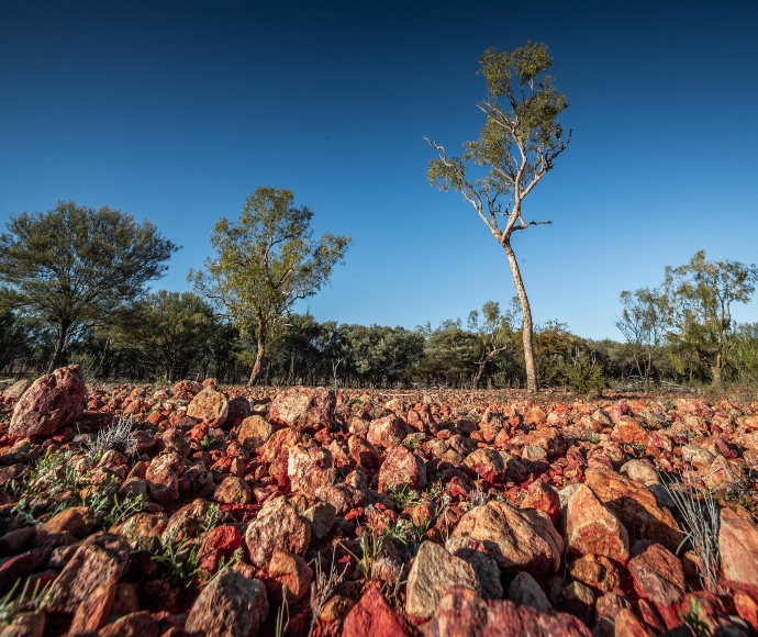
Rocky landscape of Thurloo Downs 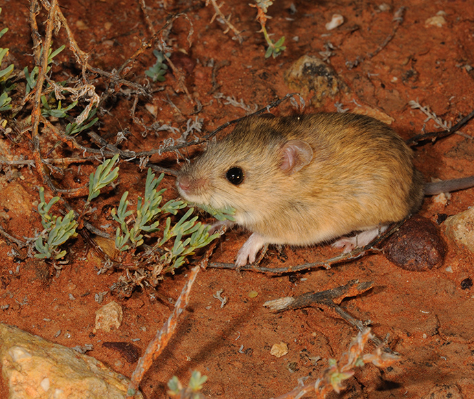
Sandy inland mouse. Its soft fur blends into its surroundings 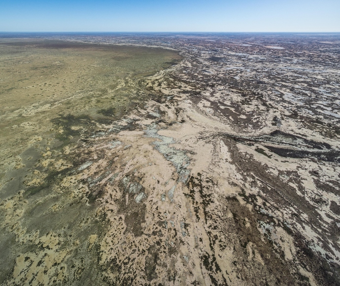
Aerial view of Bulloo overflow country 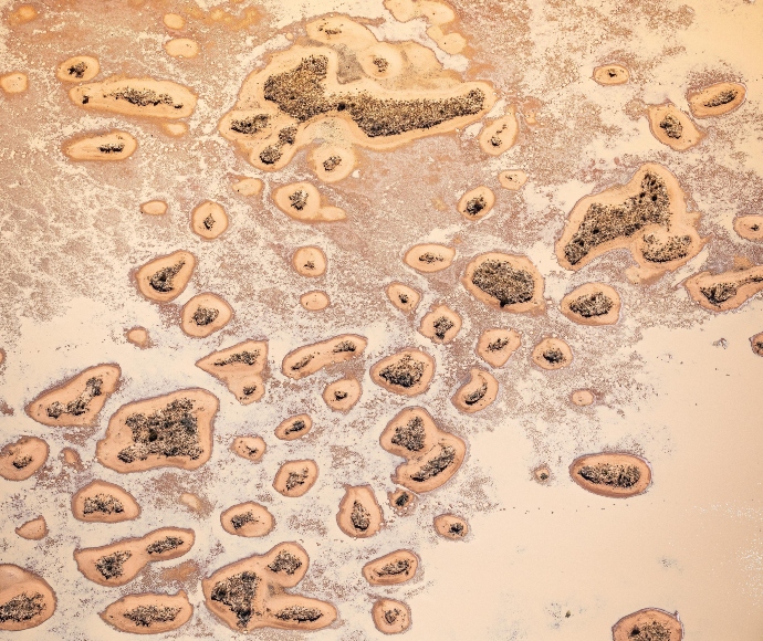
Channel country landscape and wetlands in Thurloo Downs 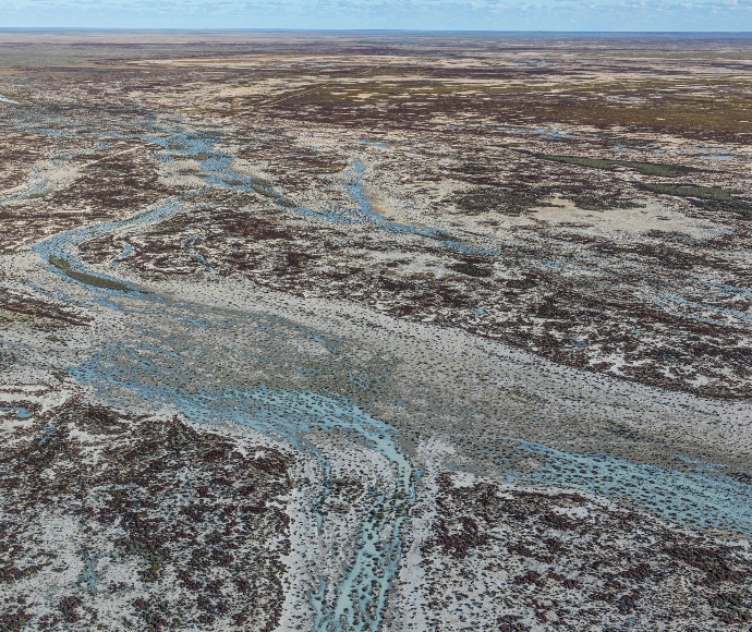
Bulloo overflow country aerial view 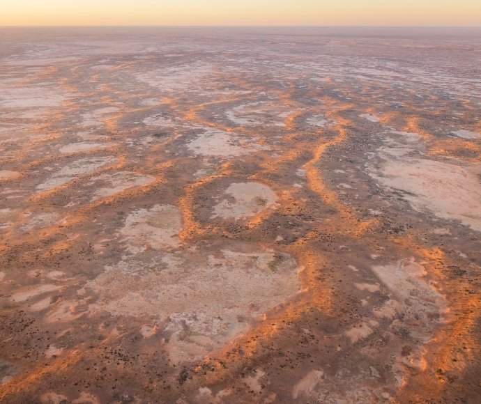
Aerial view of the channel country landscape, Thurloo Downs 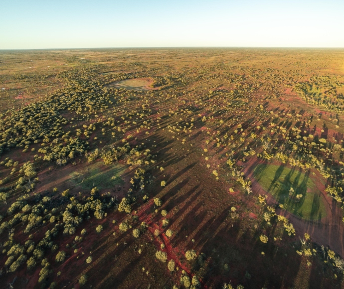
Arid woodland landscape, Thurloo Downs 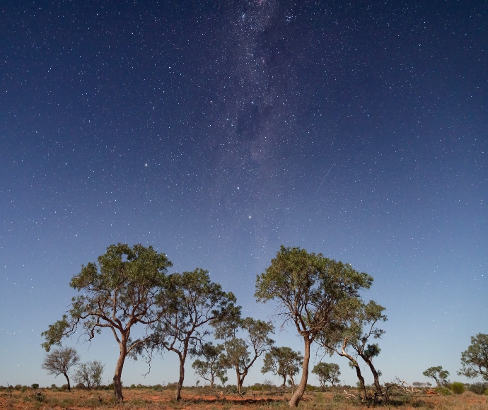
Starry skies over Thurloo Downs