Wambool Nature Reserve is located approximately 20 kilometres east of Bathurst within the Central Tablelands of New South Wales. The nature reserve was established in June 1987 and is 194 hectares in area. A large part of the reserve was originally part of the Wambool Common.
Wanna Wanna Nature Reserve is located in the southern tablelands of NSW, approximately 5 kilometres east of Queanbeyan. It was gazetted as part of the Southern Regional Forest Agreement in 2001, and is 33 hectares in size.
Warra National Park is located on the Northern Tablelands of New South Wales east of Glencoe, between Glen Innes and Guyra, and covers an area of 2031 hectares.
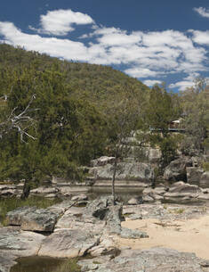
Warrabah National Park is located on the northern tablelands near Manilla. It covers an area of 3,984 hectares and is bisected by the Namoi River. It was initially established in April 1971 as the Warrabah Nature Reserve, however, following the dedication of additional lands the nature reserve was declared as Warrabah National Park in 1984.
This Memorandum of Understanding is made between the National Parks and Wildlife Service, Office of Environment and Heritage and the Southern Snowy Mountains Aboriginal Community.
Memorandum of understandingKosciuszko National Park
Georges River National Park is located on the lower reaches of the Georges River 25 kilometres south-west of Sydney. It includes several large and small discrete riverfront areas with a total of 32O hectares. Most of the park consists of steep forested hillsides and plateau areas which are found on either side of the river and its tributary creeks.
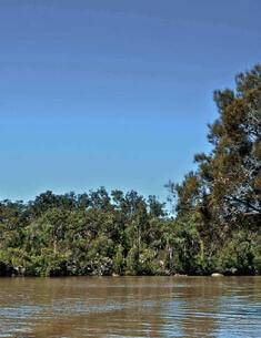
Hunter Wetlands National Park covers 4549 hectares in the lower estuarine reaches of the Hunter River, north of Newcastle. The lands are in the traditional Country of the Awabakal and Worimi peoples.
Maria National Park lies approximately 5 kilometres south-east of Kempsey, immediately east of the north coast rail line. Most of the park, which covers an area of 2,335 hectares, was formerly part of Maria River State Forest.