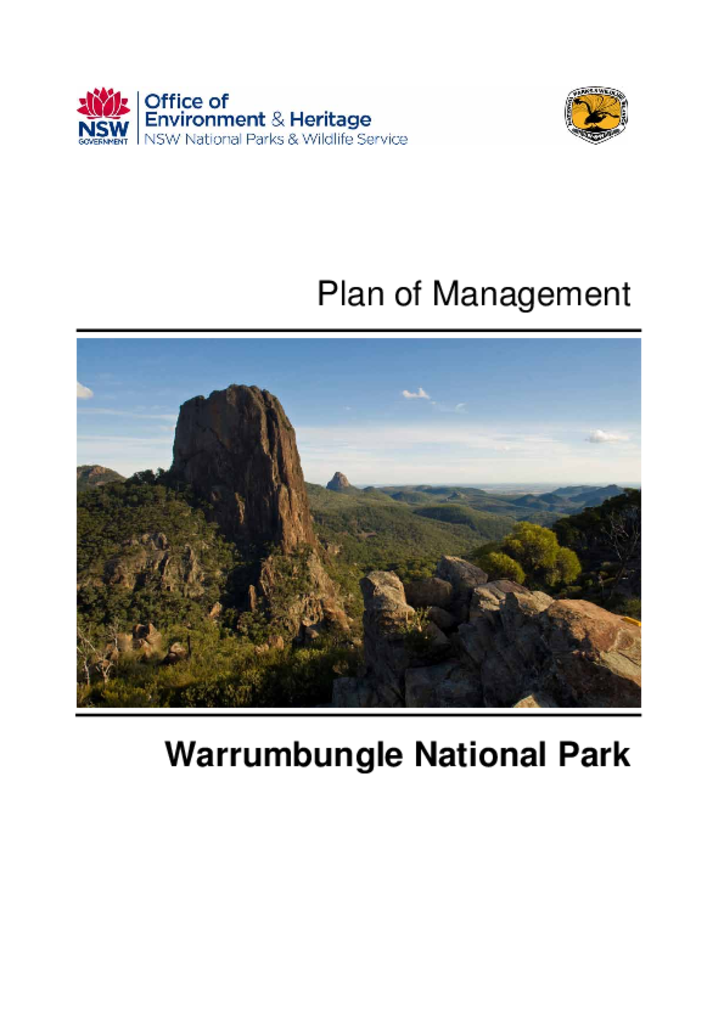
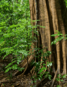
A NSW Government website

Park management documents

Filter results
Showing results 681 - 690 of 1467 results
A serene landscape of Murramarang Aboriginal Area, including lush green vegetation, white fine sand and glistening ocean in various shades of blue.
01 Mar 1998
PDF 310.92 KB
Murramarang Aboriginal Area is located 30 kilometres north of Batemans Bay, on the south coast of NSW. It has an area of 60 hectares and comprises the headland of Murramarang Point, sand dunes along Murramarang Beach to the north and part of a small lagoon.
Plan of management Final
Preview Image
23 Nov 2020
PDF 2.16 MB
The Crookwell Reserves are located approximately 40 kilometres north of Crookwell in the Southern Tablelands of NSW, within the traditional Country of the Wiradjuri, Gundungurra and Ngunnawal peoples. They cover a combined area of 2806 hectares.
Plan of management Final
Preview Image
01 Apr 2010
PDF 3.65 MB
Watagans National Park and Jilliby State Conservation Area are located 60 kilometres north of Sydney, 31 kilometres west of Newcastle and 15 kilometres south of Cessnock. Watagans National Park covers 7,798 hectares and Jilliby State Conservation Area 12,159 hectares.
Plan of management Final
Preview Image
01 Dec 2003
PDF 94.07 KB
Linton Nature Reserve covers 640 hectares and is located on the western fall of the New England Tablelands approximately 90 kilometres by road west of Armidale.
Plan of management Final
Preview Image
01 Jul 2005
PDF 105.54 KB
Berkeley Nature Reserve consists of two small islands in the north west of Lake Illawarra, adjacent to the Wollongong suburb of Berkeley. Gooseberry Island and Hooka Island are approximately 0.25 kilometres apart and are a significant feature of the landscape of the Illawarra, being close to the shore of Lake Illawarra and visible from many points on the mainland.
Plan of management Final
01 May 2012
PDF 18.91 MB
Hill End Historic Site, located in central west NSW, has its origins in the mining and gold rush boom of the 19th century. It continues to be a living village and holds significant historic heritage value.
Master plan Final
Preview Image
01 Nov 1999
PDF 78 KB
Bermaguee Nature Reserve covers most of the catchment of Baragoot Lake, a small estuary south of Wallaga Lake on the south coast of NSW about 35 km south of Narooma, near the town of Bermagui.
Plan of management Final
01 Jun 2004
PDF 1.58 MB
Flagstaff Memorial Nature Reserve covers 18 hectares and is located on the south-west slopes of New South Wales, approximately 16 kilometres north of Cootamundra on the road between Temora and Harden.
Plan of management Final
Preview Image
14 Feb 2023
PDF 3.31 MB
Berowra Valley National Park and Berowra Valley Regional Park are located approximately 20 kilometres to north west of Sydney in New South Wales in Country maintained and cared for by Aboriginal custodians.
Plan of management Final
01 Mar 1996
PDF 74.37 KB
Cocoparra National Park and Cocopara Nature Reserve are located about 25 kilometres north-east of Griffith in the Riverina District of southern NSW.
Plan of management Final